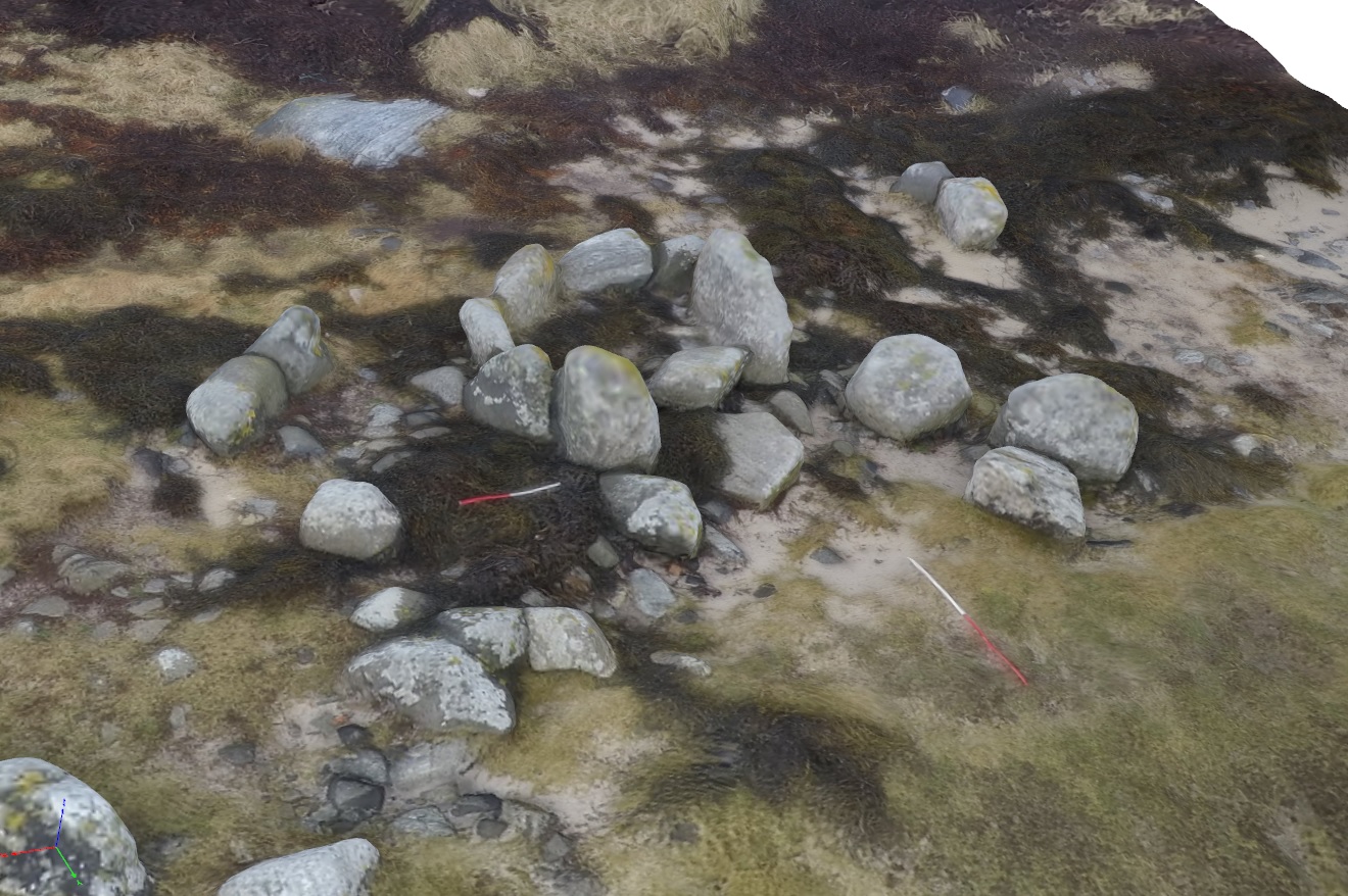
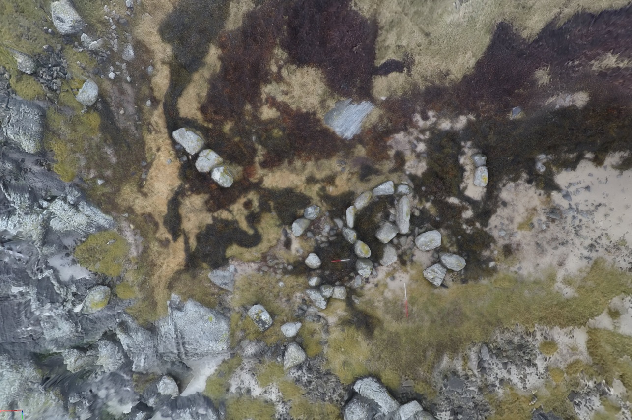
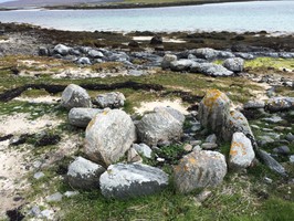
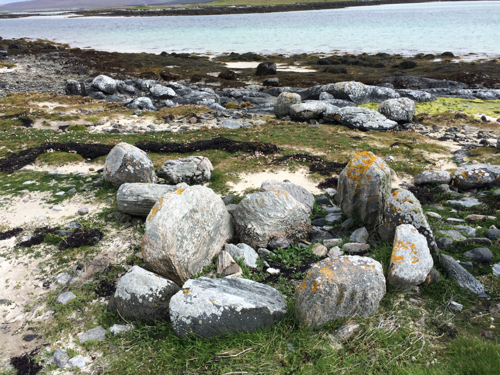
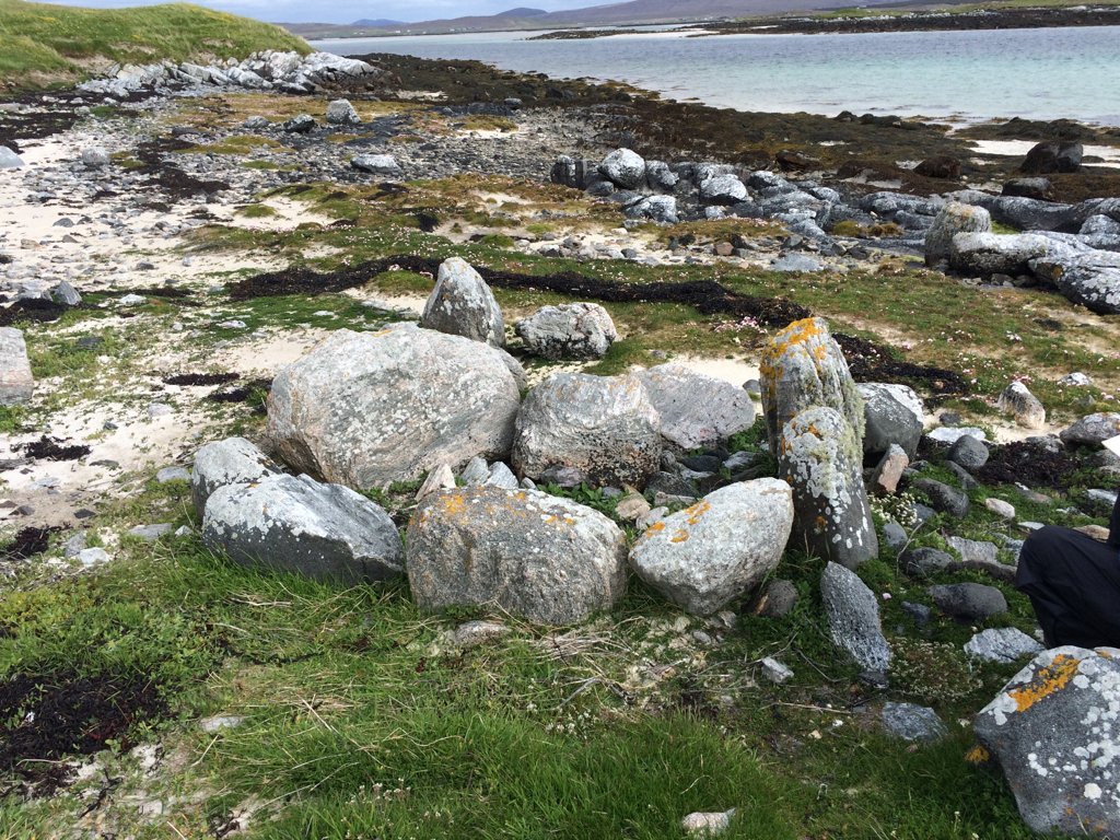
A sub-rectangular structure formed of at least 8 uprights. Outlying stones and a small stretch of walling is also visible. Co-ordinate suggests this may be the same site noted in NMRS (NF77NE 36) (site 808), although description of structure is slightly different.
ShoreUPDATE June 2015
As described.
ShoreUPDATE January 2016
The structure lies around 15m N of the location shown.
3D models of the structure and surrounding site available from these links:
Structure: https://drive.google.com/file/d/0B7QqVX2IsWHJMmtyblpSdVFHejA/view?usp=sharing
Site: https://drive.google.com/file/d/0B7QqVX2IsWHJS0RSOVpFZjQyVXM/view?usp=sharing
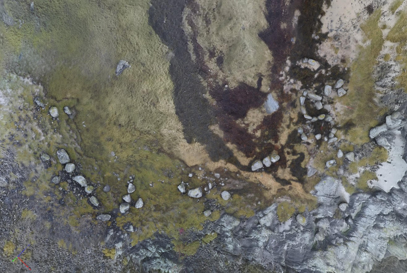
It's considered unlikely that this site is the same as NMRS NF77NE 36 = SCHARP 9780 as the description for that refers to a 4m high SE facing section, whereas the coastal slope here is barely 1m high (see image). Likely NGR error.
Location
76537.00
875930.00
27700
57.6566391
-7.4254804
Submitted photographs
Image
Date
Caption
User
13/01/2016
9779 aerial angled view
DavidNewman
13/01/2016
9779 structure aerial view
DavidNewman
13/01/2016
9779 site area view
DavidNewman
13/01/2016
9779 looking E
DavidNewman
01/06/2015
Upright stones forming structure
artintendo
01/06/2015
Upright stones forming structure
artintendo
Submitted updates
Update id
Date
User
2407
13/01/2016
DavidNewman
Tidal state
Low
Site located?
Yes
Proximity to coast edge
Intertidal
Coastally eroding?
has eroded in the past
Threats
stock erosion
Visibility above ground
Limited visibility (partial remains)
Visibility in section
Limited visibility in section
Access
accessible - difficult terrain
Local knowledge
is not locally known
Description
A sub-rectangular structure formed of at least 8 uprights. Outlying stones and a small stretch of walling is also visible. Co-ordinate suggests this may be the same site noted in NMRS (NF77NE 36) (site 808), although description of structure is slightly different.
ShoreUPDATE June 2015
As described.
ShoreUPDATE January 2016
The structure lies around 15m N of the location shown.
3D models of the structure and surrounding site available from these links:
Structure: https://drive.google.com/file/d/0B7QqVX2IsWHJMmtyblpSdVFHejA/view?usp=sharing
Site: https://drive.google.com/file/d/0B7QqVX2IsWHJS0RSOVpFZjQyVXM/view?usp=sharing
It's considered unlikely that this site is the same as NMRS NF77NE 36 = SCHARP 9780 as the description for that refers to a 4m high SE facing section, whereas the coastal slope here is barely 1m high (see image). Likely NGR error.
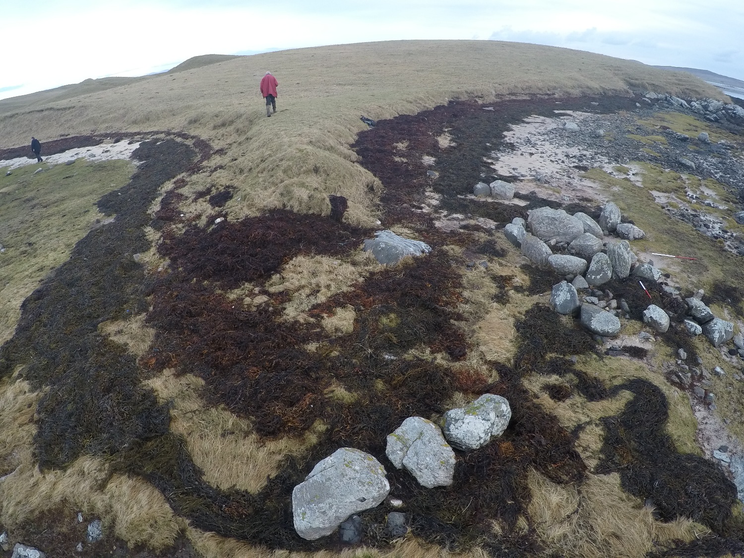
As can be seen from the images the site is inundated at spring high tides regularly, so seems a priority for further investigation and recording.
Comments
The structure lies around 15m N of the location shown.
3D models of the structure and surrounding site available from these links:
Structure: https://drive.google.com/file/d/0B7QqVX2IsWHJMmtyblpSdVFHejA/view?usp=sharing
Site: https://drive.google.com/file/d/0B7QqVX2IsWHJS0RSOVpFZjQyVXM/view?usp=sharing
It's considered unlikely that this site is the same as NMRS NF77NE 36 = SCHARP 9780 as the description for that refers to a 4m high SE facing section, whereas the coastal slope here is barely 1m high (see image). Likely NGR error.
2353
01/06/2015
artintendo
Tidal state
Low
Site located?
Yes
Proximity to coast edge
Intertidal
Coastally eroding?
active sea erosion; has eroded in the past
Visibility above ground
Highly visible (substantial remains)
Visibility in section
Limited visibility in section
Access
accessible - difficult terrain; accessible on foot (no footpath)
Local knowledge
is well known; has local associations/history
Description
A sub-rectangular structure formed of at least 8 uprights. Outlying stones and a small stretch of walling is also visible. Co-ordinate suggests this may be the same site noted in NMRS (NF77NE 36) (site 808), although description of structure is slightly different.
ShoreUPDATE June 2015
As described.