Sithean Mor, a grass-covered heap of sand 30m by 20m and 3.6 to 14m high upon the outer extremity of Callernish and close to the shore at the west entrance of Vallay Sound. A cutting from N to S revealed a kitchen-midden reaching a maximum thickness of 0.6m, apparently confined to the east end of the mound. Underneath there was a solid mass of fine windblown sand. Beveridge suggests that its existence may be due to some original cairn having served as a nucleus. Finds included pottery, a few hammer-stones and a sharpening-stone. Further kitchen-midden remains lie on level and cultivated ground immediately to the south. A sherd of pottery, a flint and burials have been found at this south edge. 1911
Sithean Mor, a grass-covered sandy mound, 22.0m N-S by 36.0m transversely and c. 2.5m high, shows no sign of antiquity, and no middens were seen in the vicinity. Visited 1965.
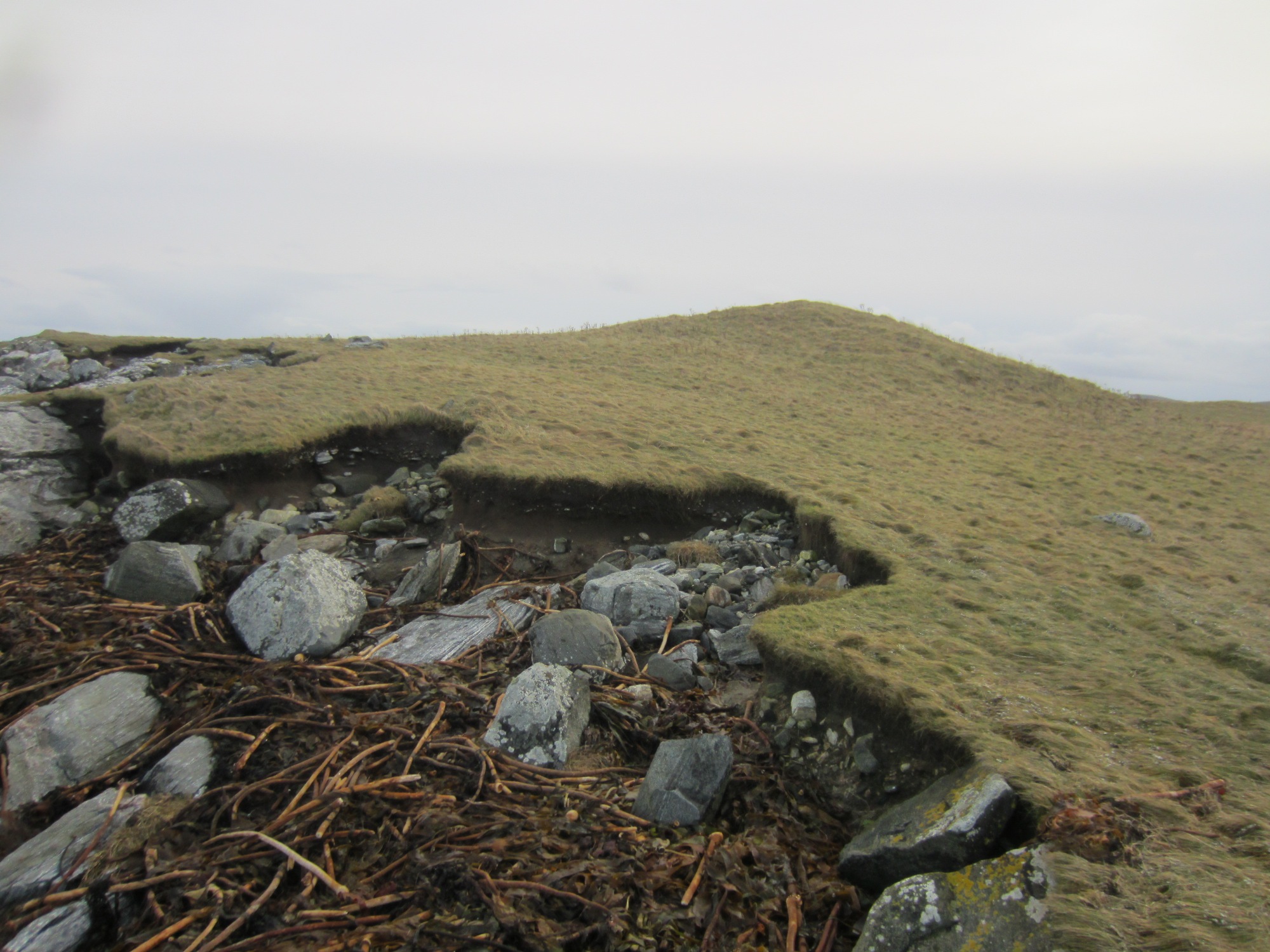
Square-facetted or bramble-headed pin, found in an earth-house, 1973. There are definite signs of midden material within this mound. The S side of the mound has been eroded away and animal bone, shell and pottery were found within this area. The pottery has been tentatively dated to the Iron Age.
December 2015
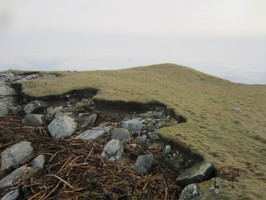
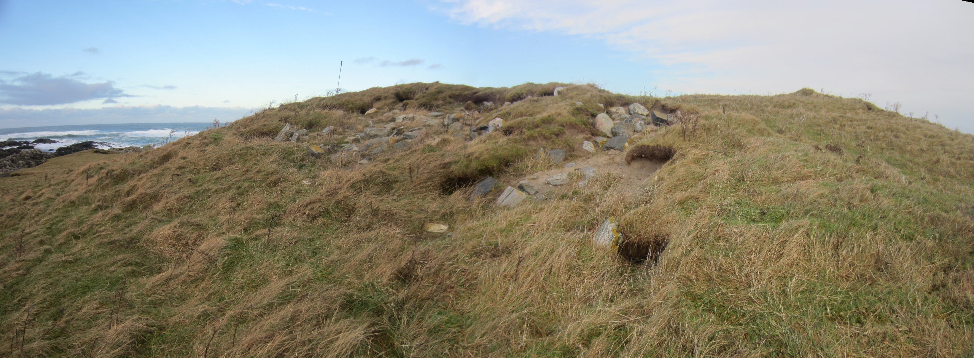
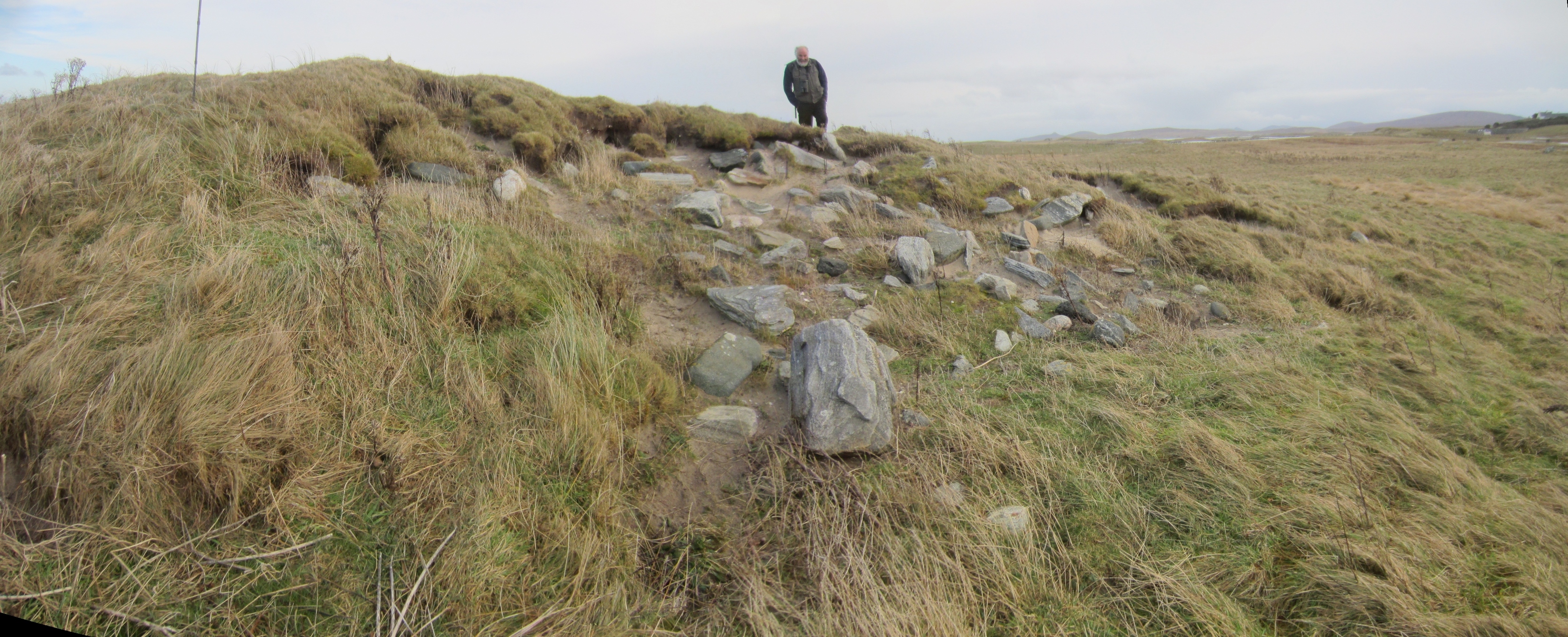
The erosion on this site is related to rabbit burrows, livestock and wind and although the original extent of coastal erosion reported is not understood, at present it doesn't seem to pose a particular threat. Although the coastline some 40m to the north of the site is very exposed, and the topsoil overburden shows some signs of erosion (see image), it is founded on bedrock and the site located several metres above max HWS. However, wind erosion exacerbated by animal burrowing and stock erosion are causing damage.
Location
74910.00
876590.00
27700
57.6613693
-7.4535089
Submitted photographs
Image
Date
Caption
User
03/12/2015
Topsoil erosion to N of site
DavidNewman
03/12/2015
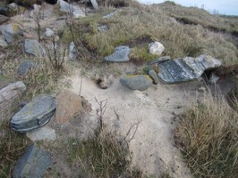
Rabbit erosion
DavidNewman
03/12/2015
Eroding area on summit viewed from SE
DavidNewman
03/12/2015
Eroding area on summit viewed from SW
DavidNewman
Submitted updates
Update id
Date
User
2291
03/12/2015
DavidNewman
Tidal state
Mid
Site located?
Yes
Proximity to coast edge
11-50m
Coastally eroding?
active wind erosion (in dunes only)
Threats
stock erosion; animal burrows
Visibility above ground
Limited visibility (partial remains)
Visibility in section
Not visible
Access
accessible on foot (no footpath)
Local knowledge
is not locally known
Description
Sithean Mor, a grass-covered heap of sand 30m by 20m and 3.6 to 14m high upon the outer extremity of Callernish and close to the shore at the west entrance of Vallay Sound. A cutting from N to S revealed a kitchen-midden reaching a maximum thickness of 0.6m, apparently confined to the east end of the mound. Underneath there was a solid mass of fine windblown sand. Beveridge suggests that its existence may be due to some original cairn having served as a nucleus. Finds included pottery, a few hammer-stones and a sharpening-stone. Further kitchen-midden remains lie on level and cultivated ground immediately to the south. A sherd of pottery, a flint and burials have been found at this south edge. 1911
Sithean Mor, a grass-covered sandy mound, 22.0m N-S by 36.0m transversely and c. 2.5m high, shows no sign of antiquity, and no middens were seen in the vicinity. Visited 1965.
Square-facetted or bramble-headed pin, found in an earth-house, 1973. There are definite signs of midden material within this mound. The S side of the mound has been eroded away and animal bone, shell and pottery were found within this area. The pottery has been tentatively dated to the Iron Age.
December 2015
The erosion on this site is related to rabbit burrows, livestock and wind and although the original extent of coastal erosion reported is not understood, at present it doesn't seem to pose a particular threat. Although the coastline some 40m to the north of the site is very exposed, and the topsoil overburden shows some signs of erosion (see image), it is founded on bedrock and the site located several metres above max HWS. However, wind erosion exacerbated by animal burrowing and stock erosion are causing damage.
Retain priority. Monitor regularly. More detailed survey.