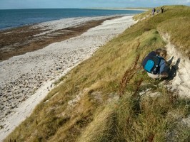
There are intermittent exposures of stonework and anthropogenic deposits along a 140m long stretch of coastline. The NGR provided above represents a central point. The exposures are visible in the face of sand dunes which have been cut vertical by the recent storm. These remains are located to the seaward side of three previously recorded Norse settlement sites (NF71NW10, 11 and 18). From the northern end of the exposure and extending for some 85m the deposits comprise mainly of loose stonework which is eroding from the exposure close to the top of the dunes. The southernmost 55m of the coastal exposure contains more organic soil deposits, up to 0.2m thick. These contain inclusions of shell, animal bone and fish bone. A decorated fragment of a bone comb, possibly of Pictish design, was recovered from this area and has been sent for specialist assessment and conservation. In places the midden deposits are situated some 2-4m above the level of the beach, over deposits of windblown sand. These deposits are thought to be associated with an extensive Norse settlement which lies in the immediate hinterland and which has been partially excavated. The interim results of this work indicate that the settlement comprised of five longhouses, together with associated outbuildings and middens and that it spanned from the late 10th C to the late 13th C AD (Brennand, M, Parker Pearson, M and Smith, H 1998 'Cille Pheadair (Kilpheder) (South Uist parish), Norse settlement and Pictish cairn' in Discovery and Excavation in Scotland 1998, 102-103).
ShoreUPDATE September 2014
Site as described.
Dune face stabilised following severe erosion 2005 storm event.
Update December 2015
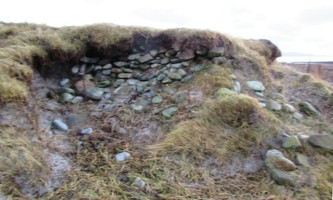
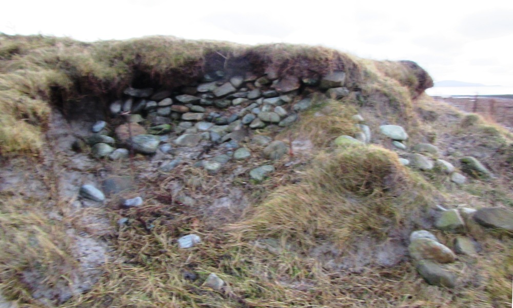
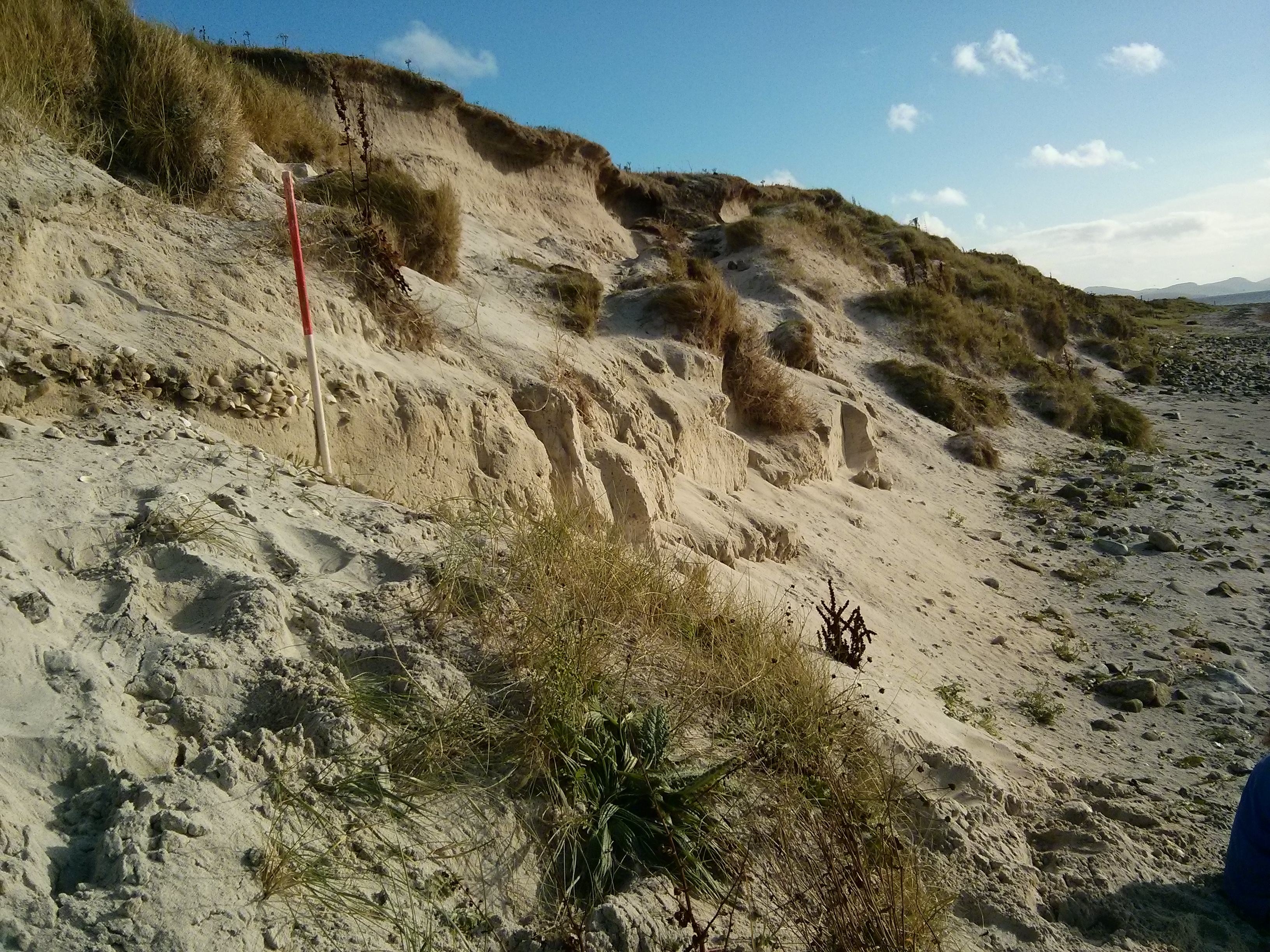
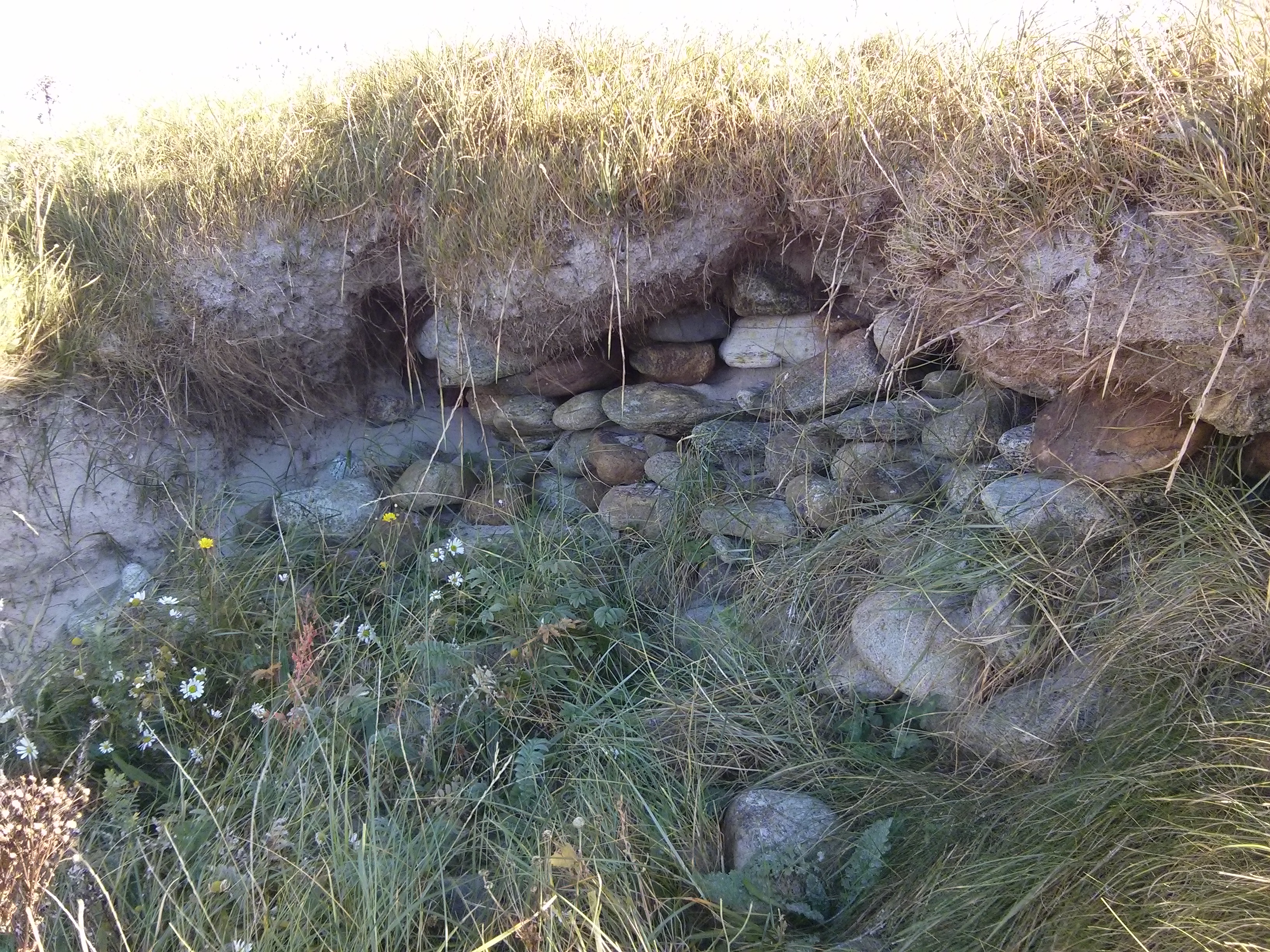
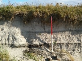
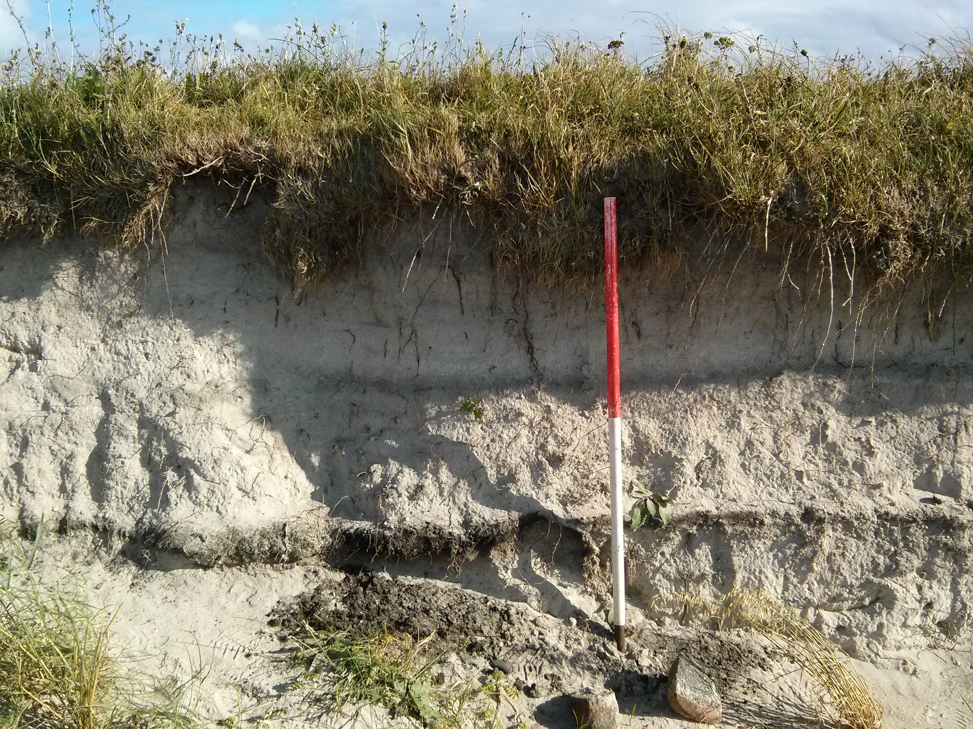
The dunes are still deteriorating with collapse to the shore side and wind/tide erosion undermining this edge. Several areas of apparent exposed wall lines are identifiable as are several sections of dark (?ash?) lens deposits which may also contain low level midden material. There is one very significant area of exposed 'wall' at NF 72940 19852 (see associated picture)
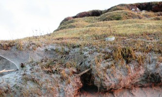
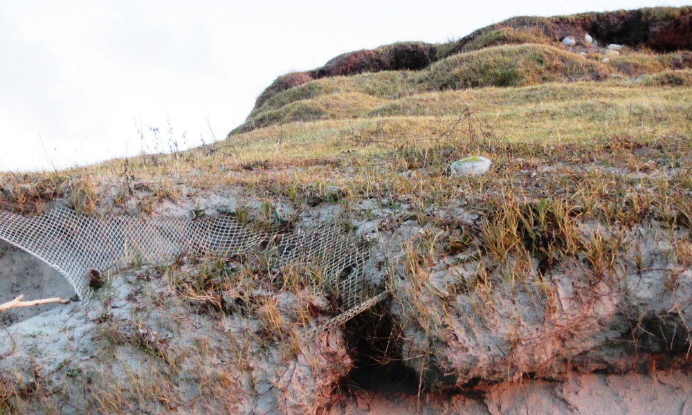
There appears to have been some netting applied to the dune escarpment in an attempt to stabilise the structures, but this is mostly undermined and no longer achieving very much!
It would appear that animal activity, including sheep grazing, is accelerating the slippage of the dune face.
October 2021
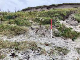
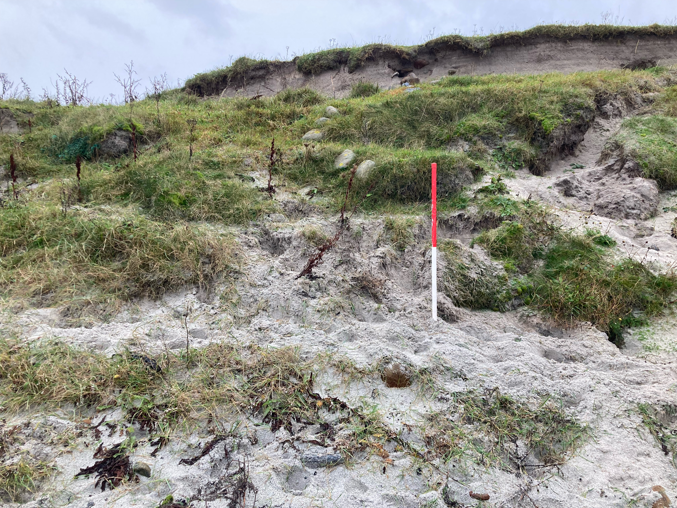
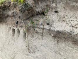
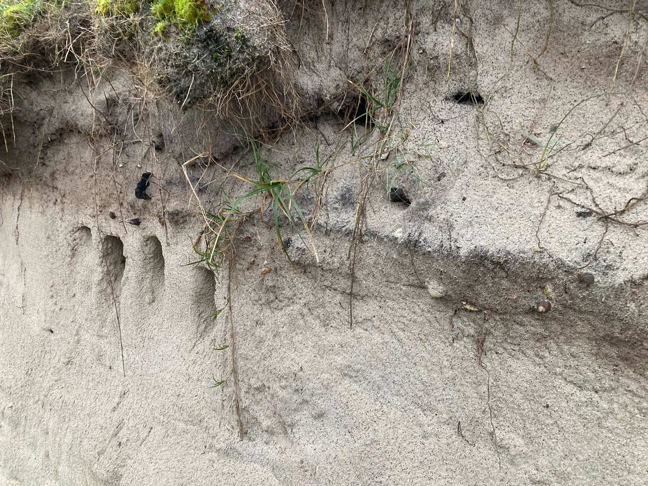
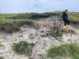
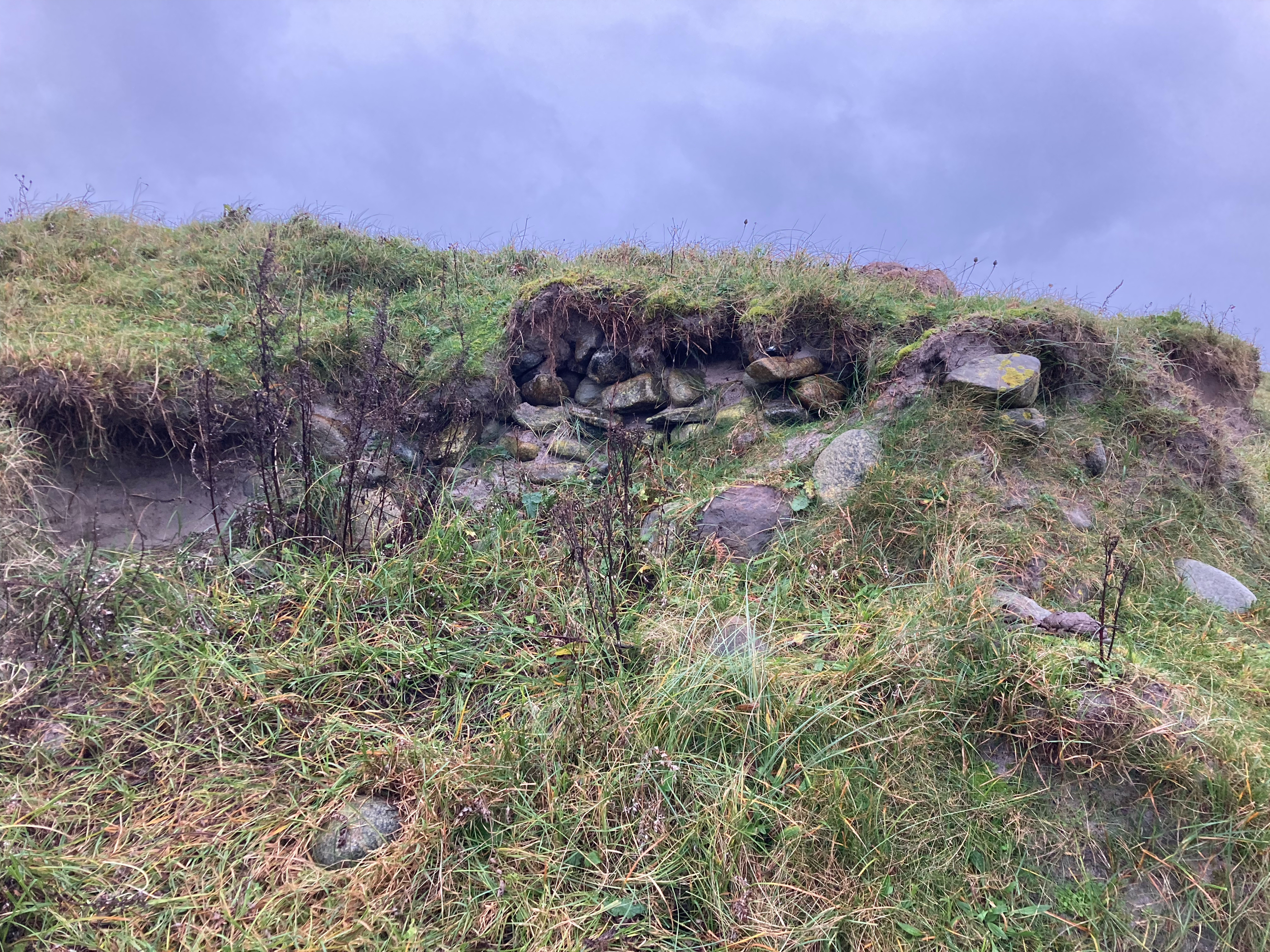
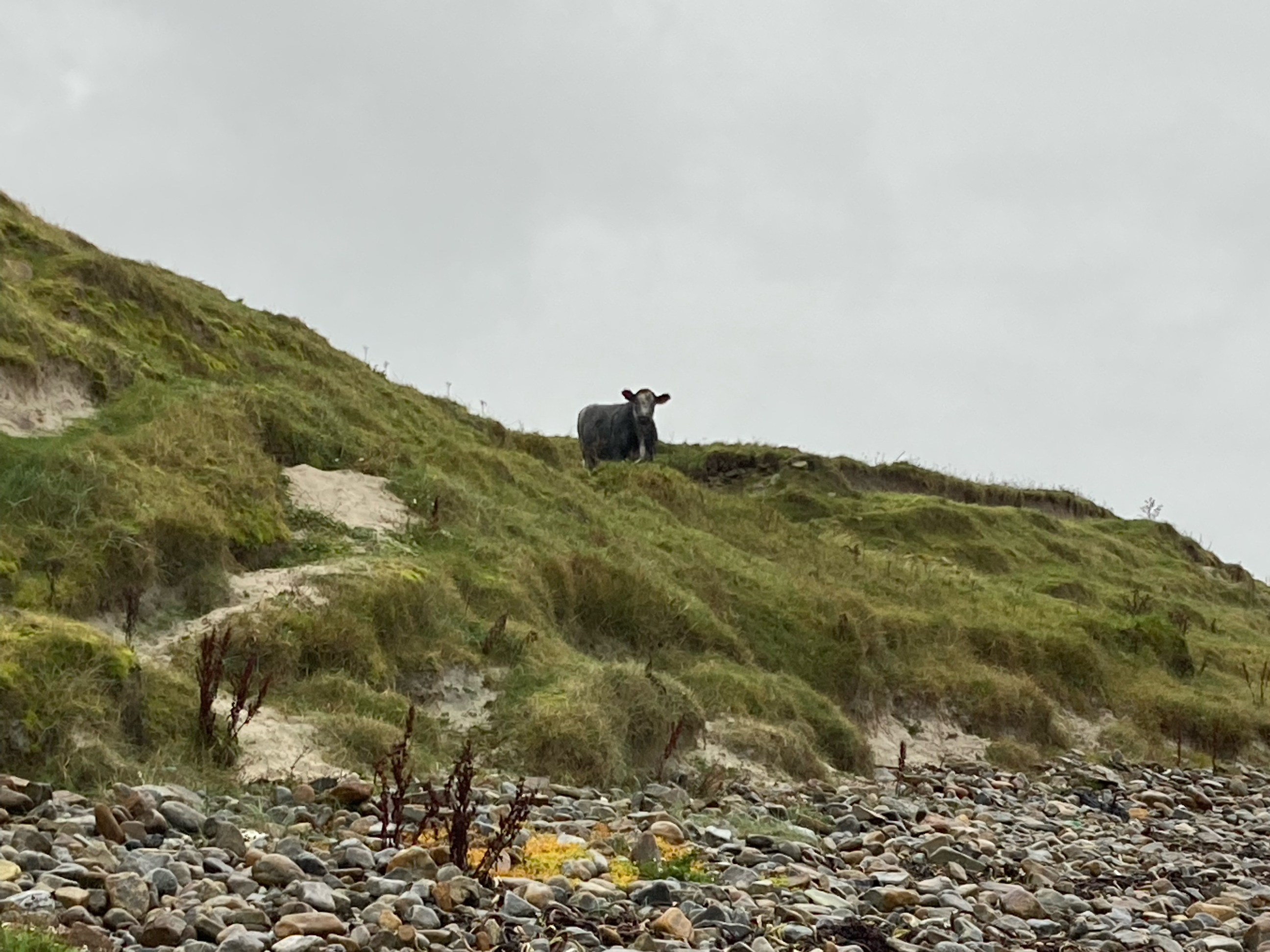
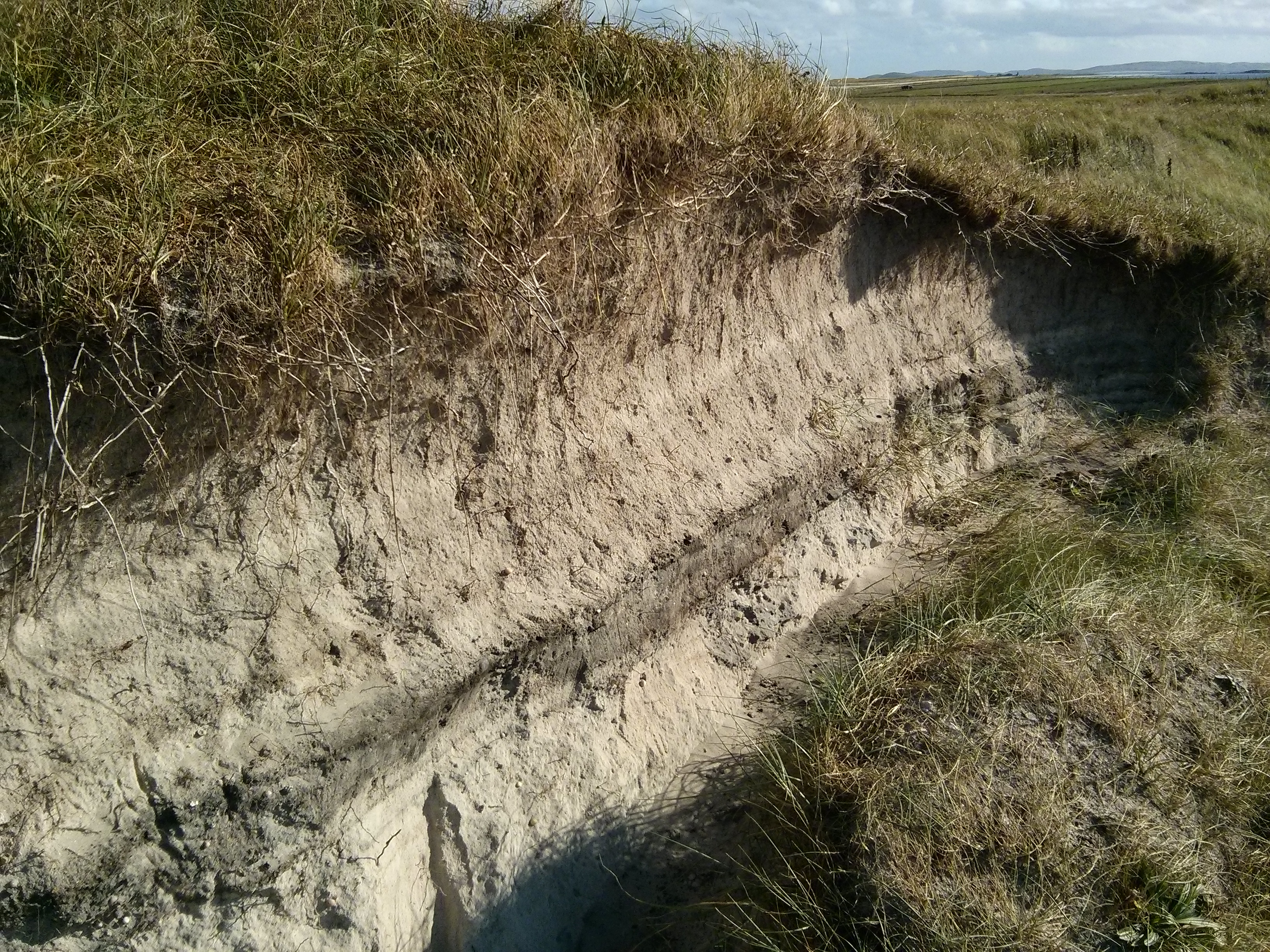
Site largely as described, coastline unstable and eroding, with stonework and anthropogenic soil horizons visible in the section. Cattle activity appears to be exacerbating the coastal erosion. Walling at top of exposed dune face at north end of exposure still identifiable, further areas of loose cobble sized stones in the section and slumped down the face to the south may indicate further structures. Several anthropogenic soil horizons visible in section, with shell, animal bone, charcoal and burnt stone.
Location
72935.00
819844.00
27700
57.1525000
-7.4109000
Submitted photographs
Image
Date
Caption
User
31/10/2021
Linear stonework / possible wall line in dune face
Ellie
31/10/2021
Buried soil horizon in section
Ellie
31/10/2021
Stonework eroding out of section
Ellie
31/10/2021
Walling at top of dune face, north end of exposure
Ellie
31/10/2021
General view of coast edge, with culprit cow
Ellie
12/12/2015
Eroding dune cliff
Smilemaker
12/12/2015
Exposed walling at the site
Smilemaker
12/12/2015
Netting is becoming undermined
Smilemaker
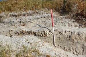
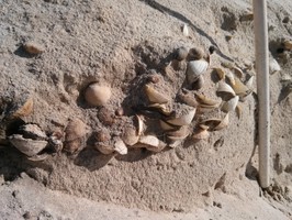
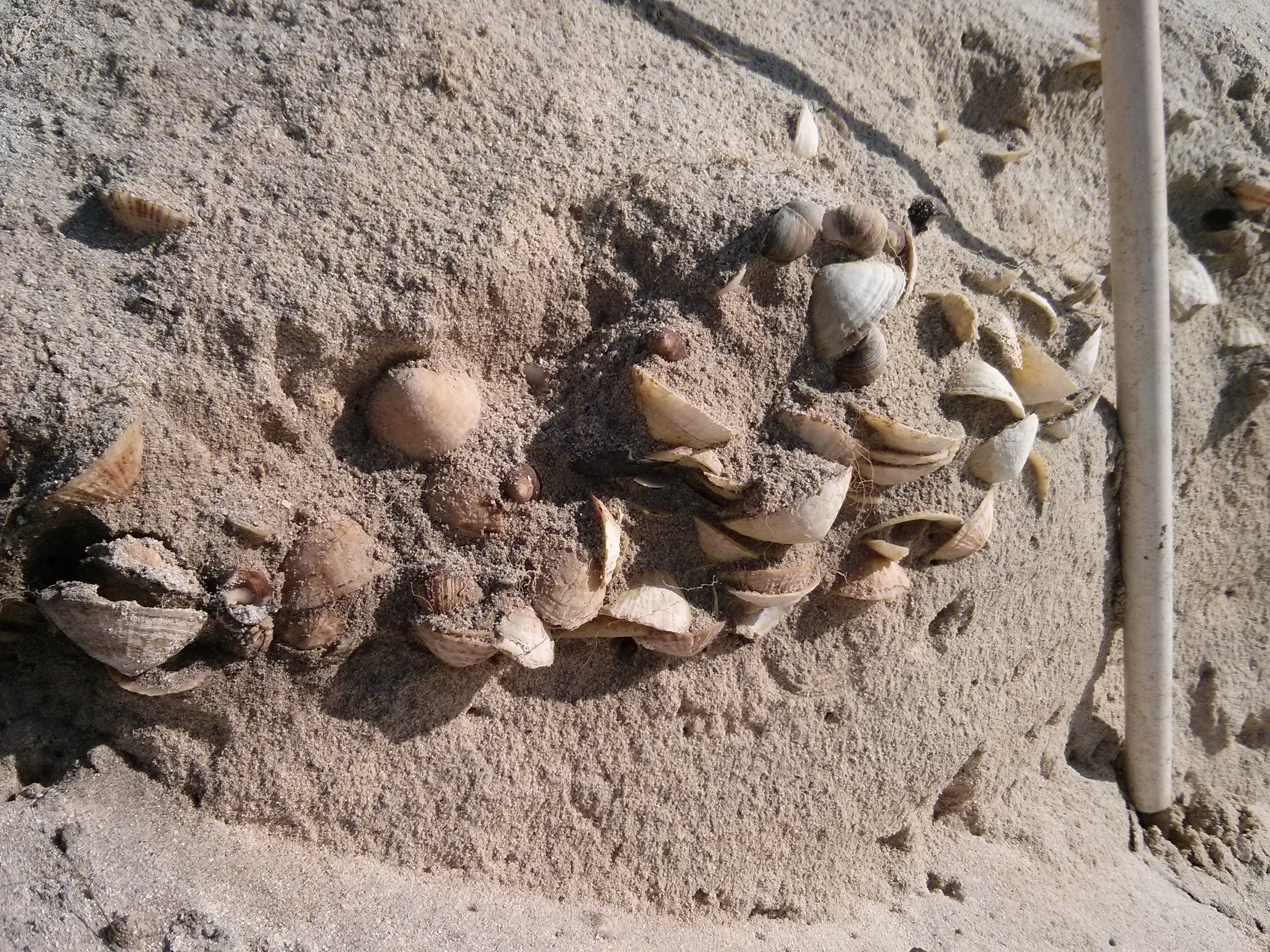
24/09/2014
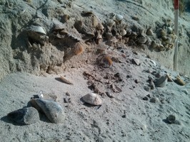
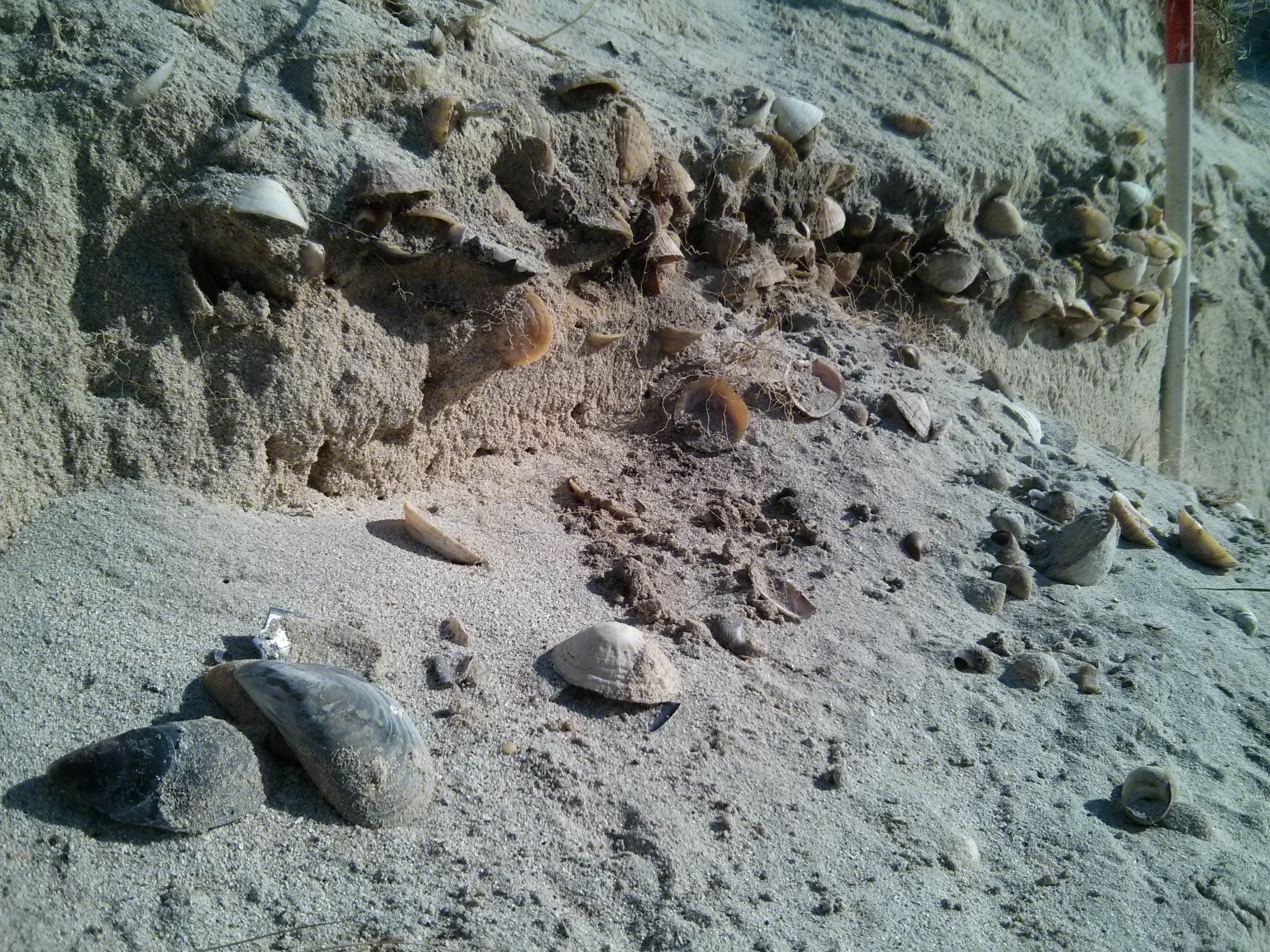
Sithean Biorach - shell midden
training1
24/09/2014
Sithean Biorach - general view
MartynJ
24/09/2014
Sithean Biorach - detail of shell midden
MartynJ
24/09/2014
Sithean Biorach - shell midden
MartynJ
24/09/2014
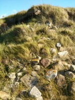
Sithean Biorach - stone of wall collapsing down dune
MartynJ
24/09/2014
Sithean Biorach - wall in upper section of dune
MartynJ
24/09/2014
Sithean Biorach - dune face at coast edge and beach
MartynJ
24/09/2014
Sithean Biorach - upper section of dune face
MartynJ
24/09/2014
Sithean Biorach - upper section of dune face
MartynJ
Submitted updates
Update id
Date
User
3628
31/10/2021
Ellie
Tidal state
Mid
Site located?
Unsure
Proximity to coast edge
Coast edge
Coastally eroding?
active sea erosion; active wind erosion (in dunes only); has eroded in the past
Other threats
Animal damage
Access
easily accessible - no restrictions
Description
October 2021
Site largely as described, coastline unstable and eroding, with stonework and anthropogenic soil horizons visible in the section. Cattle activity appears to be exacerbating the coastal erosion. Walling at top of exposed dune face at north end of exposure still identifiable, further areas of loose cobble sized stones in the section and slumped down the face to the south may indicate further structures. Several anthropogenic soil horizons visible in section, with shell, animal bone, charcoal and burnt stone.
Maintain priority score, regular updates and monitoring
2305
12/12/2015
Smilemaker
Tidal state
Mid
Site located?
Yes
Proximity to coast edge
Coast edge
Coastally eroding?
active sea erosion; active wind erosion (in dunes only); has eroded in the past
Threats
stock erosion; animal burrows
Visibility above ground
Limited visibility (partial remains)
Visibility in section
Limited visibility in section
Access
easily accessible - no restrictions; accessible - difficult terrain; vehicular access; accessible on foot (no footpath)
Local knowledge
is well known
Description
There are intermittent exposures of stonework and anthropogenic deposits along a 140m long stretch of coastline. The NGR provided above represents a central point. The exposures are visible in the face of sand dunes which have been cut vertical by the recent storm. These remains are located to the seaward side of three previously recorded Norse settlement sites (NF71NW10, 11 and 18). From the northern end of the exposure and extending for some 85m the deposits comprise mainly of loose stonework which is eroding from the exposure close to the top of the dunes. The southernmost 55m of the coastal exposure contains more organic soil deposits, up to 0.2m thick. These contain inclusions of shell, animal bone and fish bone. A decorated fragment of a bone comb, possibly of Pictish design, was recovered from this area and has been sent for specialist assessment and conservation. In places the midden deposits are situated some 2-4m above the level of the beach, over deposits of windblown sand. These deposits are thought to be associated with an extensive Norse settlement which lies in the immediate hinterland and which has been partially excavated. The interim results of this work indicate that the settlement comprised of five longhouses, together with associated outbuildings and middens and that it spanned from the late 10th C to the late 13th C AD (Brennand, M, Parker Pearson, M and Smith, H 1998 'Cille Pheadair (Kilpheder) (South Uist parish), Norse settlement and Pictish cairn' in Discovery and Excavation in Scotland 1998, 102-103).
ShoreUPDATE September 2014
Site as described.
Dune face stabilised following severe erosion 2005 storm event.
Update December 2015
The dunes are still deteriorating with collapse to the shore side and wind/tide erosion undermining this edge. Several areas of apparent exposed wall lines are identifiable as are several sections of dark (?ash?) lens deposits which may also contain low level midden material. There is one very significant area of exposed 'wall' at NF 72940 19852 (see associated picture)
There appears to have been some netting applied to the dune escarpment in an attempt to stabilise the structures, but this is mostly undermined and no longer achieving very much!
It would appear that animal activity, including sheep grazing, is accelerating the slippage of the dune face.
If it is desired to learn more about this site, now would be a good time for intervention as there are several easily accessed areas of potential interest.
1801
24/09/2014
MartynJ
Tidal state
Mid
Site located?
Yes
Proximity to coast edge
Coast edge
Coastally eroding?
active sea erosion; active wind erosion (in dunes only); has eroded in the past
Threats
animal burrows
Visibility above ground
Not visible
Visibility in section
Clearly visible in section
Access
easily accessible - no restrictions; accessible on foot (no footpath)
Local knowledge
don't know
Description
There are intermittent exposures of stonework and anthropogenic deposits along a 140m long stretch of coastline. The NGR provided above represents a central point. The exposures are visible in the face of sand dunes which have been cut vertical by the recent storm. These remains are located to the seaward side of three previously recorded Norse settlement sites (NF71NW10, 11 and 18). From the northern end of the exposure and extending for some 85m the deposits comprise mainly of loose stonework which is eroding from the exposure close to the top of the dunes. The southernmost 55m of the coastal exposure contains more organic soil deposits, up to 0.2m thick. These contain inclusions of shell, animal bone and fish bone. A decorated fragment of a bone comb, possibly of Pictish design, was recovered from this area and has been sent for specialist assessment and conservation. In places the midden deposits are situated some 2-4m above the level of the beach, over deposits of windblown sand. These deposits are thought to be associated with an extensive Norse settlement which lies in the immediate hinterland and which has been partially excavated. The interim results of this work indicate that the settlement comprised of five longhouses, together with associated outbuildings and middens and that it spanned from the late 10th C to the late 13th C AD (Brennand, M, Parker Pearson, M and Smith, H 1998 'Cille Pheadair (Kilpheder) (South Uist parish), Norse settlement and Pictish cairn' in Discovery and Excavation in Scotland 1998, 102-103).
ShoreUPDATE September 2014
Site as described.
Dune face stabilised following severe erosion 2005 storm event.
Regular monitoring
Comments
Site as described.
Dune face stabilised following severe erosion 2005 storm event.