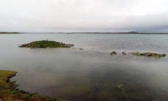
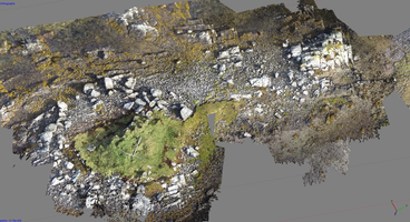
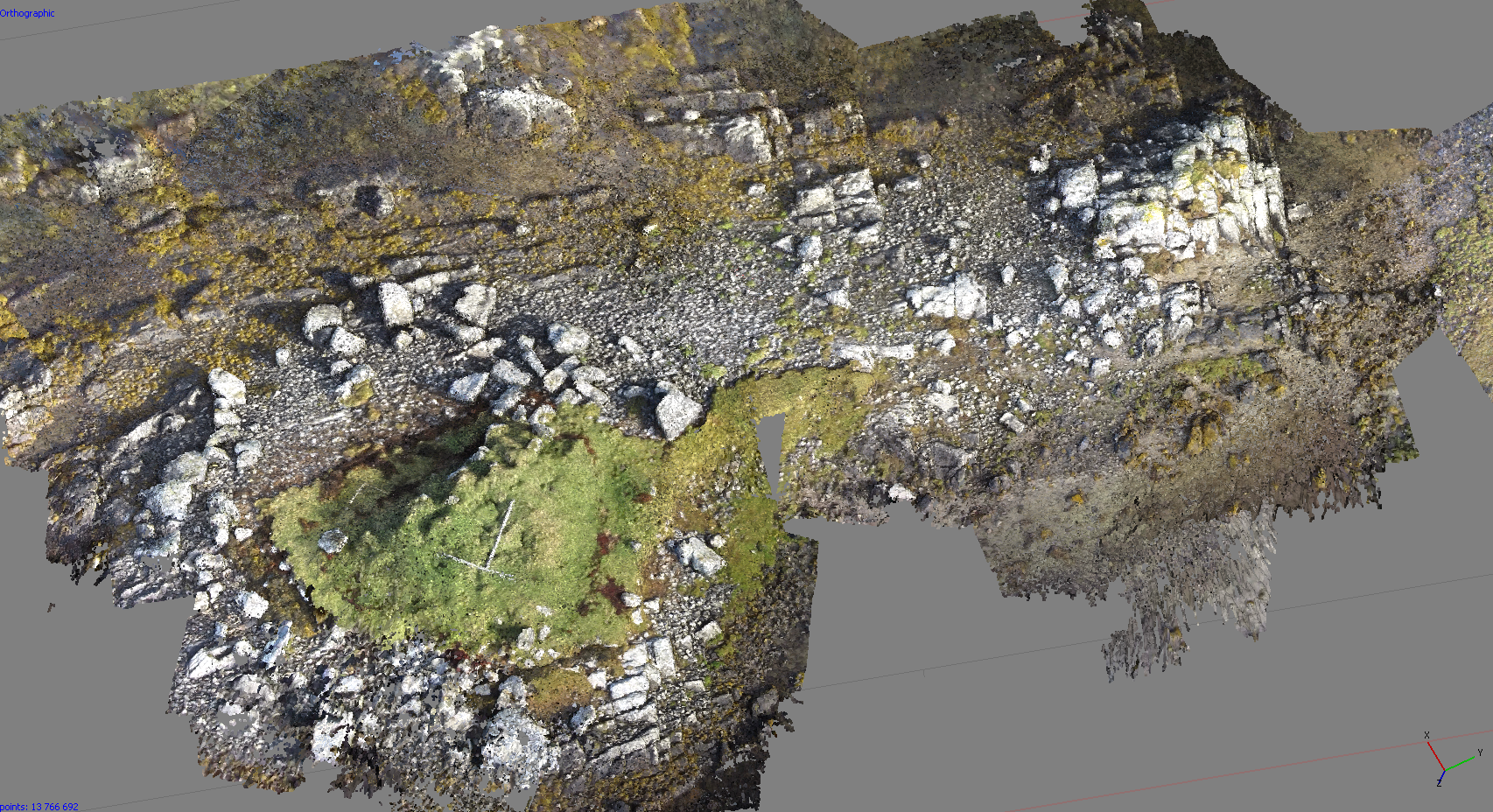
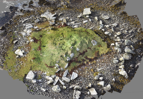
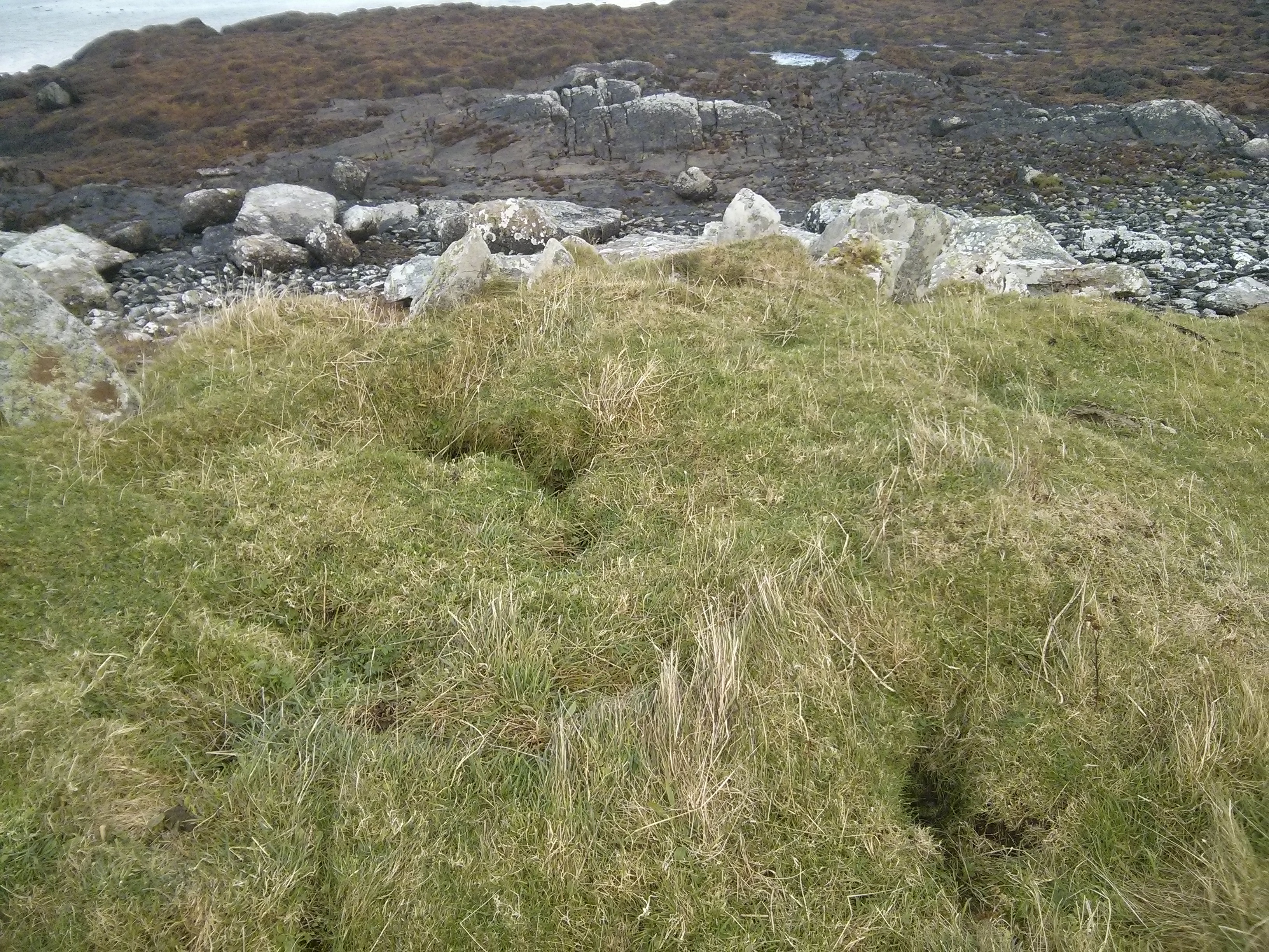
The remains of a much disturbed stony mound, sited on the coast edge, may represent a Neolithic chambered cairn. The site stands on the edge of a tidal islet, which at times is entirely cut off by the sea. The visible remains comprise of a low mound, measuring some 11m in diameter and standing up to 1m high. The seaward edge (north) of the mound is actively eroding and stony cairn material can be seen in the coastal exposures. Towards the center of the mound, the tops of two rows of large stones, probably representing the side walls of a passage, protrude through the turf. These are orientated east-west. Further large stones at the eastern tip of the mound may be part of a facade. There is no longer any trace of the surrounding kerb, noted previously by Henshall (see RCAHMS Canmore entry). In addition to coastal erosion, this site is being undermined by rabbit burrowing. It is recommended that a survey and/or rescue excavation be undertaken without delay.
Update October 2014:
In terms of the active erosion reported, it is felt this is of old surface deposits of soil and turf formed by sea-washed/windblown seaweed and sand and sheep grazing rather than the original cairn structure, which, if it followed the Uist model, would have been made entirely of rock stones, boulders and slabs. (see photo 1) No active rabbit burrowing was observed and this seems unlikely given that the whole site is probably inundated at extreme high tides. The 'holes' are more likely to be washed out cavities between the stone structure. (see photo 2)
Site visit at April high spring tide to observe 'normal' inundation - see April 2022 photos
Location
80981.82
845480.25
27700
57.3874771
-7.3114707
Submitted photographs
Image
Date
Caption
User
17/04/2022
High resolution stitched panorama of the chambered cairn at high spring tide, viewed from the east
Smilemaker
17/04/2022
The chambered cairn at high spring tide, viewed from the south
Smilemaker
28/10/2014
Cairn and islet
DavidNewman
28/10/2014
Aerial view from NE
DavidNewman
28/10/2014
Aerial plan view
DavidNewman
25/10/2014
Rubha Ghaisinis, Carnan, Sig More. Holes
DavidNewman
25/10/2014
Rubha Ghaisinis, Carnan, Sig More. View from north
DavidNewman
Submitted updates
Update id
Date
User
3737
17/04/2022
Smilemaker
Tidal state
High
Site located?
Yes
Proximity to coast edge
Coast edge
Description
Site visit at April high spring tide to observe 'normal' inundation - photos taken (below)
1827
25/10/2014
DavidNewman
Tidal state
Low
Site located?
Yes
Proximity to coast edge
Intertidal
Coastally eroding?
has eroded in the past
Visibility above ground
Highly visible (substantial remains)
Visibility in section
Limited visibility in section
Access
accessible on foot (no footpath)
Local knowledge
don't know
Description
The remains of a much disturbed stony mound, sited on the coast edge, may represent a Neolithic chambered cairn. The site stands on the edge of a tidal islet, which at times is entirely cut off by the sea. The visible remains comprise of a low mound, measuring some 11m in diameter and standing up to 1m high. The seaward edge (north) of the mound is actively eroding and stony cairn material can be seen in the coastal exposures. Towards the center of the mound, the tops of two rows of large stones, probably representing the side walls of a passage, protrude through the turf. These are orientated east-west. Further large stones at the eastern tip of the mound may be part of a facade. There is no longer any trace of the surrounding kerb, noted previously by Henshall (see RCAHMS Canmore entry). In addition to coastal erosion, this site is being undermined by rabbit burrowing. It is recommended that a survey and/or rescue excavation be undertaken without delay.
Update October 2014: In terms of the active erosion reported, it is felt this is of old surface deposits of soil and turf formed by sea-washed/windblown seaweed and sand and sheep grazing rather than the original cairn structure, which, if it followed the Uist model, would have been made entirely of rock stones, boulders and slabs. (see photo 1) No active rabbit burrowing was observed and this seems unlikely given that the whole site is probably inundated at extreme high tides. The 'holes' are more likely to be washed out cavities between the stone structure. (see photo 2)
An up to date aerial survey would be useful to record the existing structures and monitor future erosion patterns. It is hoped to carry this out before the end of 2014.
Demote to priority 3
Comments
Relative to coastal sites on the west side of Uist, this location is very sheltered, and taking all these factors into account, and the fact that the main cause of degradation to date - robbing - has now ceased, this structure feels to be less of a priority than others.