A large mound situated on the coast edge has been cut into by the sea. The mound measures some 90m E-W by 70m N-S. It was probably originally circular in plan, but up to 10m of the seaward side has been lost to coastal erosion. Part of the SW side of the mound is likely to have been damaged when the present road was built, and subsequently at each new improvement of the road. A section, measuring some 120m long is now exposed. Prior to damage caused during the recent storms, anthropogenic deposits, together with traces of possible stonework, were noted in this exposure. These remains were not visible at the time of this survey due to the presence of slumped turf and accumulated sand. (Information supplied by R. McCullagh).
Update from visit by Access Archeology group 25/10/2014. The site in reasonable condition. a large expanse of midden deposits in exposed section on southern beach-side escarpment. around the mid point of this eroded escarpment there is a quantity of exposed masonry in a horizontal line which might be indicative of a structure eroding from the mound, although it seems stable currently.
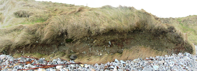
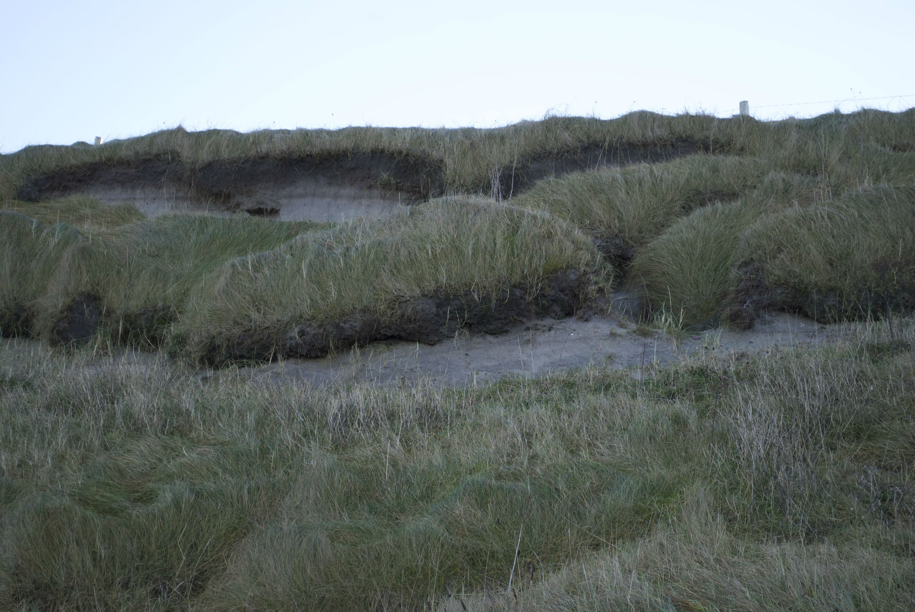
ShoreUPDATE December 2015 The slope is currently mostly vegetated, with small patches of exposed face where stonework and midden is visible. Requires regular monitoring
Update 27th December 2015 - Vegetation more extensive than previous visits, but still midden areas visible in eroding sections together with random masonry and some organised possible wall sections. The beach now has self created a wide, flat shingle shelf, which offers a little protection currently, although such a structure might vanish overnight just as easily as it formed!
The top of the mound is well covered and stable, although tantalising series of ridges and ditches are visible below the vegetation.
May 2016
Site is stable and well-vegetated with no sign of recent erosion. Midden material containing frequent limpet, some winkle, and occasional animal bone in a peat ash-rich matrix is visible towards the top of the mound at the south west end of the section. Three areas of drystone masonry are visible in the north side of the mound. Although the slope is very steep, and so is vulnerable to slippage and erosion, it is currently very well-vegetated and stable.
May 2018
As described
ShoreUPDATE 2020
As described. Face remains generally stable and well-vegetated, with small area of exposure at base on west side, and some slumping of turn at top of section.
March 2024. Vegetated and stable.
Location
77561.00
855413.00
27700
57.4738960
-7.3811822
Submitted photographs
Image
Date
Caption
User
11/03/2024
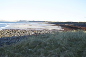
Vegetated mound in March 2024, looking east
joannahambly
11/03/2024
Vegetated mound in March 2024 looking west
joannahambly
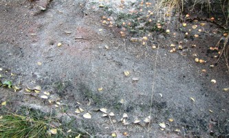
26/01/2020
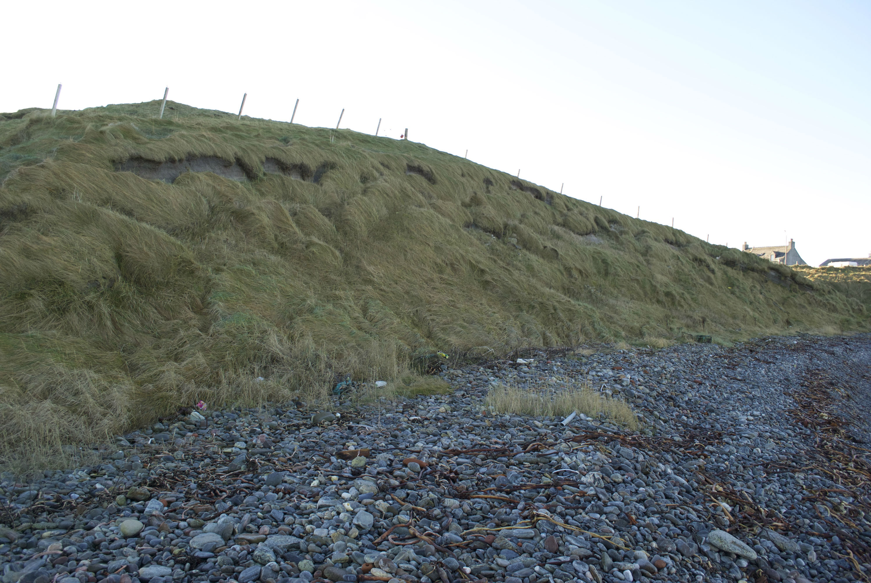
Jan 2020: Detail of short eroding section at base of face
Smilemaker
26/01/2020
Jan 2020: The vegetated face of the mound
Smilemaker
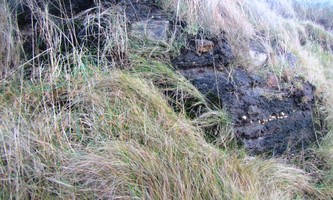
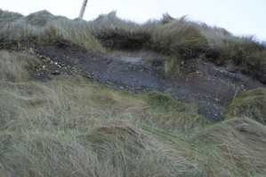
16/12/2015
Stonework visible in vegetated coast edge
training1
27/12/2015
Banded midden deposits
Smilemaker
27/12/2015
Sections show masonry and midden materials
Smilemaker
27/12/2015
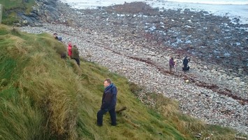
Examining the dune face
Smilemaker
16/12/2015
The mound from the landward side. Photo by Mark Hall
EllieSCHARP
16/12/2015
Coastal section generally vegetated with small patches of erosion. Photo by Mark Hall
EllieSCHARP
16/12/2015
Small exposure with midden and stonework. Photo by Mark Hall
EllieSCHARP
16/12/2015
Midden exposed in section. Photo by Mark Hall
EllieSCHARP
16/12/2015
Patch of slumping at top of section. Photo by Mark Hall
EllieSCHARP
16/12/2015
Stonework visible in grassed section. Photo by Mark Hall
EllieSCHARP
16/12/2015
The vegetated section. Photo by Mark Hall
EllieSCHARP
16/12/2015
View from mound to sea. Photo by Mark Hall
EllieSCHARP
16/12/2015
General view of the section. Photo by Mark Hall
EllieSCHARP
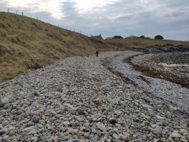
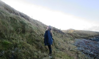
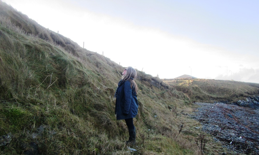
25/10/2014
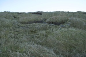
Cnoc Sornain
Smilemaker
25/10/2014
Cnoc Sornain
Smilemaker
Submitted updates
Update id
Date
User
4727
11/03/2024
joannahambly
Tidal state
Mid
Proximity to coast edge
Coast edge
Coastally eroding?
has eroded in the past; not eroding
Access
accessible on foot (footpath); accessible on foot (no footpath)
Local knowledge
is well known
Description
March 2024. Vegetated and stable
This site is regulalry monitored and has been stable for 10 years. Reassigned a priority 3 (monitor) status in March 2024.
3367
26/01/2020
Smilemaker
Description
ShoreUPDATE 2020
As described. Face remains generally stable and well-vegetated, with small area of exposure at base on west side, and some slumping of turn at top of section.
3322
30/05/2018
EllieSCHARP
Description
May 2018
As described
2335
27/12/2015
Smilemaker
Tidal state
Low
Site located?
Yes
Proximity to coast edge
Coast edge
Coastally eroding?
active sea erosion; active wind erosion (in dunes only); has eroded in the past
Threats
stock erosion; animal burrows
Visibility above ground
Limited visibility (partial remains)
Visibility in section
Limited visibility in section
Access
easily accessible - no restrictions; accessible on foot (footpath); vehicular access; accessible on foot (no footpath)
Local knowledge
is well known; has local associations/history
Description
A large mound situated on the coast edge has been cut into by the sea. The mound measures some 90m E-W by 70m N-S. It was probably originally circular in plan, but up to 10m of the seaward side has been lost to coastal erosion. Part of the SW side of the mound is likely to have been damaged when the present road was built, and subsequently at each new improvement of the road. A section, measuring some 120m long is now exposed. Prior to damage caused during the recent storms, anthropogenic deposits, together with traces of possible stonework, were noted in this exposure. These remains were not visible at the time of this survey due to the presence of slumped turf and accumulated sand. (Information supplied by R. McCullagh).
Update from visit by Access Archeology group 25/10/2014. The site in reasonable condition. a large expanse of midden deposits in exposed section on southern beach-side escarpment. around the mid point of this eroded escarpment there is a quantity of exposed masonry in a horizontal line which might be indicative of a structure eroding from the mound, although it seems stable currently.
ShoreUPDATE December 2015 The slope is currently mostly vegetated, with small patches of exposed face where stonework and midden is visible. Requires regular monitoring
Update 27th December 2015 - Vegetation more extensive than previous visits, but still midden areas visible in eroding sections together with random masonry and some organised possible wall sections. The beach now has self created a wide, flat shingle shelf, which offers a little protection currently, although such a structure might vanish overnight just as easily as it formed!
The top of the mound is well covered and stable, although tantalising series of ridges and ditches are visible below the vegetation.
Ongoing regular assessments need to be made to establish what might erode from the dune face with the ongoing wind and storm damage
Comments
Some lovely sections of stratified midden deposits visible on exposed sections, although the vast majority of the dune face is currently stabilised with the vegetation.
2324
16/12/2015
EllieSCHARP
Site located?
Yes
Description
A large mound situated on the coast edge has been cut into by the sea. The mound measures some 90m E-W by 70m N-S. It was probably originally circular in plan, but up to 10m of the seaward side has been lost to coastal erosion. Part of the SW side of the mound is likely to have been damaged when the present road was built, and subsequently at each new improvement of the road. A section, measuring some 120m long is now exposed. Prior to damage caused during the recent storms, anthropogenic deposits, together with traces of possible stonework, were noted in this exposure. These remains were not visible at the time of this survey due to the presence of slumped turf and accumulated sand. (Information supplied by R. McCullagh).
Update from visit by Access Archeology group 25/10/2014. The site in reasonable condition. a large expanse of midden deposits in exposed section on southern beach-side escarpment. around the mid point of this eroded escarpment there is a quantity of exposed masonry in a horizontal line which might be indicative of a structure eroding from the mound, although it seems stable currently.
ShoreUPDATE December 2015
The slope is currently mostly vegetated, with small patches of exposed face where stonework and midden is visible. Requires regular monitoring
May 2016
Site is stable and well-vegetated with no sign of recent erosion. Midden material containing frequent limpet, some winkle, and occasional animal bone in a peat ash-rich matrix is visible towards the top of the mound at the south west end of the section. Three areas of drystone masonry are visible in the north side of the mound. Although the slope is very steep, and so is vulnerable to slippage and erosion, it is currently very well-vegetated and stable.
1824
25/10/2014
Smilemaker
Tidal state
Mid
Site located?
Yes
Proximity to coast edge
Coast edge
Coastally eroding?
active sea erosion; active wind erosion (in dunes only); has eroded in the past
Threats
animal burrows
Visibility above ground
Highly visible (substantial remains)
Visibility in section
Clearly visible in section
Access
easily accessible - no restrictions
Local knowledge
is well known
Description
A large mound situated on the coast edge has been cut into by the sea. The mound measures some 90m E-W by 70m N-S. It was probably originally circular in plan, but up to 10m of the seaward side has been lost to coastal erosion. Part of the SW side of the mound is likely to have been damaged when the present road was built, and subsequently at each new improvement of the road. A section, measuring some 120m long is now exposed. Prior to damage caused during the recent storms, anthropogenic deposits, together with traces of possible stonework, were noted in this exposure. These remains were not visible at the time of this survey due to the presence of slumped turf and accumulated sand. (Information supplied by R. McCullagh).
Update from visit by Access Archaeology group 25/10/2014. The site in reasonable condition. A large expanse of midden deposits in exposed section on southern beach-side escarpment. Around the mid point of this eroded escarpment there is a quantity of exposed masonry in a horizontal line which might be indicative of a structure eroding from the mound, although it seems stable currently.
Keep under review. This coastline undergoes periodic erosion events, rather than a slow constant land loss. When these events do occur, they tend to be significant and potentially catastrophic. The mound itself is a significant structure and would probably be relatively easy to assess using non invasive geophysical survey. An informed decision to investigate further before the site might be lost can then be made.
Demote from priority 1 to priority 2
Comments
There is a pronounced boundary ridge immediately to the north of the mound which partly encircle the northern section. This northern area has an uneven surface suggestive of subsurface structures and possible building platforms.
Access Archaeology will continue to monitor the site and report as appropriate.