A slight rise is located on the coast edge. It measures 30m in diameter and is up to 1.5m high. Sea erosion in front of the mound has exposed archaeological deposits in a 25m long section. To the west side, these include a band of highly organic soil, covering shell midden, which is predominantly cockle. To the east side, occasional large stones and a block of coursed masonry protrude from the section. The block of masonry is faced on one side, extends for 1m and stands to 0.5m or 6 courses in height. The stones lie over a very distinctive, highly organic silty soil layer which is up to 0.35m deep. The site was previously recorded as a broch, on the tenuous evidence that it had been included as such on Petrie's list. Cartloads of stone are said to have been removed from the site, but there is no record of what, if anything, was uncovered during these investigations. Ref.: Orkney Name Book, 2, #24; Petrie, G (1873), 'Notice of the brochs or large round towers of Orkney', Arch Scotica, 5 (1874-1890), 71-94; Hamilton, JRC (1968) 'Excavations at Clickhimin, Shetland', 174; RCAHMS (1946), #182; RCAHMS (1980), #151.
ShoreUPDATE may 2013 CP- as described above.
ShoreUPDATE March 2016:
As described. There are two very distinct layers. The lower is a compacted and mid orangey brown, with dry stone-built structures. Struck flint, including a scraper and animal bone are visible in this deposit. The upper layer is looser and very dark brown containing frequent animal and fish bone.
ShoreUPDATE August 2018:
As described. The stone structures could be the remains of a single drystone building. There are two areas of coursed stonework with a large orthostat between them. Several pieces of struck flint were recovered from the eroding lower compact orangey brown deposit. No animal bone or pottery visible despite careful scrutiny.
Location
366591.00
1045421.00
27700
59.2939186
-2.5882556
Submitted photographs
Image
Date
Caption
User
25/08/2018
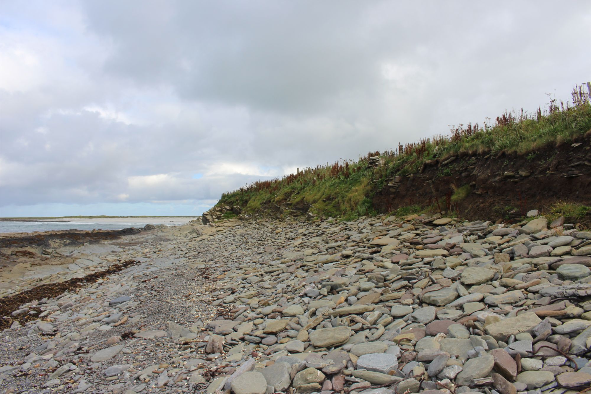
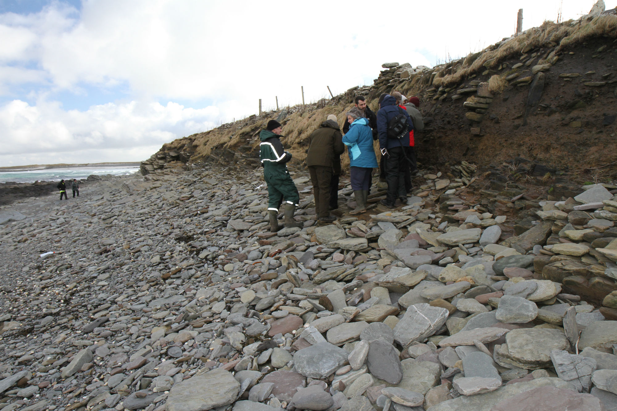
Aug 2018: general view along coast edge
training1
25/08/2018
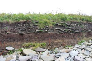
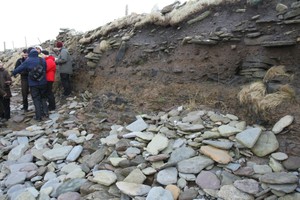
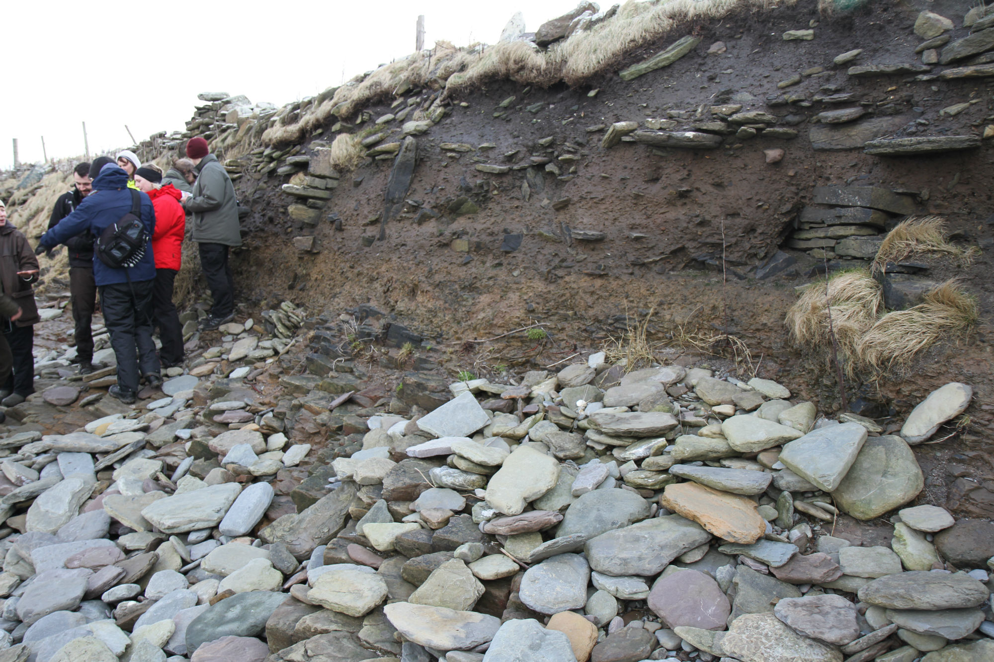
August 2018: Rubble in section to west of drystone building
training1
25/08/2018
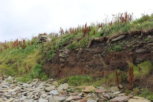
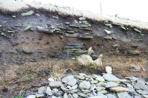
August 2018: Possible building in section, coursed stonework with large orthostat between
training1
26/08/2013
March 2016: Western side of main exposure, looking S
cparker
26/08/2013
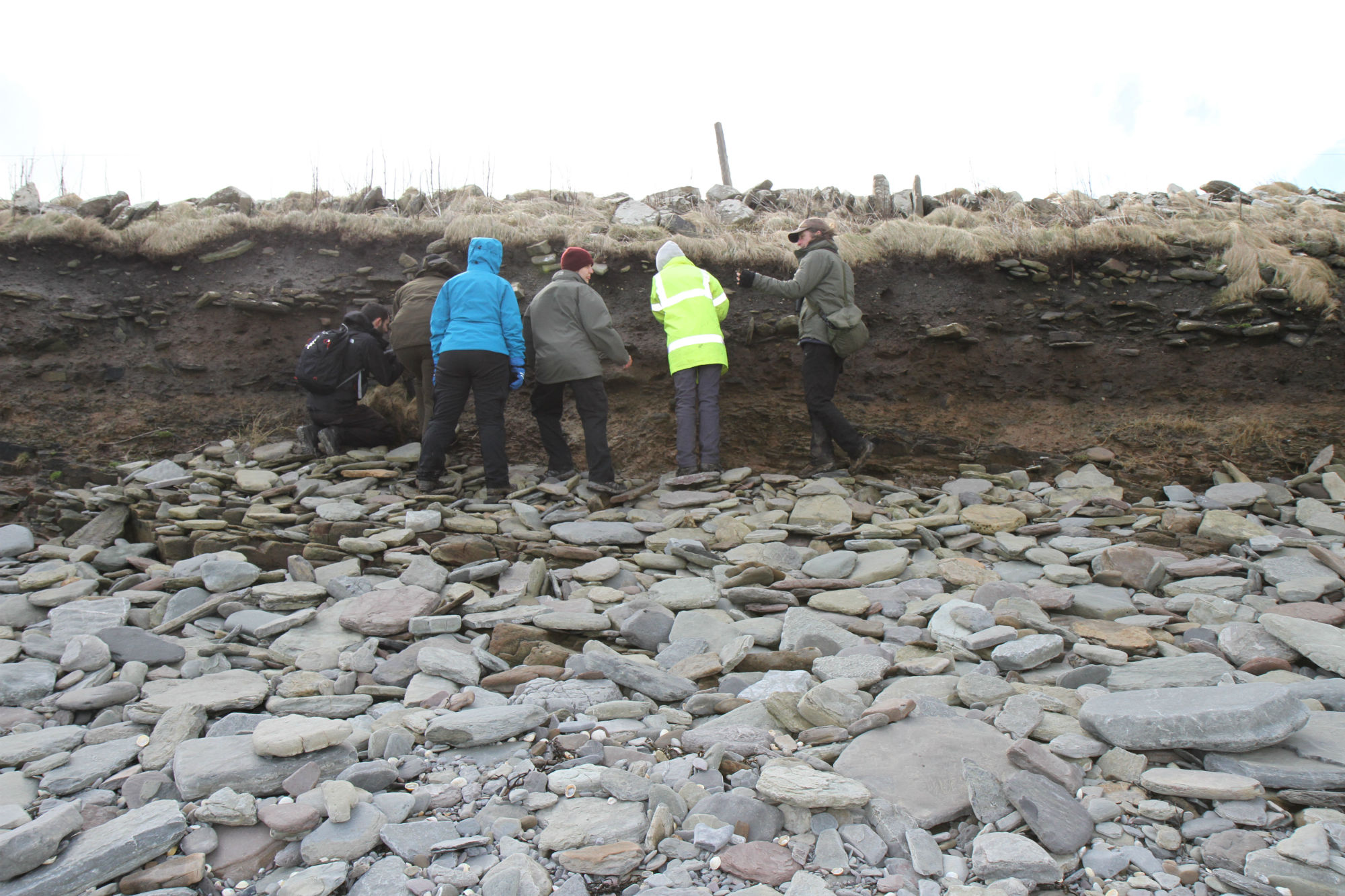
March 2016: Close-up of section showing structures and distinctive layers, looking S
cparker
26/08/2013
March 2016: Closer view looking E
cparker
26/08/2013
March 2016: General view of section looking E
cparker
Submitted updates
Update id
Date
User
3180
25/08/2018
training1
Tidal state
Low
Site located?
Yes
Proximity to coast edge
Coast edge
Coastally eroding?
active sea erosion; has eroded in the past
Visibility above ground
Not visible
Access
accessible - difficult terrain
Local knowledge
don't know
Description
A slight rise is located on the coast edge. It measures 30m in diameter and is up to 1.5m high. Sea erosion in front of the mound has exposed archaeological deposits in a 25m long section. To the west side, these include a band of highly organic soil, covering shell midden, which is predominantly cockle. To the east side, occasional large stones and a block of coursed masonry protrude from the section. The block of masonry is faced on one side, extends for 1m and stands to 0.5m or 6 courses in height. The stones lie over a very distinctive, highly organic silty soil layer which is up to 0.35m deep. The site was previously recorded as a broch, on the tenuous evidence that it had been included as such on Petrie's list. Cartloads of stone are said to have been removed from the site, but there is no record of what, if anything, was uncovered during these investigations. Ref.: Orkney Name Book, 2, #24; Petrie, G (1873), 'Notice of the brochs or large round towers of Orkney', Arch Scotica, 5 (1874-1890), 71-94; Hamilton, JRC (1968) 'Excavations at Clickhimin, Shetland', 174; RCAHMS (1946), #182; RCAHMS (1980), #151.
ShoreUPDATE may 2013 CP- as described above.
ShoreUPDATE March 2016:
As described. There are two very distinct layers. The lower is a compacted and mid orangey brown, with dry stone-built structures. Struck flint, including a scraper and animal bone are visible in this deposit. The upper layer is looser and very dark brown containing frequent animal and fish bone.
ShoreUPDATE August 2018:
As described. The stone structures could be the remains of a single drystone building. There are two areas of coursed stonework with a large orthostat between them. Several pieces of struck flint were recovered from the eroding lower compact orangey brown deposit. No animal bone or pottery visible despite careful scrutiny.
Section cleaning and recording. Retrieval of samples for dating.
Comments
This looks very like a Neolithic house.
1235
26/05/2013
cparker
Tidal state
Low
Site located?
Yes
Proximity to coast edge
Coast edge
Coastally eroding?
active sea erosion
Threats
none
Visibility above ground
Not visible
Visibility in section
Limited visibility in section
Access
accessible - difficult terrain
Description
A slight rise is located on the coast edge. It measures 30m in diameter and is up to 1.5m high. Sea erosion in front of the mound has exposed archaeological deposits in a 25m long section. To the west side, these include a band of highly organic soil, covering shell midden, which is predominantly cockle. To the east side, occasional large stones and a block of coursed masonry protrude from the section. The block of masonry is faced on one side, extends for 1m and stands to 0.5m or 6 courses in height. The stones lie over a very distinctive, highly organic silty soil layer which is up to 0.35m deep. The site was previously recorded as a broch, on the tenuous evidence that it had been included as such on Petrie's list. Cartloads of stone are said to have been removed from the site, but there is no record of what, if anything, was uncovered during these investigations. Ref.: Orkney Name Book, 2, #24; Petrie, G (1873), 'Notice of the brochs or large round towers of Orkney', Arch Scotica, 5 (1874-1890), 71-94; Hamilton, JRC (1968) 'Excavations at Clickhimin, Shetland', 174; RCAHMS (1946), #182; RCAHMS (1980), #151.
ShoreUPDATE may 2013 CP- as described above.
ShoreUPDATE March 2016:
As described. There are two very distinct layers. The lower is a compacted and mid orangey brown, with dry stone-built structures. Struck flint, including a scraper and animal bone are visible in this deposit. The upper layer is looser and very dark brown containing frequent animal and fish bone.
Geophysics to ascertain the extent of the site.
Section cleaning, sampling and recording to aid dating and characterisation.
Re-assign Priority 1.