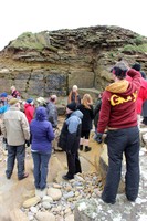
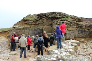
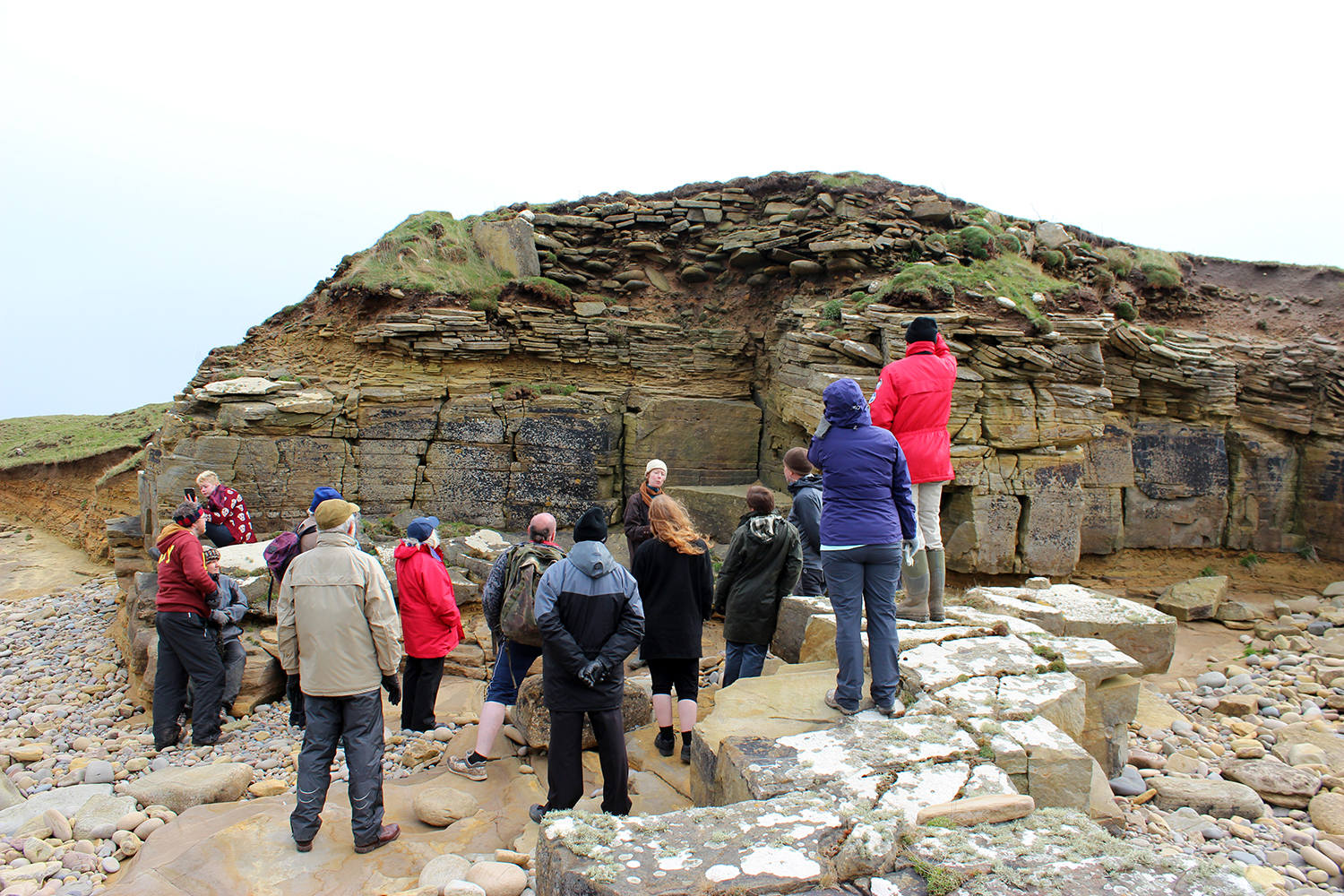
The seaward side of an overgrown mound, which lies at the top of 5m high banks, is being eroded by the sea. The 12m long coastal exposure reveals a cairn, comprising a concentration of beach stone, uprights and coursed walling. To the centre of the section, a block of walling, made up of larger stones appears to be part of a small chamber or cist structure. Other structural features include a large upright slab which protrudes from the north end of the cairn and an associated 2.2m long fragment of coursed masonry. The cairn lies over an OGS, which covers a thin deposit of till over bedrock. The cairn, although badly damaged in parts, extends inland for a further 12m. It remains very vulnerable to further erosion. Ref.: RCAHMS (1980), #13.
21/04/2014
As described. Arrangement of stone suggests internal structure. No cultural material visible in deposits suggesting a burial cairn rather than habitation or settlement remains.
Low mound behind coastal section with occasional stone protruding from turf.
Location
362050.00
1037990.00
27700
59.2268066
-2.6666629
Submitted photographs
Image
Date
Caption
User
21/04/2014
Closer view of section
training1
21/04/2014
Eroding face of cairn, looking southeast
training1
Submitted updates
Update id
Date
User
1689
21/04/2014
training1
Tidal state
Mid
Site located?
Yes
Proximity to coast edge
Coast edge
Coastally eroding?
active sea erosion; has eroded in the past
Visibility above ground
Limited visibility (partial remains)
Visibility in section
Clearly visible in section
Access
accessible on foot (no footpath)
Local knowledge
don't know
Description
The seaward side of an overgrown mound, which lies at the top of 5m high banks, is being eroded by the sea. The 12m long coastal exposure reveals a cairn, comprising a concentration of beach stone, uprights and coursed walling. To the centre of the section, a block of walling, made up of larger stones appears to be part of a small chamber or cist structure. Other structural features include a large upright slab which protrudes from the north end of the cairn and an associated 2.2m long fragment of coursed masonry. The cairn lies over an OGS, which covers a thin deposit of till over bedrock. The cairn, although badly damaged in parts, extends inland for a further 12m. It remains very vulnerable to further erosion. Ref.: RCAHMS (1980), #13.
21/04/2014
As described. Arrangement of stone suggests internal structure. No cultural material visible in deposits suggesting a burial cairn rather than habitation or settlement remains.
Low mound behind coastal section with occasional stone protruding from turf.
Good candidate for low level aerial photography (kite/pole/drone) to create structure from motion point cloud and model of coast edge and detailed rectified photograph of eroding section.