Midden deposits and artefacts were uncovered in the coastal section near the Church and Manse at Mail (see SM21). The finds were made in the last century by the Rev. G. Clarke. They included deposits containing burnt bone, shell and carbonised grain and steatite vessels and a quernstone. While the cliff face is now partially covered with rough vegetation and recently dumped refuse, deep deposits of cultivation soil are visible in the eroding section. These deposits contain inclusions of shell and bone and, together with the deposits and artefacts recorded in the past, suggest the presence of a prehistoric or early historic settlement site.
27/05/14
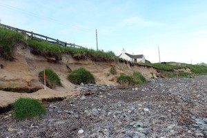
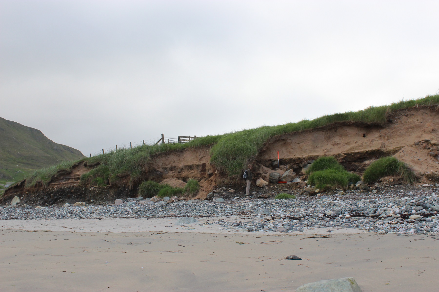
Approximately 150m of eroding sand section long the Sands of Mail below the Free Church, manse and cottage.
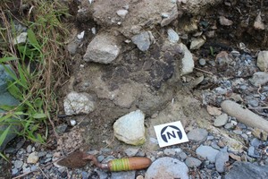
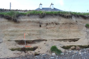
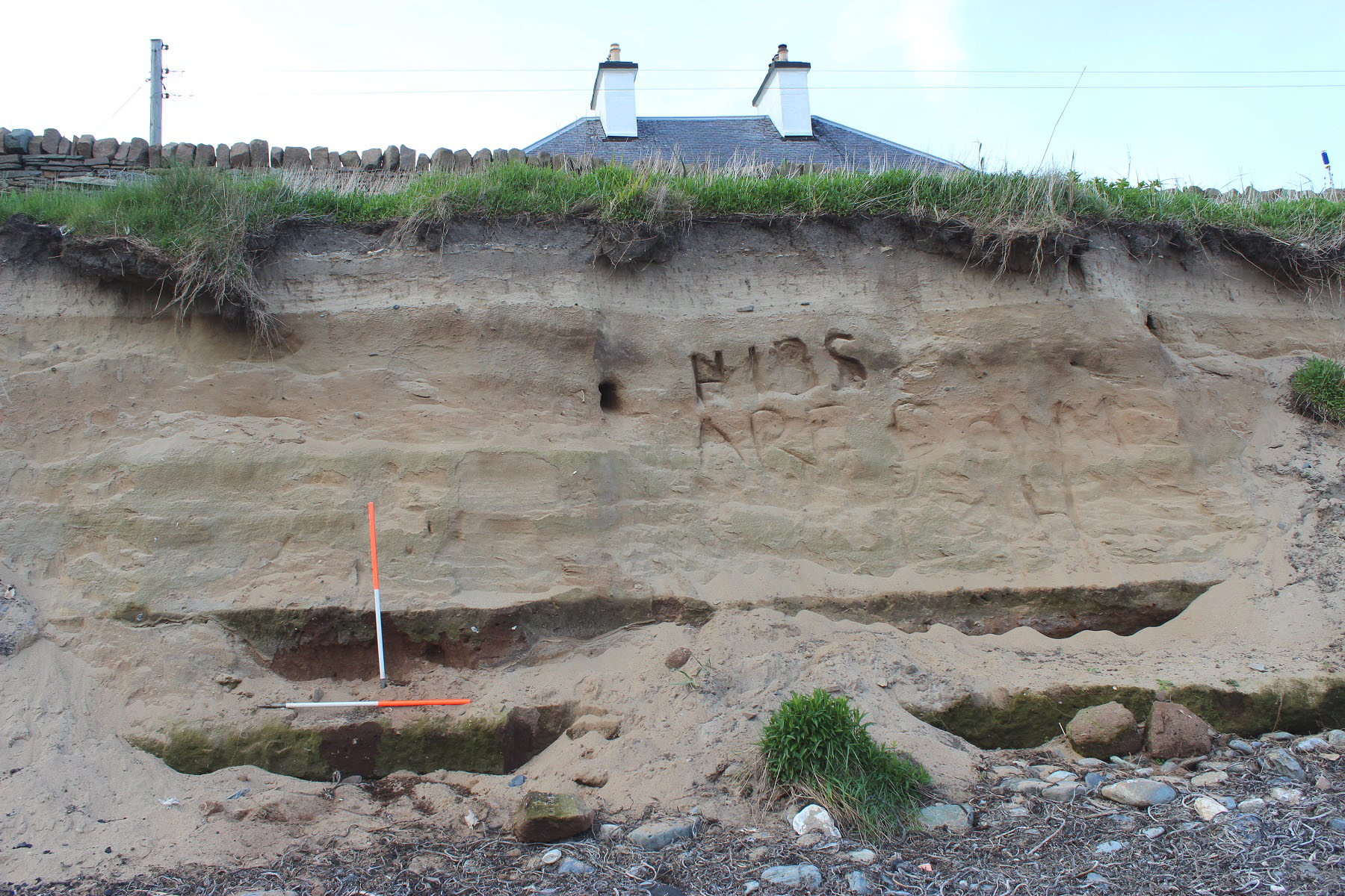
Around 3m of blown sand overlie a continuous layer of reddish brown sandy clay and midden comprised of peat ash and organic material, containing frequent charcoal, shell (mainly limpet and winkle) animal bone fragments, fire-cracked stone and angular quartz fragments. Occasional coarse prehistoric pottery can be seen, including a 30cm diameter concave bowl fragment which appears to line a depression or cut in the underlying natural till. This is located at the far eastern end of the eroding section.
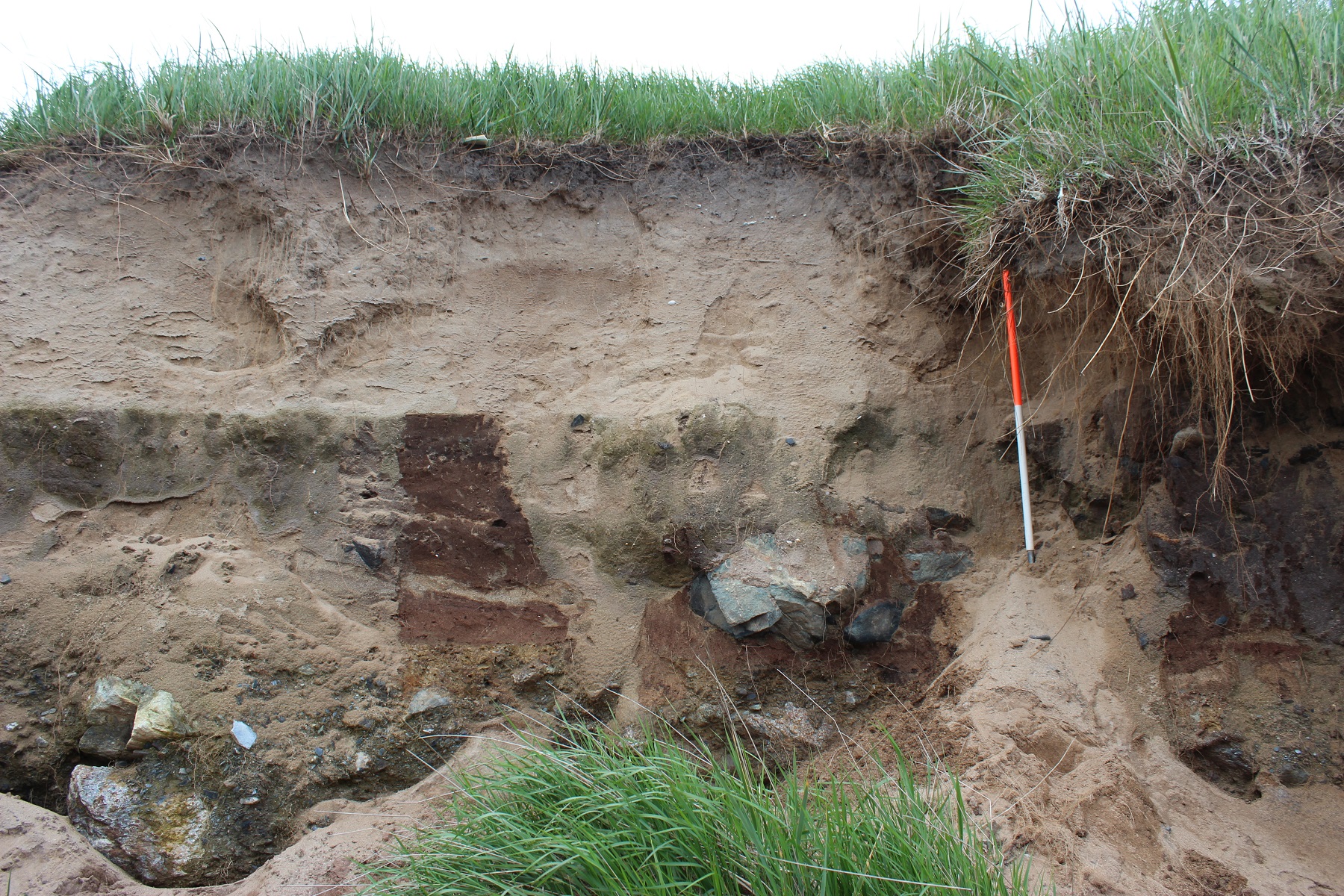
The thickness of the midden deposits varies from 0.6m to 1m. Below the Free Church and the manse, the midden deposits form 2 distinct layers separated by sandier deposits. Eastwards from the manse, the upper layer is not visible and only the lower layer extends to below the cottage where it too becomes obscured in slumped deposits.
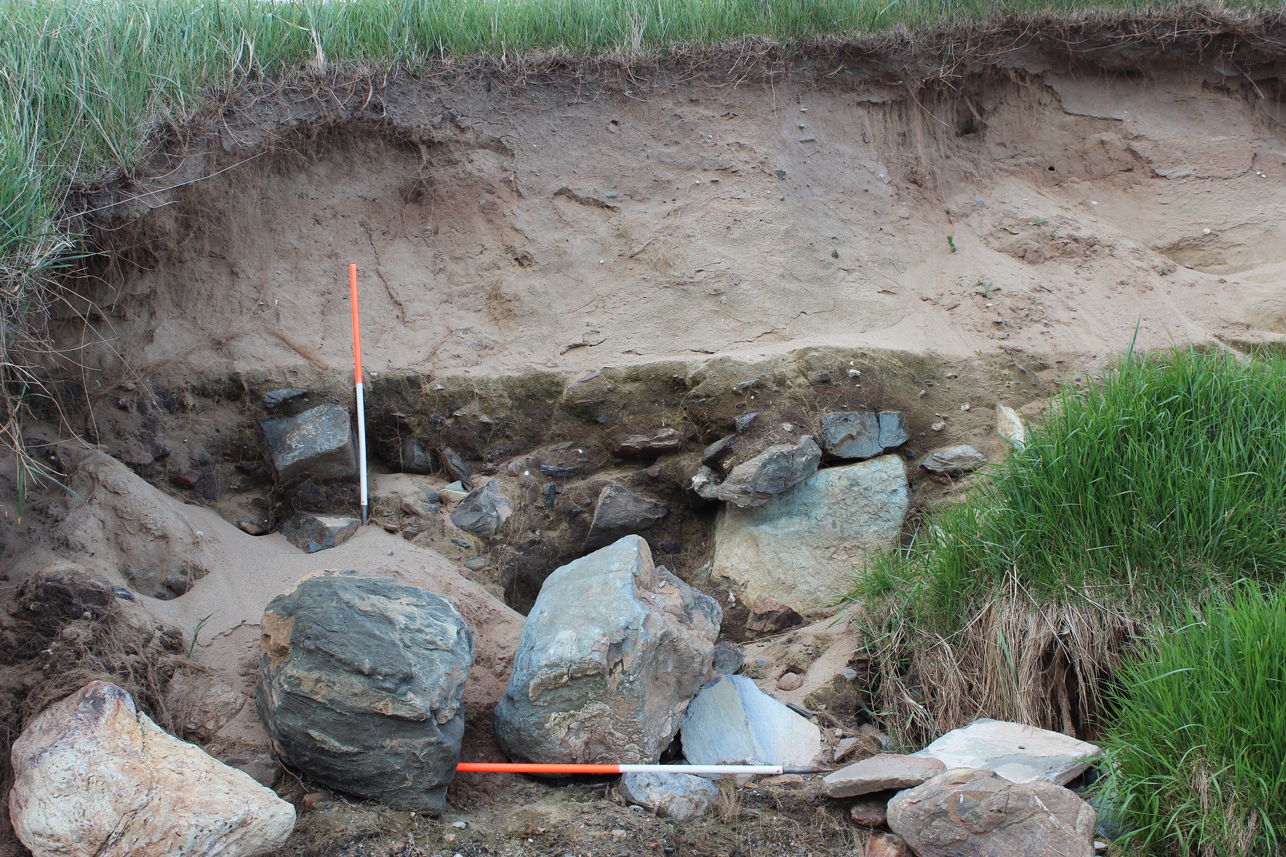
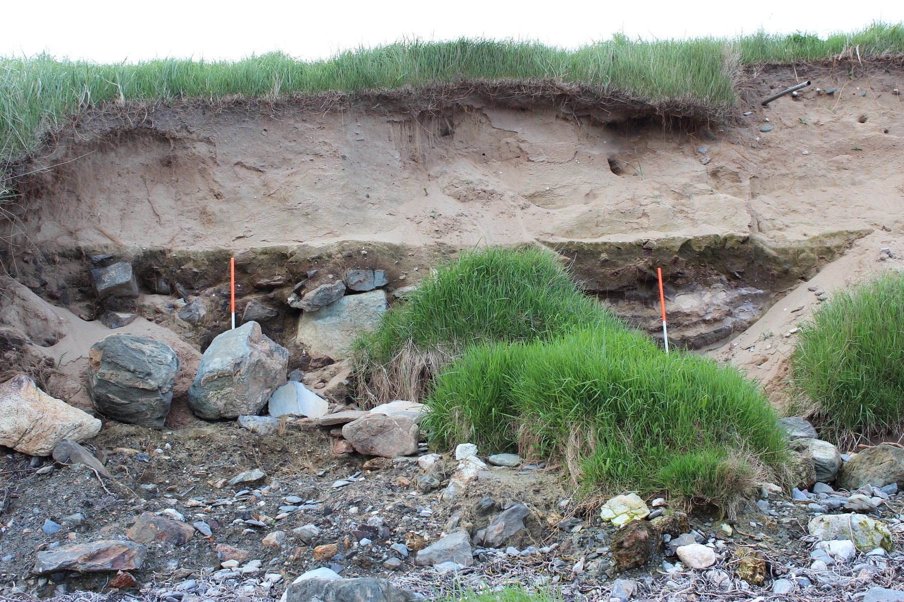
Towards the west end of the section towards the stream and more or less below the Free Church, the bedrock rises by around 1.5m to form a low platform. Upon this area of higher bedrock is an approximate 18m length of boulder sized stone associated with very thick midden deposits. Some of these boulders are nearly 1m in diametre. Two fragments of walling are identifiable, possibly aligned ENE-WSW.
Archaeological deposits rest directly upon the surface of the till. No intervening buried soils, sand etc were visible.
Update 2018
Now behind rock armour coastal defence constructed to protect nearby properties
Location
442950.00
1127920.00
27700
60.0338058
-1.2310015
Submitted photographs
Image
Date
Caption
User
27/05/2014
Detail of large pot fragment at base of eastern end of section
training1
27/05/2014
Closer view of walling
training1
27/05/2014
Structural remains, west end of seciton
training1
27/05/2014
Fragment of wall in west end of section
training1
27/05/2014
General view of eastern part of section showing where upper midden layer ceases
training1
27/05/2014
Double layer of midden deposits east of structure
training1
27/05/2014
general view of western end of section showing stone structures on bedrock rise
training1
Submitted updates
Update id
Date
User
3312
19/12/2019
training1
Site located?
No
Description
Update 2018
Now behind rock armour coastal defence constructed to protect nearby properties
1659
27/05/2014
training1
Tidal state
Low
Site located?
Yes
Proximity to coast edge
Coast edge
Coastally eroding?
active sea erosion; has eroded in the past
Visibility above ground
Not visible
Visibility in section
Clearly visible in section
Access
accessible on foot (no footpath)
Local knowledge
don't know
Description
Midden deposits and artefacts were uncovered in the coastal section near the Church and Manse at Mail (see SM21). The finds were made in the last century by the Rev. G. Clarke. They included deposits containing burnt bone, shell and carbonised grain and steatite vessels and a quernstone. While the cliff face is now partially covered with rough vegetation and recently dumped refuse, deep deposits of cultivation soil are visible in the eroding section. These deposits contain inclusions of shell and bone and, together with the deposits and artefacts recorded in the past, suggest the presence of a prehistoric or early historic settlement site.
27/05/14
Approximately 150m of eroding sand section long the Sands of Mail below the Free Church, manse and cottage.
Around 3m of blown sand overlie a continuous layer of reddish brown sandy clay and midden comprised of peat ash and organic material, containing frequent charcoal, shell (mainly limpet and winkle) animal bone fragments, fire-cracked stone and angular quartz fragments. Occasional coarse prehistoric pottery can be seen, including a 30cm diameter concave bowl fragment which appears to line a depression or cut in the underlying natural till. This is located at the far eastern end of the eroding section.
The thickness of the midden deposits varies from 0.6m to 1m. Below the Free Church and the manse, the midden deposits form 2 distinct layers separated by sandier deposits. Eastwards from the manse, the upper layer is not visible and only the lower layer extends to below the cottage where it too becomes obscured in slumped deposits.
Towards the west end of the section towards the stream and more or less below the Free Church, the bedrock rises by around 1.5m to form a low platform. Upon this area of higher bedrock is an approximate 18m length of boulder sized stone associated with very thick midden deposits. Some of these boulders are nearly 1m in diametre. Two fragments of walling are identifiable, possibly aligned ENE-WSW.
Archaeological deposits rest directly upon the surface of the till. No intervening buried soils, sand etc were visible.
Urgent rapid recording of the section, sampling for dating evidence and assessment of significance.
Comments
This site, like that of Channerwick was first exposed in the storms and easterly gales of winter 2012/13, and again in 2013/14.
Priority 1* recommended on basis of field visit; soon afterwards coastal defence was built at this site. Reassign to priority 2 status to highlight site's archaeological significance for any future coastal defence works.