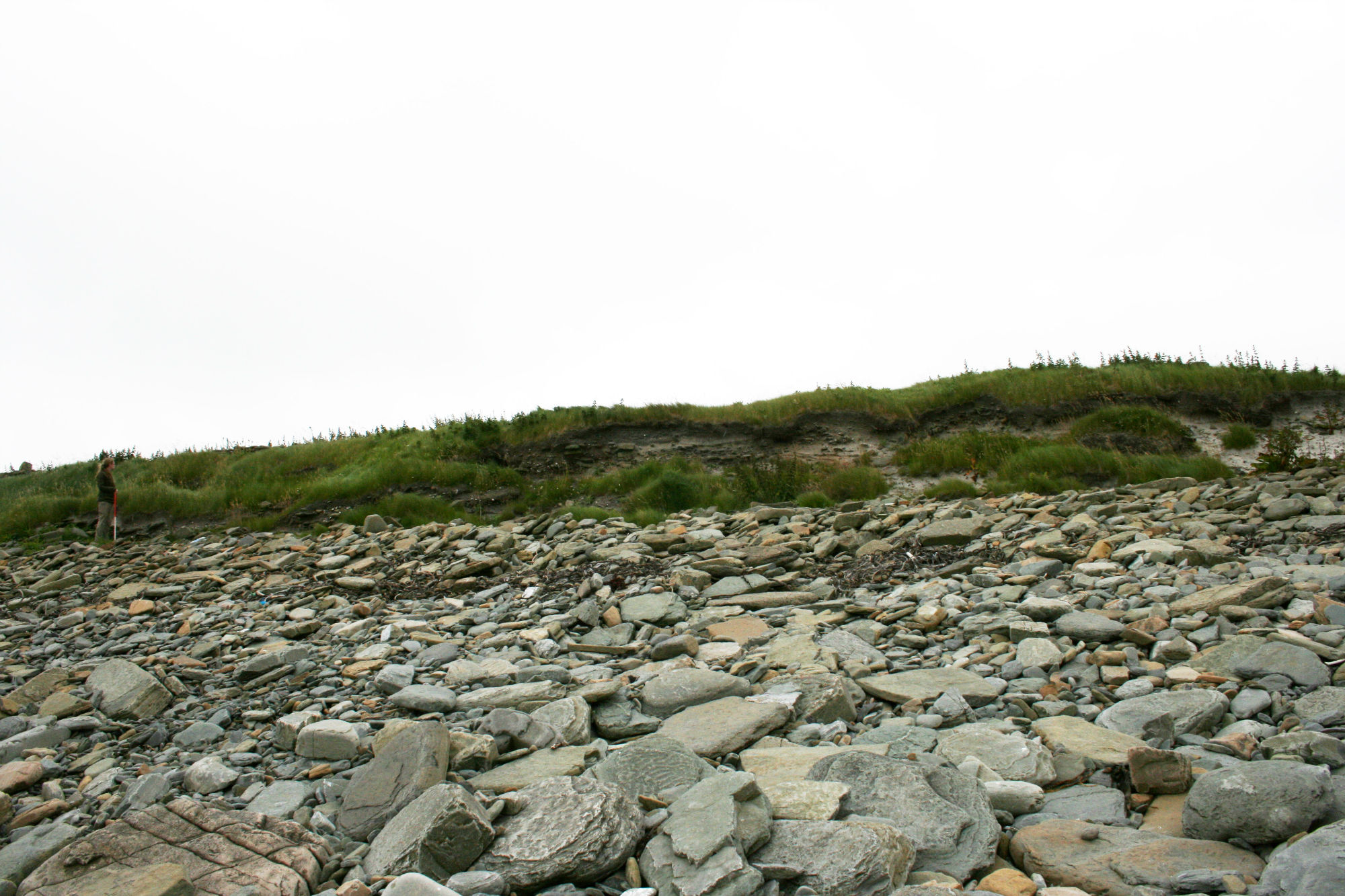
(i) A slight mound lies inland from a coastal exposure containing archaeological deposits. The mound is amorphous and has no distinguishing features. The exposure extends for 13m and stands up to 1.2m high. The visible archaeological deposits chiefly comprise loose stonework, apparently representing a wall aligned parallel to the modern shoreline. This is covered by soil deposits containing inclusions of peat ash and charcoal and latterly by shell midden. There are further deposits of peat ash beneath the wall. The coastal section has slumped to either side of the visible deposits and thus their full extent could not be determined. These deposits lie above a soft till which is being washed out by the sea, threatening further collapse. It is probable that these remains are derived from a more extensive prehistoric settlement although further assessment will be required to determine this. (ii) The 18th-20th farmstead at Biggings is situated over a large mound. This mound lies over 100m from the coast. It is at least 40m in diameter and stands to an average height of 2m. It may be a farm mound or a settlement mound.
06/07/2014
ShoreUPDATE
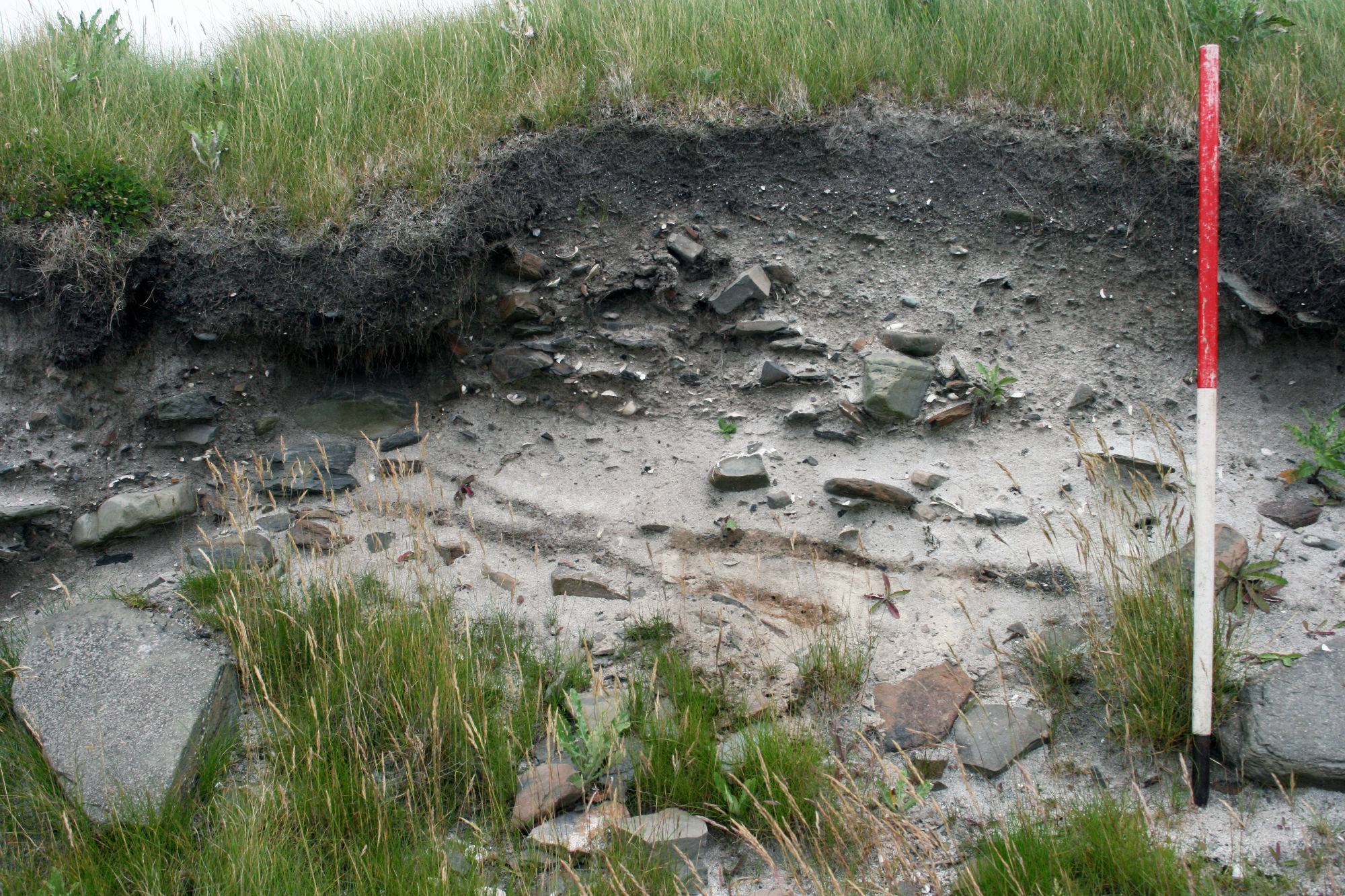
Wall perpendicular to coast edge, associated with possible paving slabs and at least 2 thin layers of ash. A possible 2nd wall would form a rectangular structure of approx. 4 m wide.
Associated with the structural remains are frequent fire-cracked stone in a dark grey sandy matrix containing frequent charcoal, broken limpet shell, fish bone and fragmented animal bone. No pottery noted.
In the northern end of the section, modern (ish), probably 19th century dumping including leather shoe, glass, fe objs is slumping over the ash layers.
Location
344400.00
1050440.00
27700
59.3366394
-2.9790657
Submitted photographs
Image
Date
Caption
User
06/07/2014
General view of coastal section looking east
training1
06/07/2014
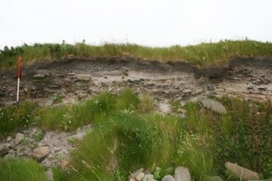
Closer view of walling
training1
06/07/2014
Biggings, showing wall, possible paving and ashy layers
training1
06/07/2014
Closer view of ashy layers
training1
Submitted updates
Update id
Date
User
1817
06/07/2014
training1
Tidal state
Mid
Site located?
Yes
Proximity to coast edge
Coast edge
Coastally eroding?
active sea erosion; has eroded in the past
Visibility above ground
Not visible
Visibility in section
Limited visibility in section
Access
easily accessible - no restrictions
Local knowledge
don't know
Description
(i) A slight mound lies inland from a coastal exposure containing archaeological deposits. The mound is amorphous and has no distinguishing features. The exposure extends for 13m and stands up to 1.2m high. The visible archaeological deposits chiefly comprise loose stonework, apparently representing a wall aligned parallel to the modern shoreline. This is covered by soil deposits containing inclusions of peat ash and charcoal and latterly by shell midden. There are further deposits of peat ash beneath the wall. The coastal section has slumped to either side of the visible deposits and thus their full extent could not be determined. These deposits lie above a soft till which is being washed out by the sea, threatening further collapse. It is probable that these remains are derived from a more extensive prehistoric settlement although further assessment will be required to determine this. (ii) The 18th-20th farmstead at Biggings is situated over a large mound. This mound lies over 100m from the coast. It is at least 40m in diameter and stands to an average height of 2m. It may be a farm mound or a settlement mound.
06/07/2014
ShoreUPDATE
Wall perpendicular to coast edge, associated with possible paving slabs and at least 2 thin layers of ash. A possible 2nd wall would form a rectangular structure of approx. 4 m wide.
Associated with the structural remains are frequent fire-cracked stone in a dark grey sandy matrix containing frequent charcoal, broken limpet shell, fish bone and fragmented animal bone. No pottery noted.
In the northern end of the section, modern (ish), probably 19th century dumping including leather shoe, glass, fe objs is slumping over the ash layers.
Some change since the 1998 survey. Located behind storm beach on very exposed coast. The site doesn't appear prehistoric in the character of the masonry or midden deposits. It would be useful to investigate further for dating. Re-assign to Priority 2.