| Tidal state |
Low |
| Site located? |
Yes |
| Proximity to coast edge |
Coast edge |
| Coastally eroding? |
active sea erosion; has eroded in the past |
| Coastal defence |
Yes |
| Visibility above ground |
Highly visible (substantial remains) |
| Visibility in section |
Clearly visible in section |
| Description |
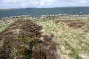
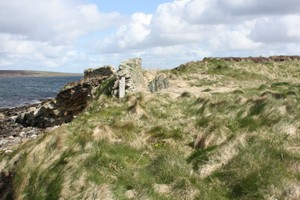
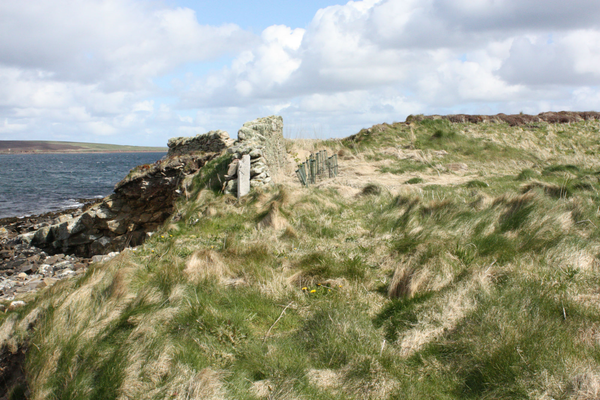
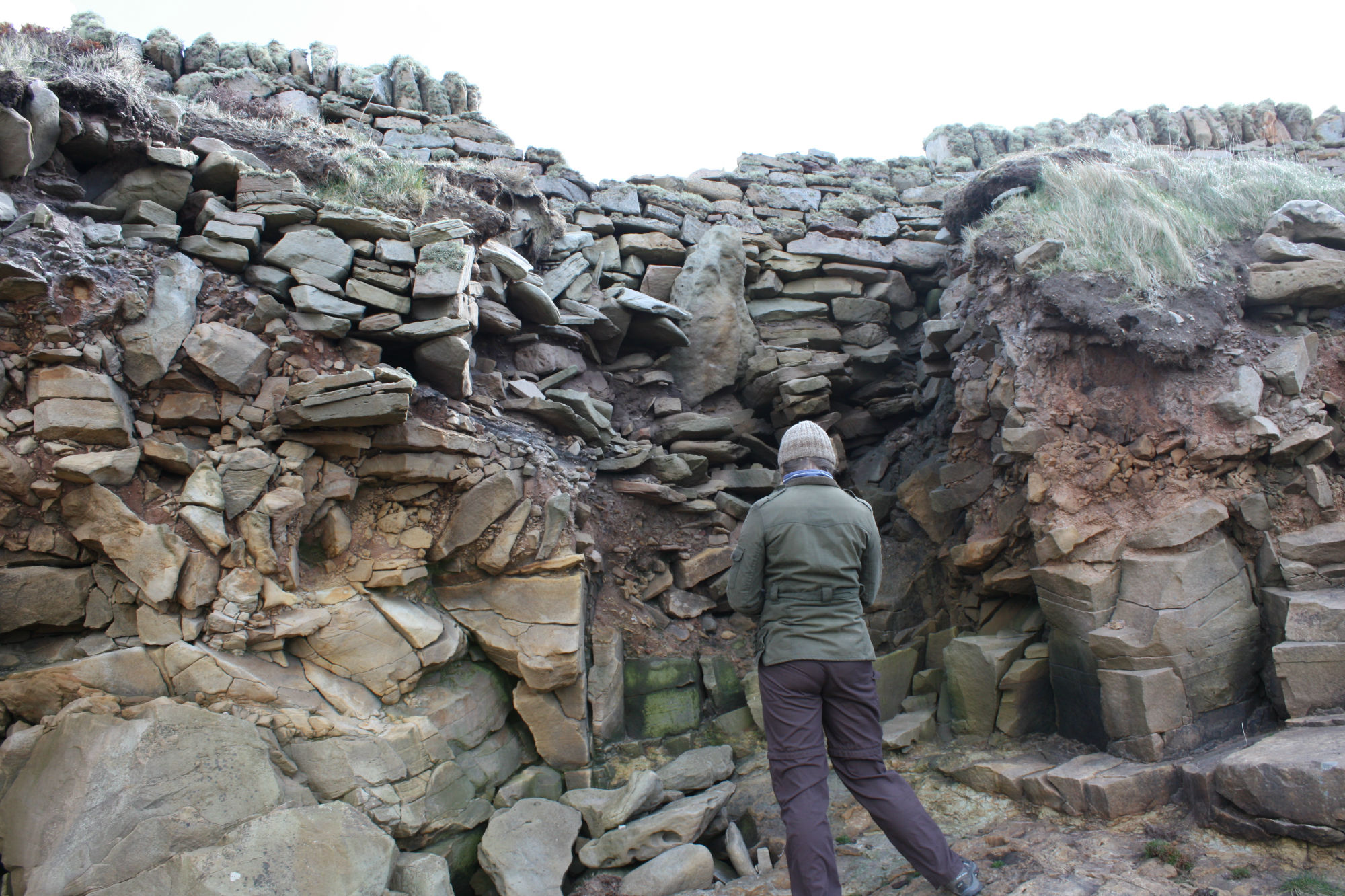
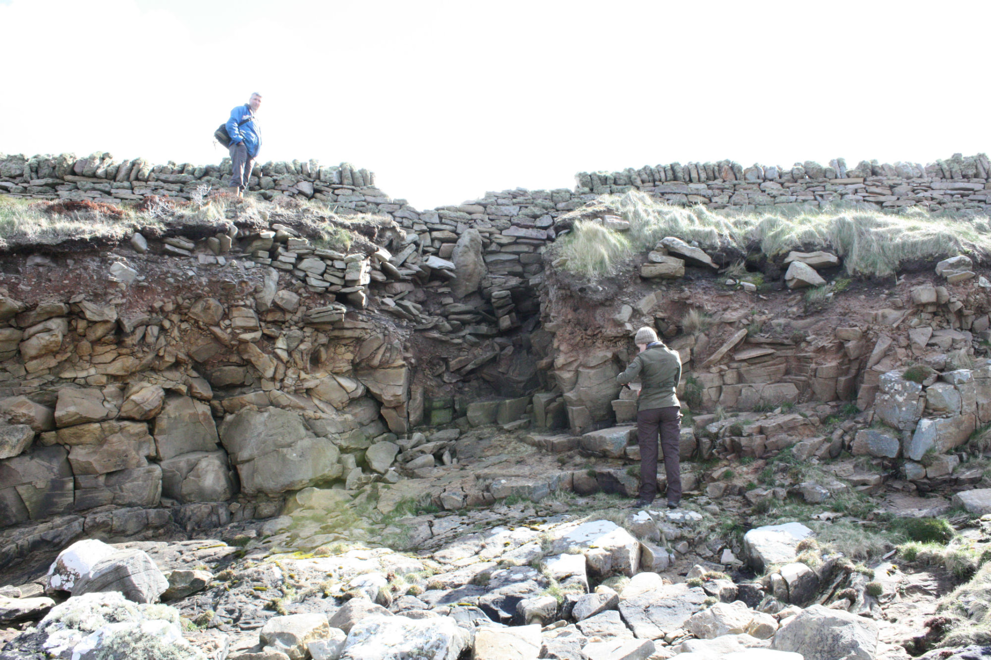
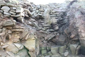
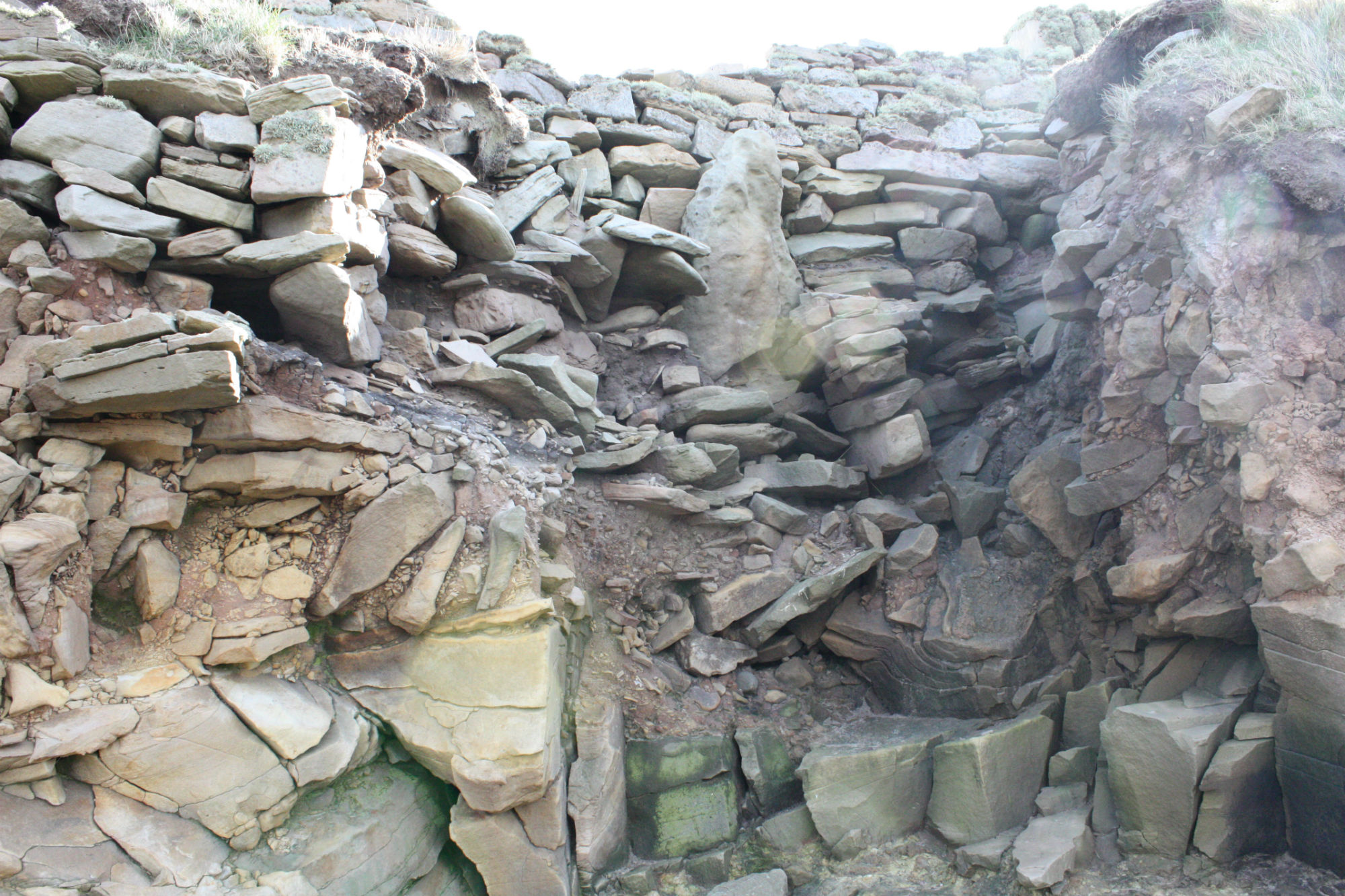
A sub-circular enclosure, measuring 30m in diameter, occupies a small, low-lying promontory. It is defined by an earthen and stone bank with a ditch to the exterior. The bank stands up to 1.5m high and is 3m wide; it is best preserved to the N side. The ditch is now filled in but was probably originally up to 2m wide. A slight bank to the outer rim of the ditch may be upcast from ditch cutting. A 0.5m gap in the bank to the NE side and is flanked by two upright slabs and may be an entrance. The W side of the enclosure is much reduced and cannot be traced on the ground. It appears to extend beneath the foundations of a ruinous boat shed (see SR9). Here, exposed in the coastal section, a vertical sided cut, 2m in width is filled with rubble and peaty deposits.
ShoreUPDATE 30 April 2015
As described, but the area described as the west side of the enclosure in the original survey (the south west side) has been altered by the demolition of the boat shed and the construction of a sea wall by the current owner which defends the garden and the house. The cut feature seen in the coastal section by the original surveyors is obscured by this sea wall.
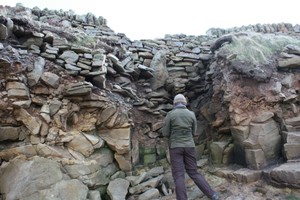
On the north west side of the site the earthworks have been truncated by erosion, exposing a section through the bank and ditch. The ditch has been cut through the till and into the bedrock. A layer of grey sandy soil with charcoal flecks represents a buried soil which formed while the ditch was open.
Drystone structures have been built on top of this layer inside the ditch. These drystone walls form a stone lining on both sides of the ditch face. The wall on the inner face of the ditch runs along the line of the enclosure, and the wall facing the outer side of the ditch forms a corner, with one face running along the line of the enclosure and a return running perpendicular to this, along the coast edge.
The bank appears to have been formed of upcast material from the excavation of the ditch, and there are traces of stone facing on the inner side of the bank.
The uppermost fill of the ditch is a stoney rubble layer into which an orthostat has been set, and a modern wall has been constructed along the top parallel with the coast edge. The orthostat appears to be related to the construction of the modern wall rather than the enclosure.
|
|