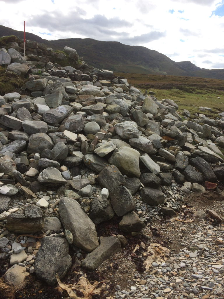
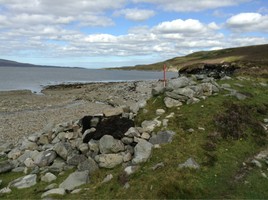
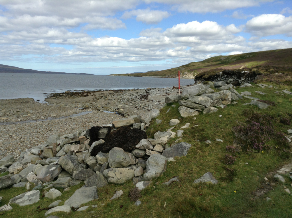
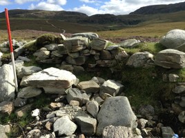
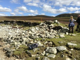
This site was visited by OS (NKB) on 8 November 1978, following identification by K Reid. The lime-kiln is situated on a flat grassy area, immediately to the N of the outflow of Allt Eriboll, and is as described in the NMRS. The remaining portion measures 2 m internally and 1.5 m towards the eroded edge. This has been reduced to 1 m in places, where it has also been destroyed by erosion to a pile of tumbled stone on the beach. The wall width is about 0.9 m, and there is no sign of a bank. The whole area is badly eroded and the lime-kiln has suffered badly. This site is in urgent need of archaeological attention
31/8/14 similar to original description. Signs of ongoing vehicle erosion to bank on inland side of limekiln, although structure is protected by collapsed rubble from site forming a rough defence. There are signs that the high water mark of very high tides is sometimes above the site, and recent flooding of the nearby stream may have reached the structure and stripped vegetation from the surrounding area.
Location
242371.00
956422.00
27700
58.4674835
-4.7041278
Submitted photographs
Image
Date
Caption
User
08/09/2014
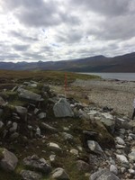
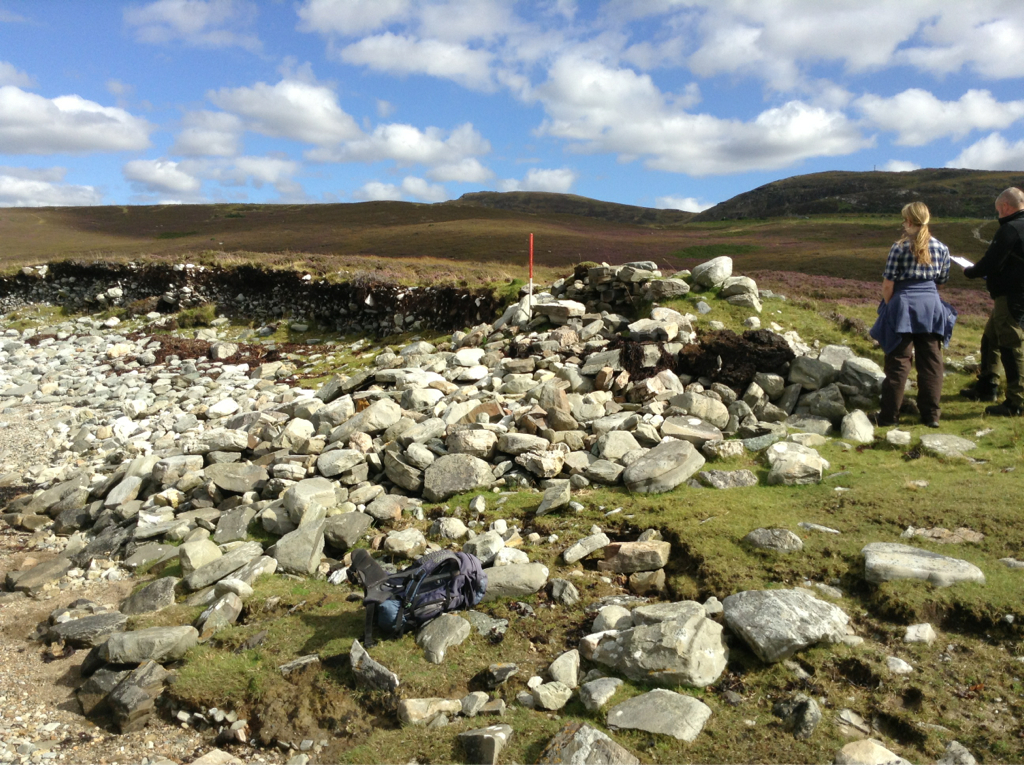
Eriboll lime kiln looking towards the loch
training1
08/09/2014
Eriboll lime kiln showing the collapsed stonework slumping onto the beach
training1
31/08/2014
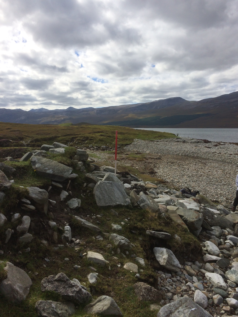
Showing proximity to sea
training1
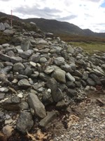
31/08/2014
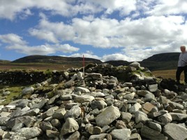
Close up of surviving wall
training1
31/08/2014
Showing eroding coast edge east of limekiln
training1
31/08/2014
Interior of kiln bowl, looking south
training1
Submitted updates
Update id
Date
User
1750
31/08/2014
training1
Tidal state
Low
Site located?
Yes
Proximity to coast edge
Coast edge
Coastally eroding?
active sea erosion; has eroded in the past
Threats
vehicle damage
Other threats
4x4 vehicles drive over the bank into which the kiln is constructed
Visibility above ground
Limited visibility (partial remains)
Visibility in section
Limited visibility in section
Access
accessible on foot (footpath)
Local knowledge
don't know
Description
This site was visited by OS (NKB) on 8 November 1978, following identification by K Reid. The lime-kiln is situated on a flat grassy area, immediately to the N of the outflow of Allt Eriboll, and is as described in the NMRS. The remaining portion measures 2 m internally and 1.5 m towards the eroded edge. This has been reduced to 1 m in places, where it has also been destroyed by erosion to a pile of tumbled stone on the beach. The wall width is about 0.9 m, and there is no sign of a bank. The whole area is badly eroded and the lime-kiln has suffered badly. This site is in urgent need of archaeological attention.
31aug2014 more or less as described, however the coast edge to the north of site is actively eroding.it seems to be only the tumbled stones from the kiln itself that is protecting the surviving edge of the kiln.
31/8/14 similar to original description. Signs of ongoing vehicle erosion to bank on inland side of limekiln, although structure is protected by collapsed rubble from site forming a rough defence. There are signs that the high water mark of very high tides is sometimes above the site, and recent flooding of the nearby stream may have reached the structure and stripped vegetation from the surrounding area.
it would benefit from being cleared and recorded thoroughly
this site is definitely at risk.
Comments
A track runs to the site ,with a gate and parking near the road.