Midden and buried land surface. The midden is up to 0.5m deep and has traces of simple stone structures in it. A local crofter recalls seeing stone structures 15m back from the eroding edge after a sand blow. Small scraps of handmade pottery, including one with an impressed groove, and a small thumb-nail scraper were seen in the midden.
ShoreUPDATE 05/05/2016
As described, buried land surface can be seen in section. Midden material not apparent, though improved soil can be seen in section. Large stones in section possibly related to large mound behind eroding edge. This feature is sub circular, approx. 15 paces in diameter. Feature is well defined by banks around 1 metre in height. Possibly a cru for stock management. Wall situated about 10 m to the east encloses the promontory.
Map regression indicates that the coast edge in front of the mound has retreated by 20m since 1878 and that the high water mark has retreated by 50-60m.
Location
61844.00
797120.00
27700
56.9413261
-7.5628099
Submitted photographs
Image
Date
Caption
User
05/05/2016
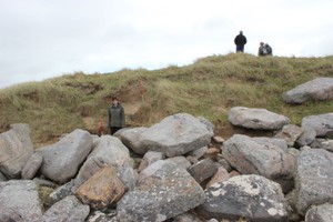
General view showing mound and wall enclosing promontory
training1
05/05/2016
Sub-circular mound behind coast edge
training1
05/05/2016
The coast edge at Traigh Varlish
training1
05/05/2016
Detail of improved soil visible in coast edge
training1
05/05/2016
Coastal exposure showing improved soil
training1
05/05/2016
Buried soil and large stone in coast edge
training1
Submitted updates
Update id
Date
User
2625
05/05/2016
training1
Tidal state
Low
Site located?
Yes
Proximity to coast edge
Coast edge
Coastally eroding?
active sea erosion; active wind erosion (in dunes only); has eroded in the past
Visibility above ground
Not visible
Visibility in section
Clearly visible in section
Access
accessible on foot (footpath)
Local knowledge
has local associations/history
Description
Midden and buried land surface. The midden is up to 0.5m deep and has traces of simple stone structures in it. A local crofter recalls seeing stone structures 15m back from the eroding edge after a sand blow. 5mall scraps of handmade pottery, including one with an impressed groove, and a 5mall thumb-nail scraper were seen in the midden.
ShoreUPDATE 05/05/2016
As described, buried land surface can be seen in section. Midden material not apparent, though improved soil can be seen in section. Large stones in section possibly related to large mound behind eroding edge. This feature is sub circular, approx. 15 paces in diameter. Feature is well defined by banks around 1 metre in height. Possibly a cru for stock management. Wall situated about 10 m to the east encloses the promontory.
Map regression indicates that the coast edge in front of the mound has retreated by 20m since 1878 and that the high water mark has retreated by 50-60m.