Galson (3225)
Description
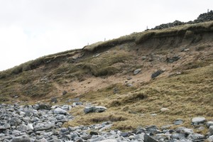
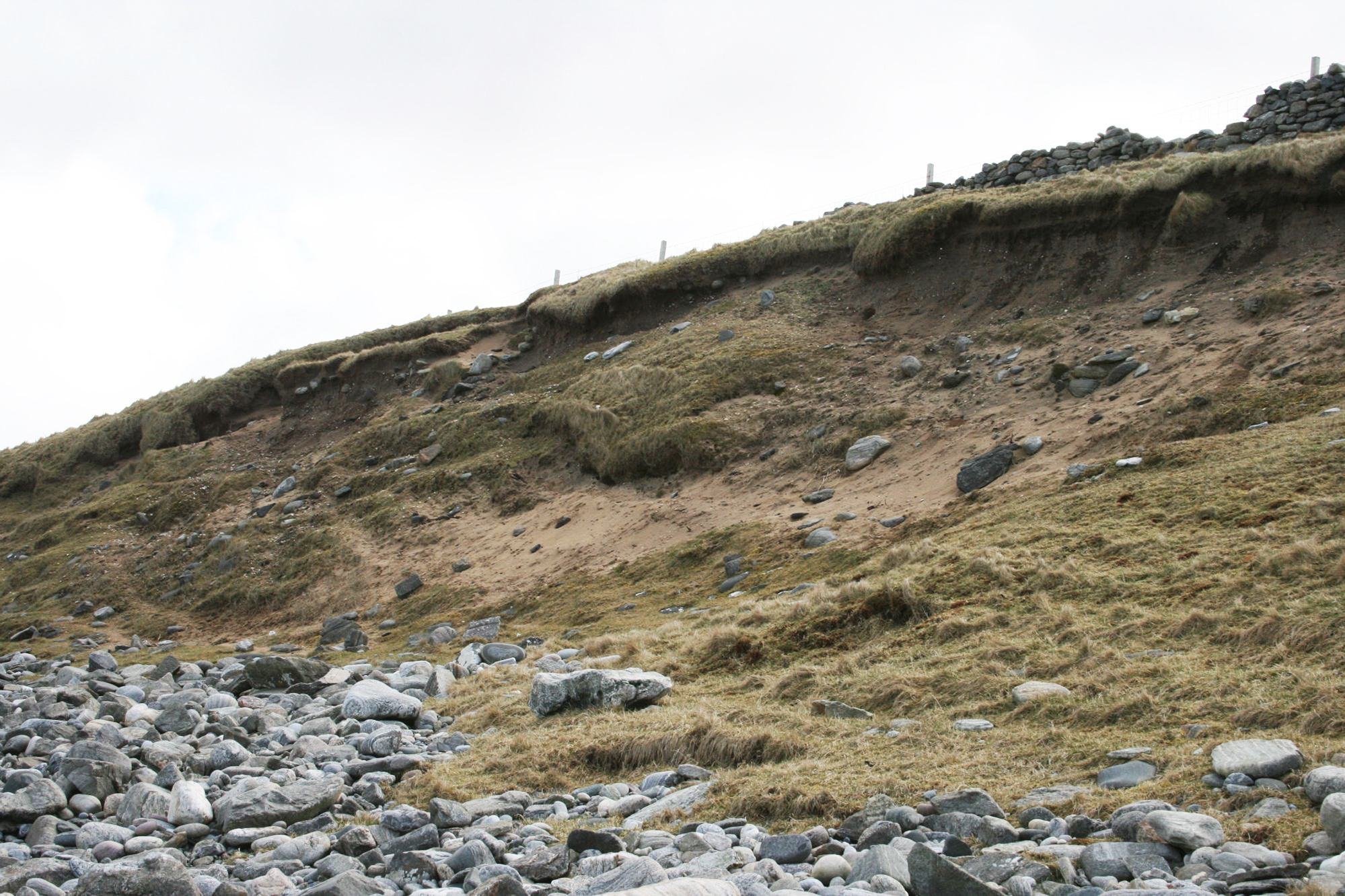
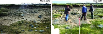
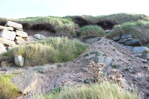
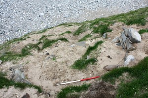
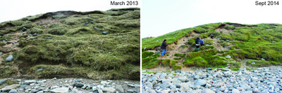
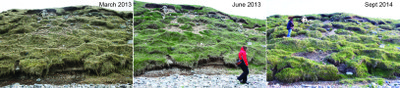
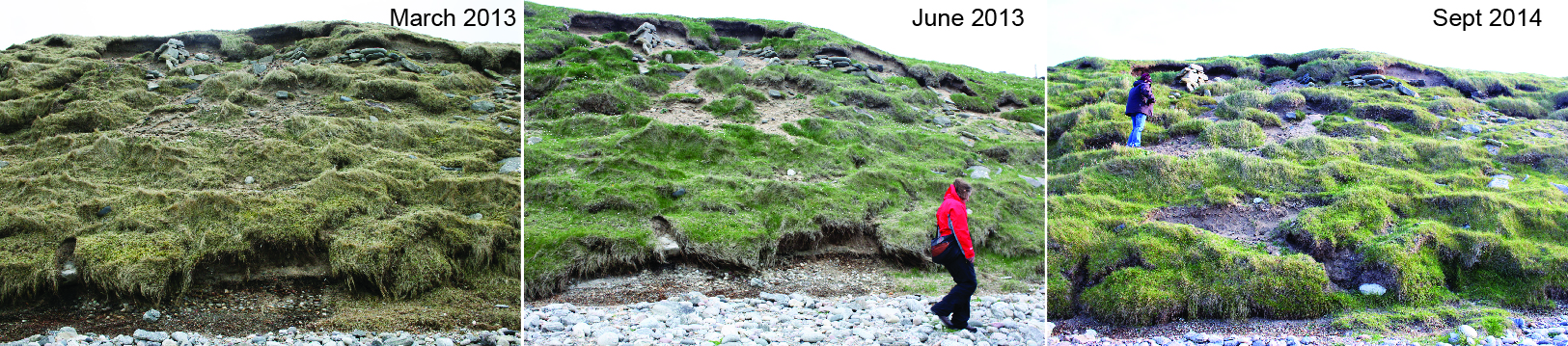
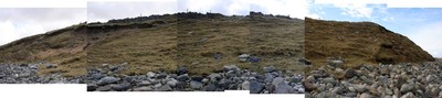
| A large settlement mound on the coast edge, incorporating remains from the Iron Age to the medieval period. A succession of structures, floors, hearths, midden deposits and long cists have been revealed, investigated and destroyed by coastal erosion. This multi-phase site has been used for settlement and burials with a succession of structures, deposits and inhumations from the Iron Age onwards. The coastal face of the mound contains a sequence of layers and stone structures visible in the eroding section. A recent geophysical survey of the area behind the coast edge revealed features which are thought to be Iron Age and Norse/medieval buildings up to 30m back from the current coast edge. Finds recovered include bone and antler tools, rotary and saddle quern stones, a steatite cup, iron knife, clay loom weights, a weaving comb, a bronze pin, a 10th century coin and pottery including Iron Age, Norse and medieval types. ShoreUPDATE September 2014 This is a composite ShoreUPDATE record reporting on 3 field visits in March 2013, June 2013 and September 2014. The photographs are labelled according to the date of the visit. This record [3225] incorporates the following Galson CZAS records: 3231, 3232, 3731, 3228, 3757, 3223, 3226, 3227, 3747. A sequence of dry-stone structures interspersed with layers of midden and blown sand are eroding from exposures in a sand mound developed upon the raised beach at Galson. The seaward face of the mound extends at least 130m E-W, and archaeological deposits can be seen in the upper 4m of the approx. 6m high coastal section. There have been a number of rescue and recording interventions at the site over the last 100 years. In summary: 16 burials from a long cist cemetery spanning the 1st to 6th century AD have been recorded; and numerous drystone structures which appear to be clustered in 2 periods: 3rd to 7th centuries AD and the 9th to 12th centuries AD have been recorded. The structures are associated with extensive midden deposits. 15 radiocarbon dates have constructed this age model. The most useful document as a baseline for monitoring the section is an unpublished report by CFA Archaeology Ltd: Tim Neighbour and Mike Church, 2001, The eroding settlement and Iron Age cemetery at Galson, Isle of Lewis: Erosion Face Recording and Geophysical Survey. There are two main areas of instability in the face of the coastal section, and it is from these exposures that archaeological deposits are eroding. This appears to have been the case over the last 40 years. The instability of the exposures varies from season to season, following storm events - and according to how accessible the site is to sheep. Stock erosion is probably the most important continuous factor in determining the stability of the section and the rate of erosion of the archaeology. Over the 6 years that SCAPE have been visiting the site (2009 - 2014) the condition of the unstable areas have waxed and waned according to the factors mentioned above. There is certainly incremental ongoing damage to archaeological deposits, but these tend to be episodic and the general pattern is one of exposure, re-stabilisation, re-exposure and so on. As far as can be determined, structures and deposits visible in the eroding face can be equated with remains that have been previously recorded. ShoreUPDATE May 2016 Lower half of the mound more eroded than seen in previous visits, exposing raised beach deposits, these account for at least half the height of the mound. Archaeological structures and deposits overlying the raised beach appear to be in a similar condition as previously seen, i.e. discrete areas of erosion interspersed by more stable vegetated slope. Rabbits are the main cause of damage. |
| July 2021: Site generally fairly well vegetated except for defined areas of extreme erosion caused by rabbit burrows in steeper parts of the section. Information from crofter that rabbits continue to be a problem on Galson, elsewhere in Lewis rabbit populations are low. |
Location
| 143670.00 | |
| 959470.00 | |
| 27700 | |
| 58.4480247 | |
| -6.3950620 |
Submitted photographs
| Image | Date | Caption | User |
|---|---|---|---|
|
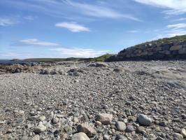
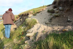
04/07/2021 | Galson settlement mound looking north from old cemetery | joannahambly |
|
|||
|
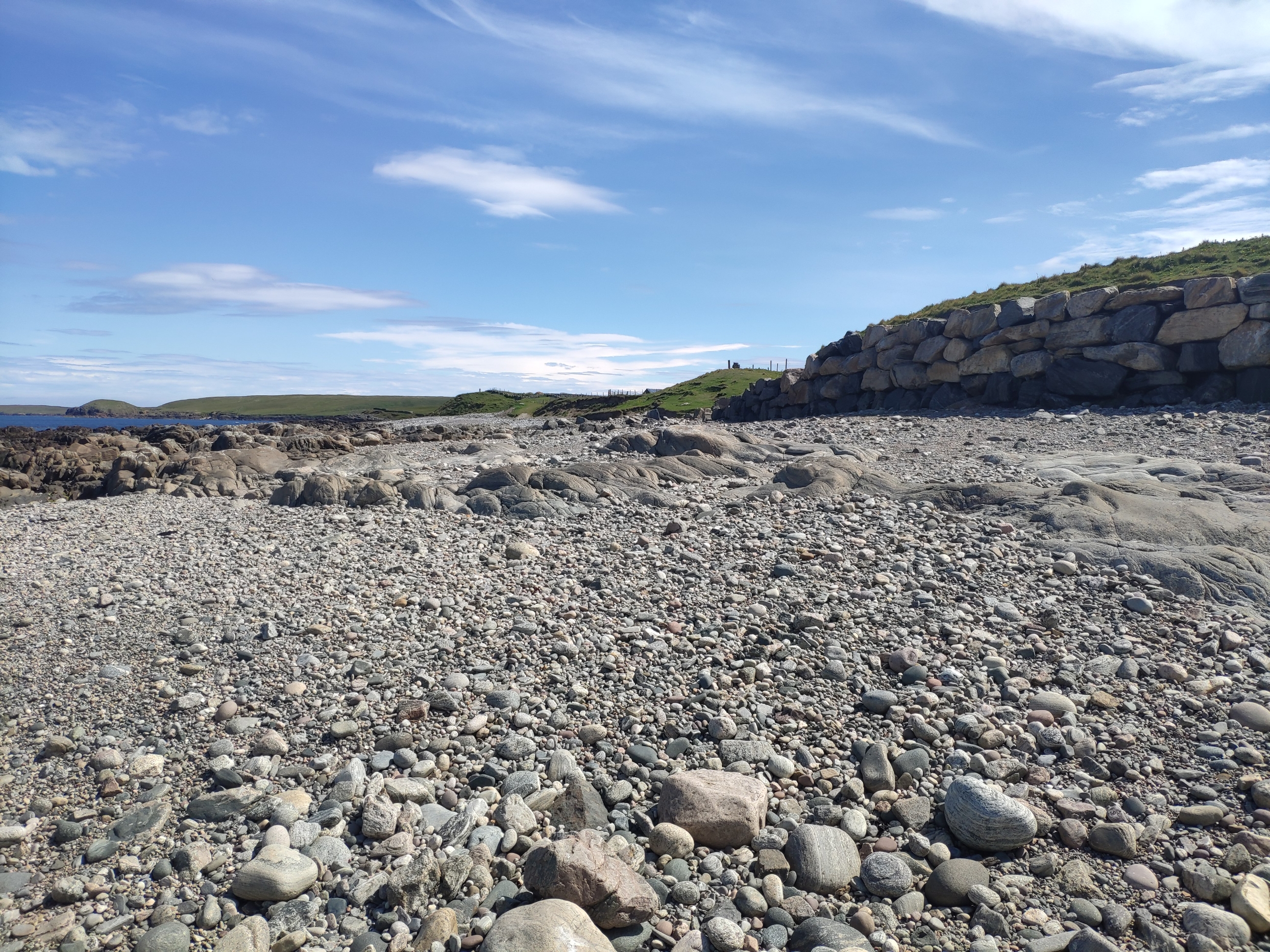
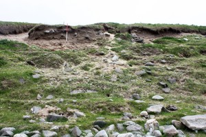
04/07/2021 | Currently stable and eroding | joannahambly |
|
|||

|
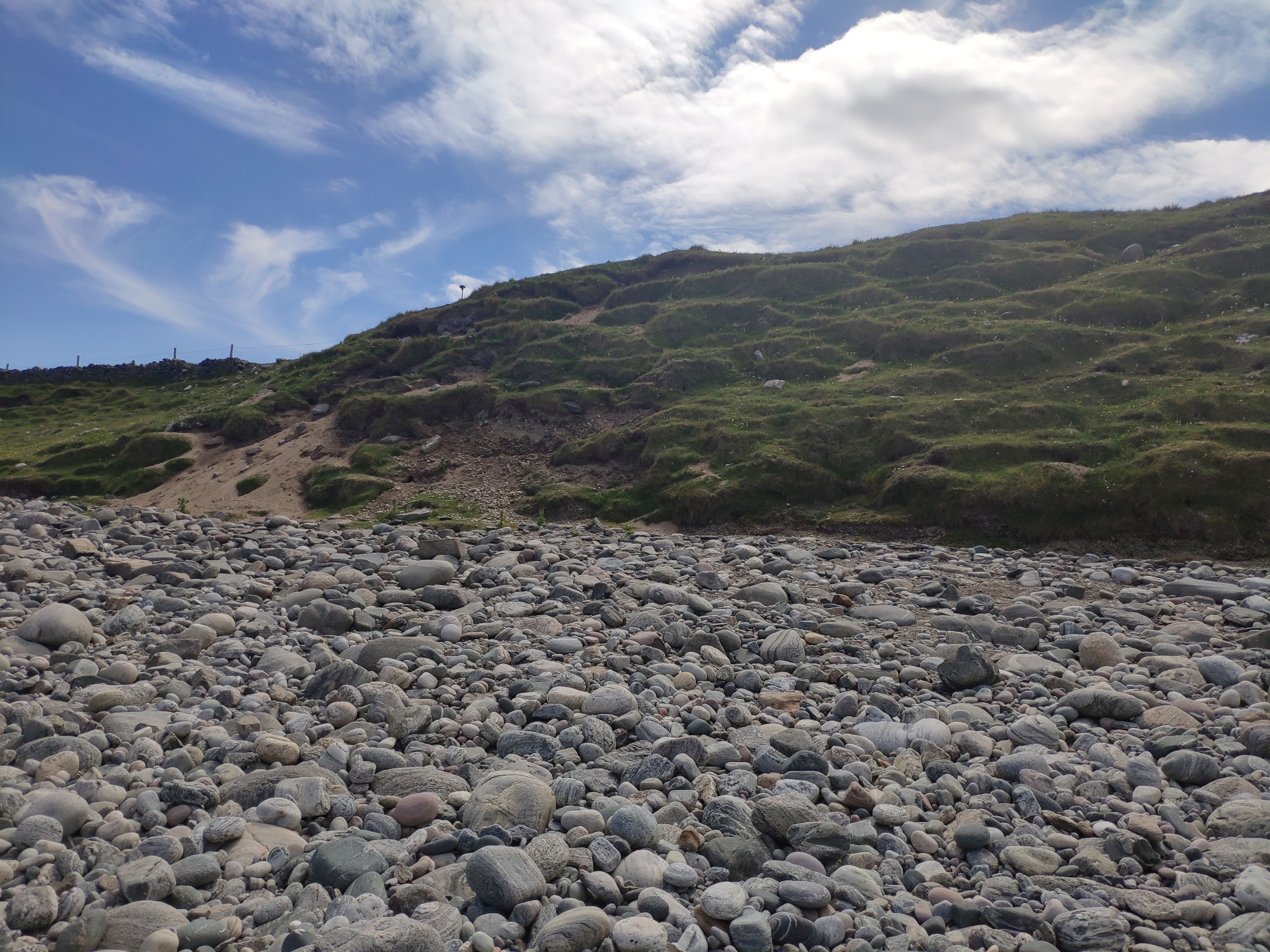
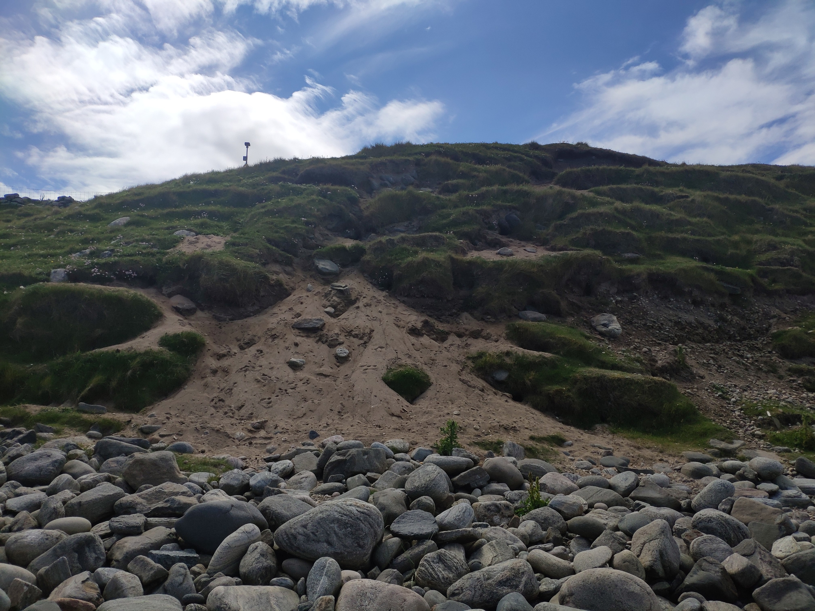
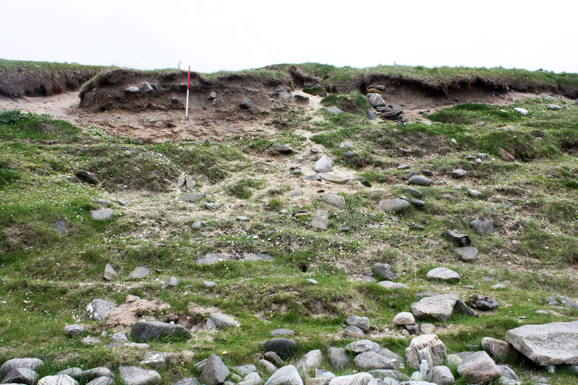
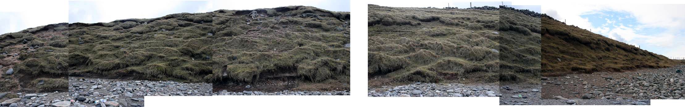
04/07/2021 | Showing typical rabbit induced erosion affecting parts of the section | joannahambly |
|
|||

|
07/01/2015 | Showing cellular structure in upper part of mound and raised beach deposits halfway up height of mound | training1 |
|
|||

|
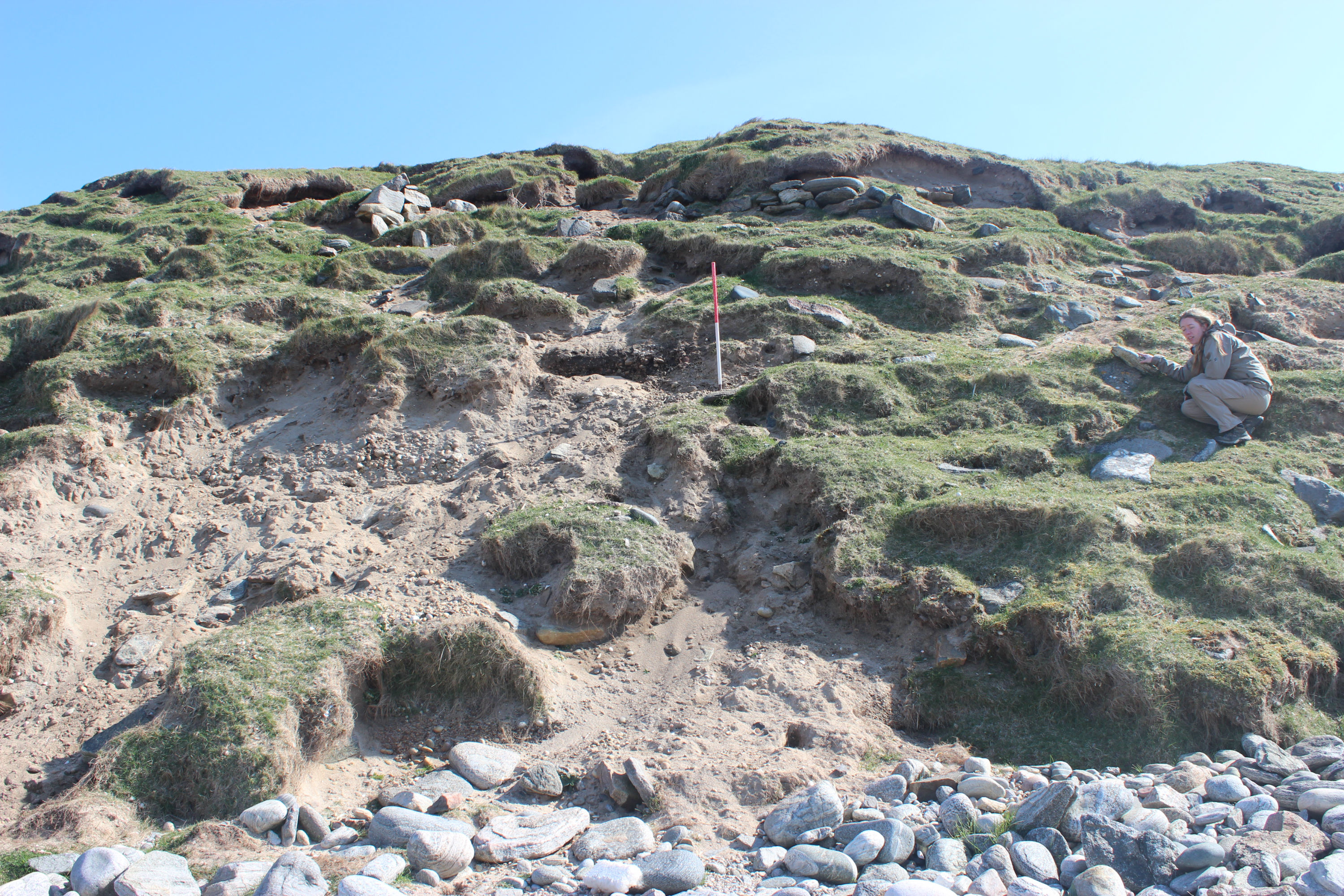
07/01/2015 | Section through east mound showing structures in upper part and raised beach in lower half (next to ranging rod) | training1 |
|
|||

|
07/01/2015 | Detail of typical Norse/medieval? deposits at topp of exposure East mound | training1 |
|
|||
|
07/01/2015 | Close up of structures at top of East mound exposure, Sept 2014 | training1 |

|
|||
|
07/01/2015 | Walling and arch deposits at eastern edge of exposure in East mound, June 2013 | training1 |
|
|||
|
07/01/2015 | Exposure in East mound showing various structures, March 2013 | training1 |
|
|||
|
07/01/2015 | Walls, Eastern exposure | training1 |

|
|||
|
07/01/2015 | Close-up of cellular structure, West mound, Sept 2014 | training1 |

|
|||
|
07/01/2015 | Plan view of cellular structure at top of West mound, June 2013 | training1 |

|
|||
|
07/01/2015 | Walls in Western mound exposure | training1 |

|
|||
|
07/01/2015 | Cellular structure at top of Western mound exposure | training1 |
|
|||
|
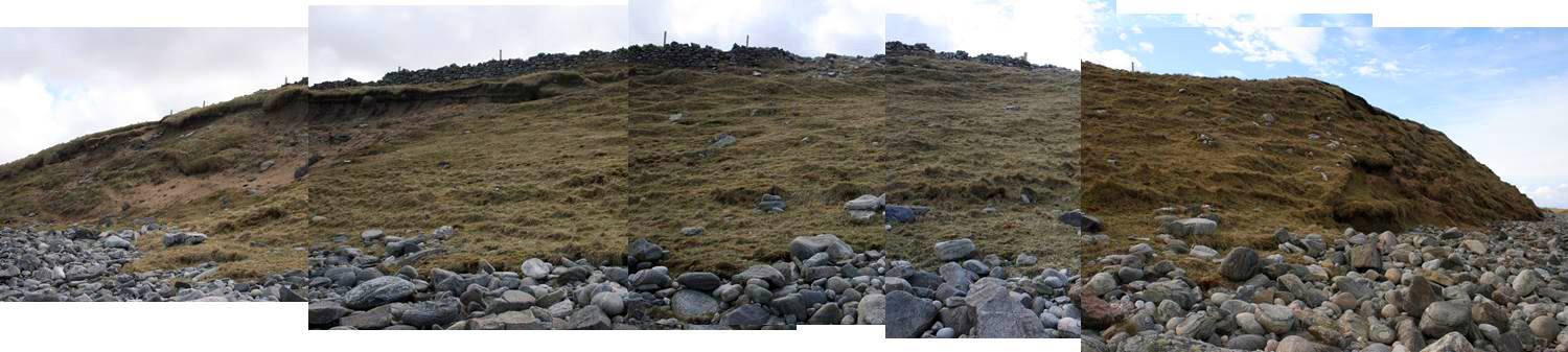
07/01/2015 | Panorama East mound, looking S | training1 |
|
|||
|
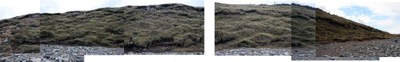
07/01/2015 | Panorama Western mound, looking S | training1 |
|
|||
|
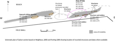
07/01/2015 | Schematic plan to show location of exposures, recorded structures and dates | training1 |

|
|||
Submitted updates
| Update id | Date | User | ||||||||||||||||||||||
|---|---|---|---|---|---|---|---|---|---|---|---|---|---|---|---|---|---|---|---|---|---|---|---|---|
| 3539 | 04/07/2021 | joannahambly | ||||||||||||||||||||||
|
||||||||||||||||||||||||
| 1895 | 07/01/2015 | training1 | ||||||||||||||||||||||
|
||||||||||||||||||||||||