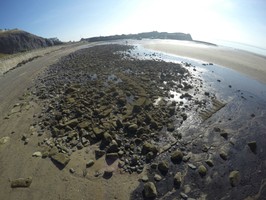
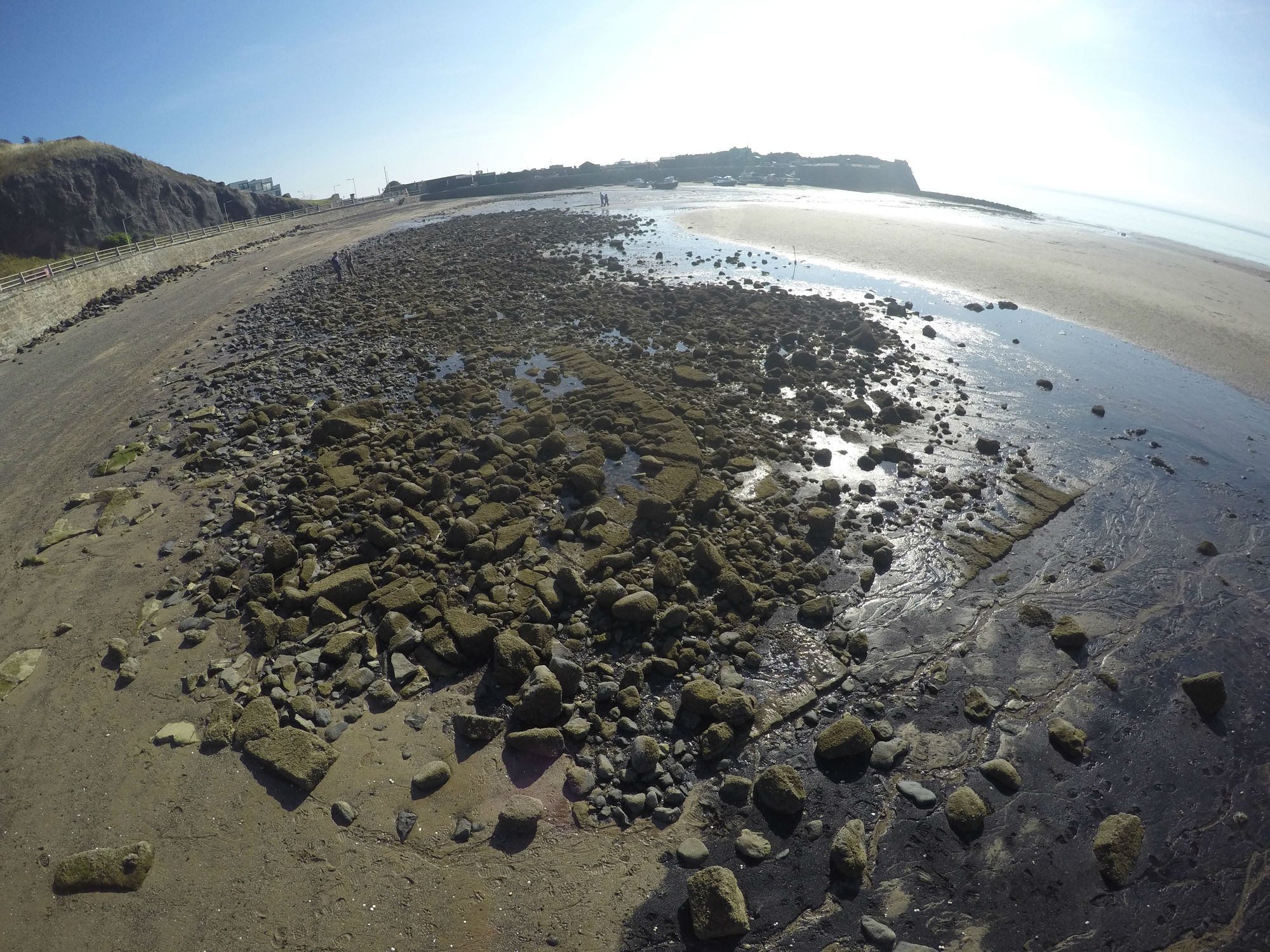
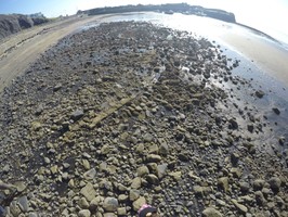
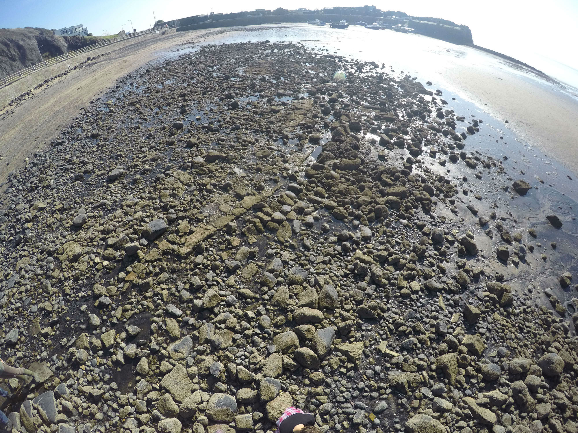
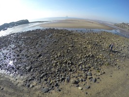
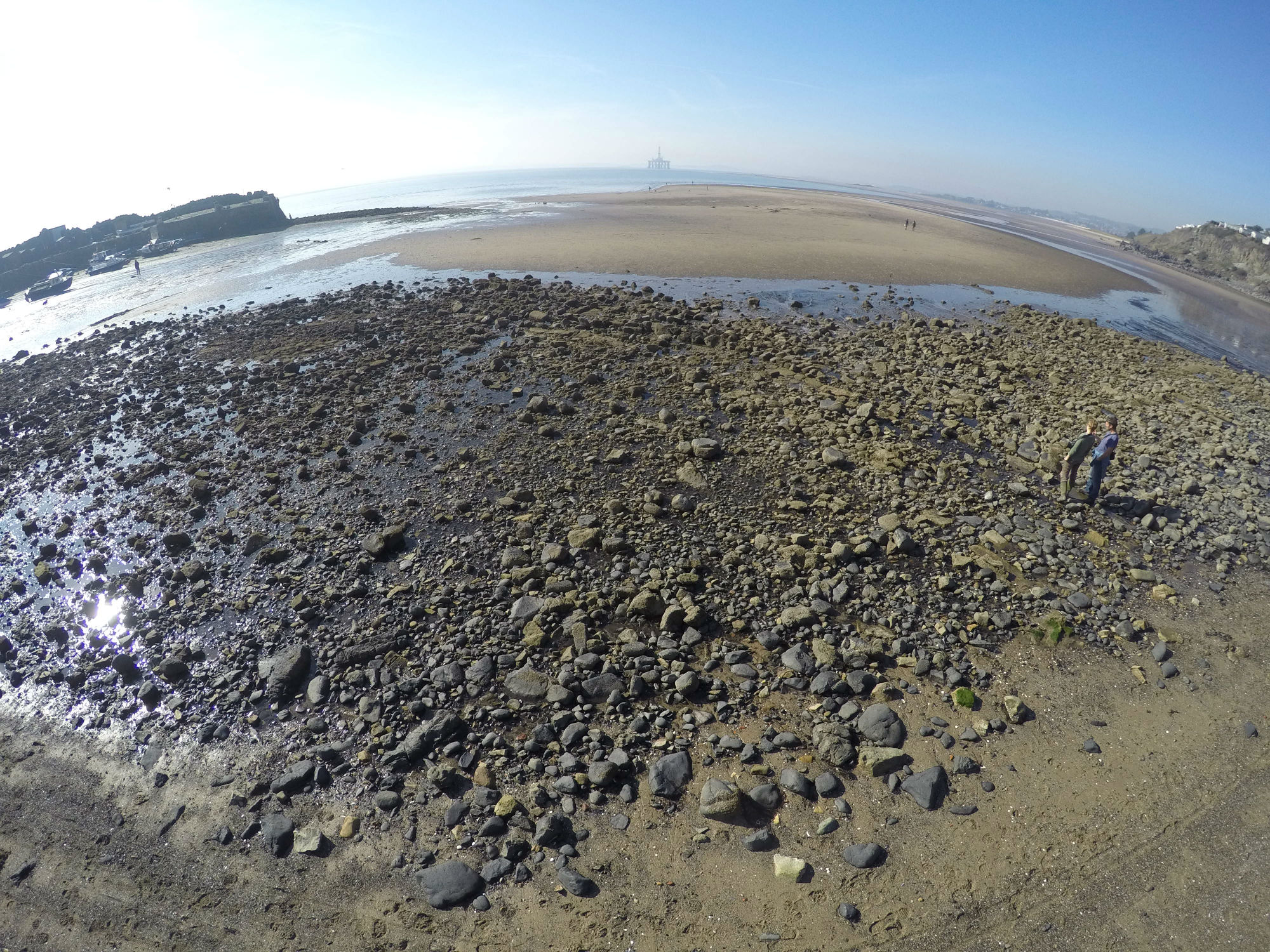
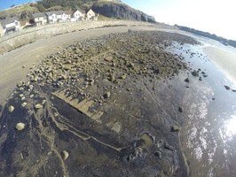
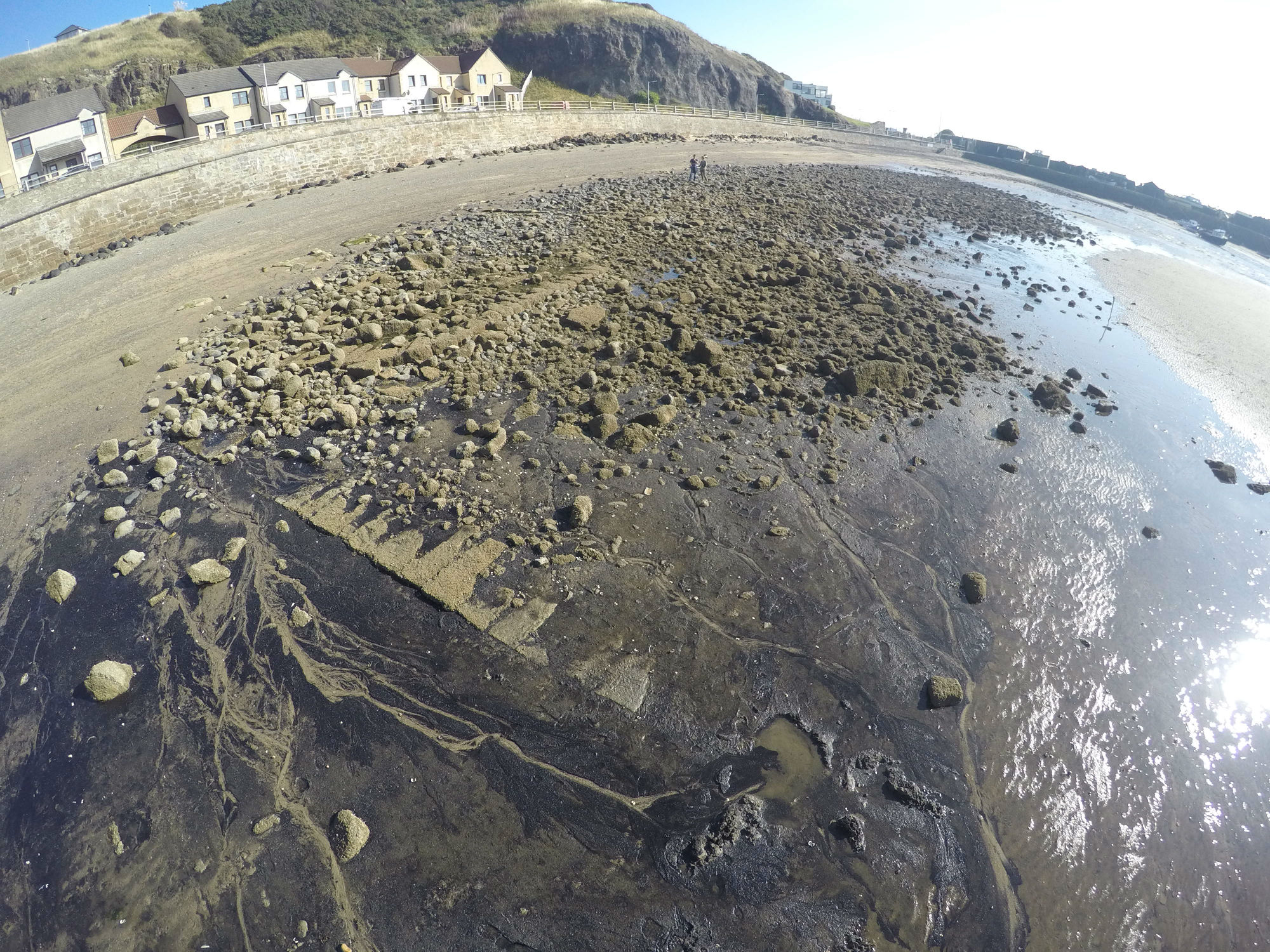
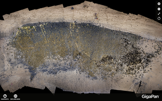
Intermittently exposed remains of substantial foundations of stone harbour are revealed towards the high water mark just west of the present Pettycur harbour. The stone is finely shaped and forms an apparent slipway or jetty at the west end, connecting to a D-shaped structure. This looks like the end of a harbour wall. To the east there are concentric curves of shaped stone forming part of a semi-circular structure. Stone channels or drains are also visible.
This is undoubtedly the remains of Pettycur’s medieval harbour, which a church record from Perth dated 25th August 1625 states that in March 1625 there was “a great and ferefull storne and tempest which led to the harbour of Pretticur being totallie overthrawin and brokin down”.
The present harbour dates from around 1760.
Angus Graham, A., 1968 The Harbours of Eastern Scotland
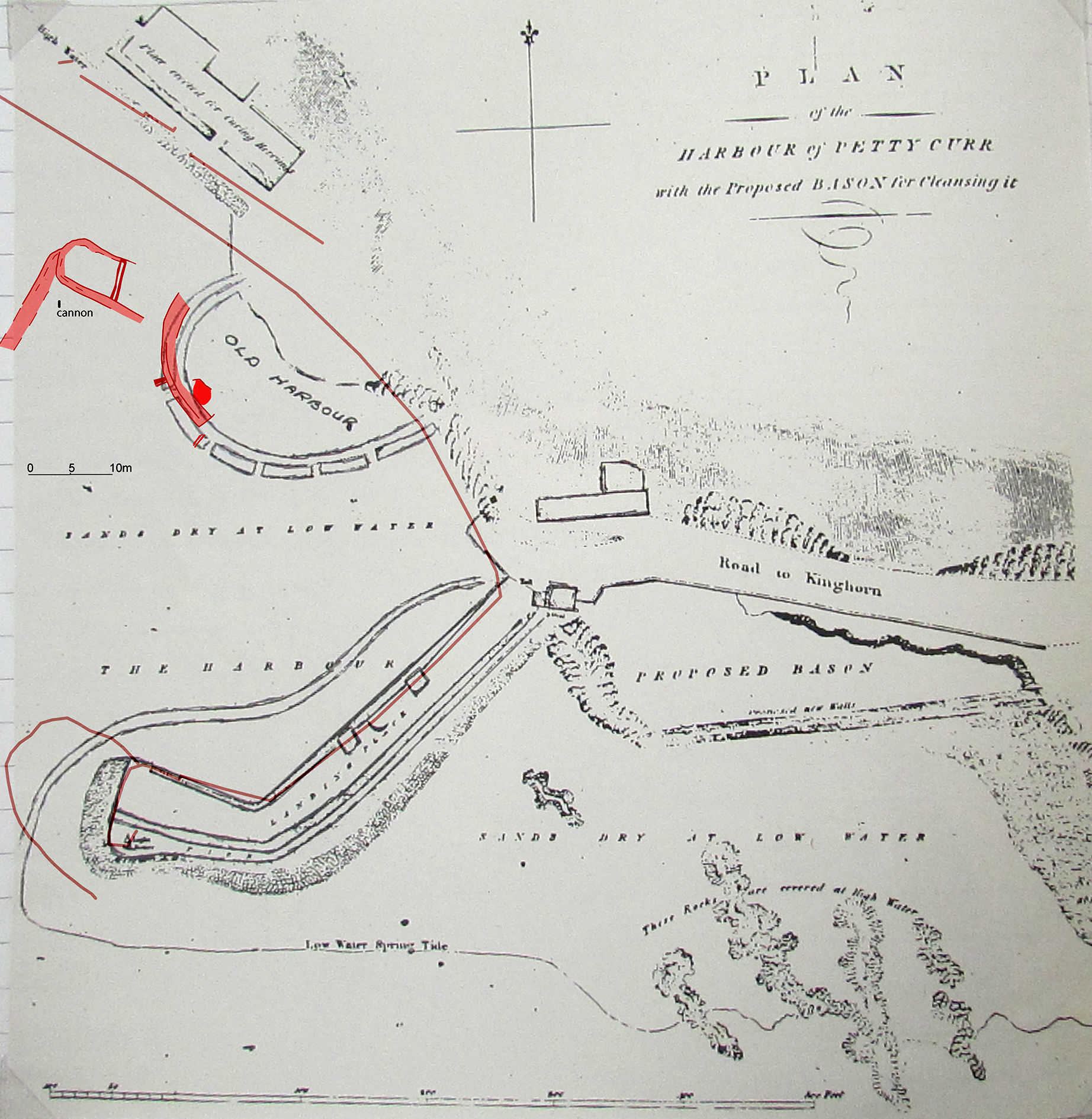
The remains of the ‘Old Harbour’ is shown on a technical drawing by John Rennie in 1801, for a proposed new basin to clear sand form the present harbour.
Original record held in Institution of Civil Engineers, Reference: REN/RB/03/202
Further information can be found on the SCHARP blog:
https://scharpblog.wordpress.com/2015/12/15/pettycurs-17th-century-storm-wrecked-harbour-revealed/
Location
326497.00
686201.00
27700
56.0629807
-3.1820395
Submitted photographs
Image
Date
Caption
User
24/05/2017
D-shaped stonework and slipway, looking E
joannahambly
24/05/2017
Concentric curving stonework, looking E
joannahambly
24/05/2017
Curved stonework just visible, looking S
joannahambly
24/05/2017
West end showing slipway and D-shaped stonework, looking E
joannahambly
24/05/2017
Screenshot of gigapan of harbour, by Eddie Martin
joannahambly
24/05/2017
Survey overlain on 1802 Rennie plan
joannahambly
Submitted updates
Update id
Date
User
2993
24/05/2017
joannahambly
Tidal state
Low
Site located?
Yes
Proximity to coast edge
Intertidal
Coastally eroding?
active sea erosion; has eroded in the past
Visibility above ground
Limited visibility (partial remains)
Visibility in section
Not visible
Access
easily accessible - no restrictions
Local knowledge
has local associations/history
Description
Intermittently exposed remains of substantial foundations of stone harbour are revealed towards the high water mark just west of the present Pettycur harbour. The stone is finely shaped and forms an apparent slipway or jetty at the west end, connecting to a D-shaped structure. This looks like the end of a harbour wall. To the east there are concentric curves of shaped stone forming part of a semi-circular structure. Stone channels or drains are also visible.
This is undoubtedly the remains of Pettycur’s medieval harbour, which a church record from Perth dated 25th August 1625 states that in March 1625 there was “a great and ferefull storne and tempest which led to the harbour of Pretticur being totallie overthrawin and brokin down”.
The present harbour dates from around 1760.
Angus Graham, A., 1968 The Harbours of Eastern Scotland
The remains of the ‘Old Harbour’ is shown on a technical drawing by John Rennie in 1801, for a proposed new basin to clear sand form the present harbour.
Original record held in Institution of Civil Engineers, Reference: REN/RB/03/202
For more information see the SCHARP blog post
https://scharpblog.wordpress.com/2015/12/15/pettycurs-17th-century-storm-wrecked-harbour-revealed/
Rare suvival of a medieval/early modern harbour linked to historical record of it's destruction in 1625. A
Located in the intertidal zone. Limited investigation and recording undertaken through SCHARP, but would benefit from more detailed survey and historical research.
Assign Priority 2.