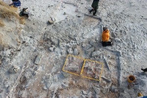
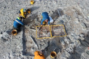
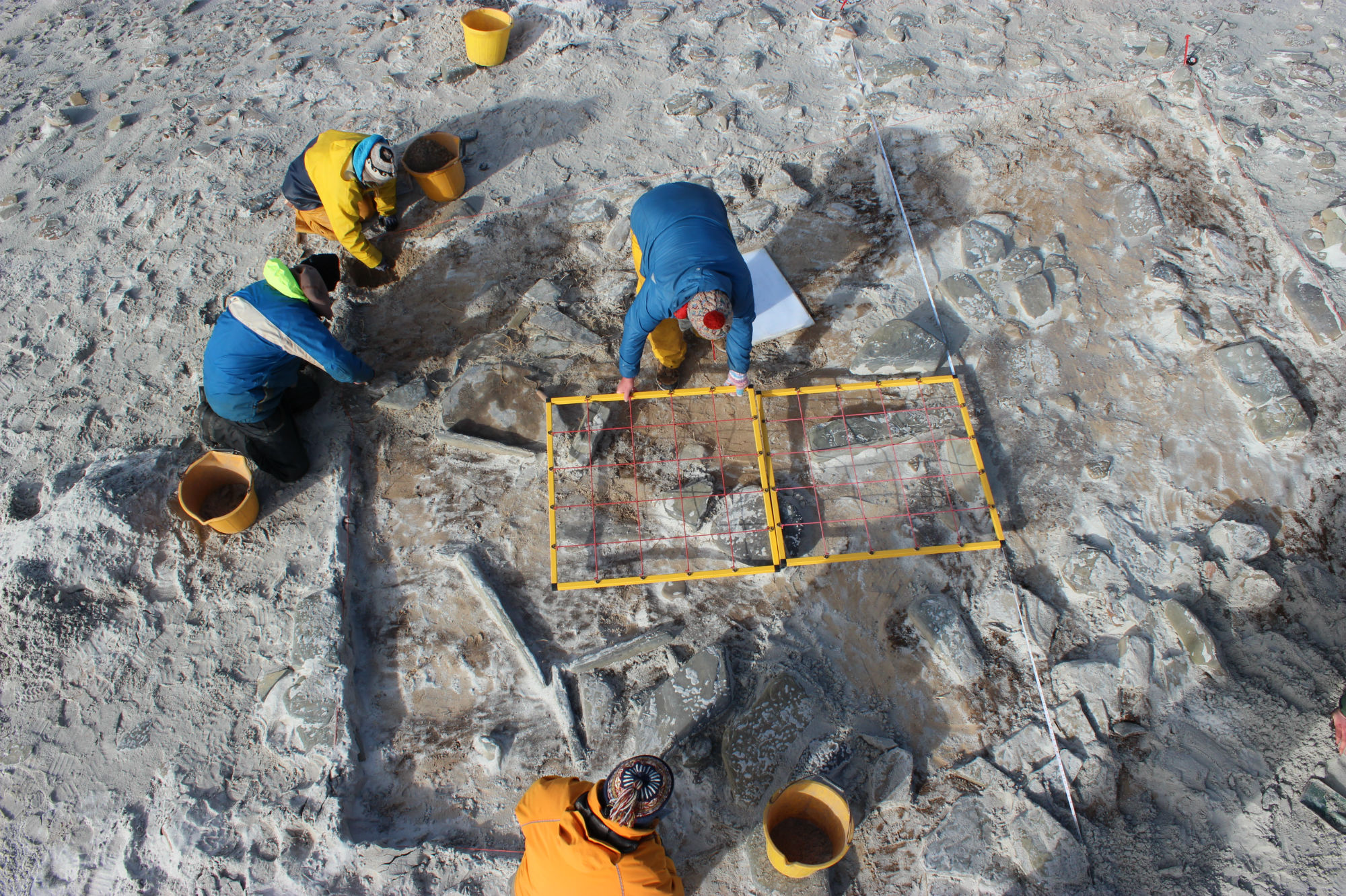
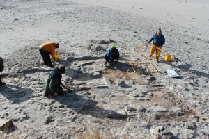
The remains are located on a gravel ridge known as The Grithies which extends along the southern edge of Cata Sand. Geophysical survey of the area shows an anomaly roughly 20m x 20m to the south of the extant dune, indicating the remains of more than one building. Blown sand removed from a part of this area revealed spreads of stone, possibly walls, and intermittent lenses of archaeological material emerging from the southwestern edge of the dune. Nine orthostats within the area investigated indicate the remains of at least one surviving structure. Clay-rich midden material containing ash and charcoal was exposed in several patches of the cleaned area. Bone, poorly preserved pottery, coarse stone stools and struck flint have been recovered.
August 2018: As described. Further excavation carried out in 2019. The excavation also revealed two pits cut through the Neolithic structure and filled with the skeletons of pilot whales, either the result of a ca'ing (when whales were driven ashore and butchered for blubber) or a mass stranding
Location
370427.00
1039659.00
27700
59.2424622
-2.5201275
Submitted photographs
Image
Date
Caption
User
05/03/2016
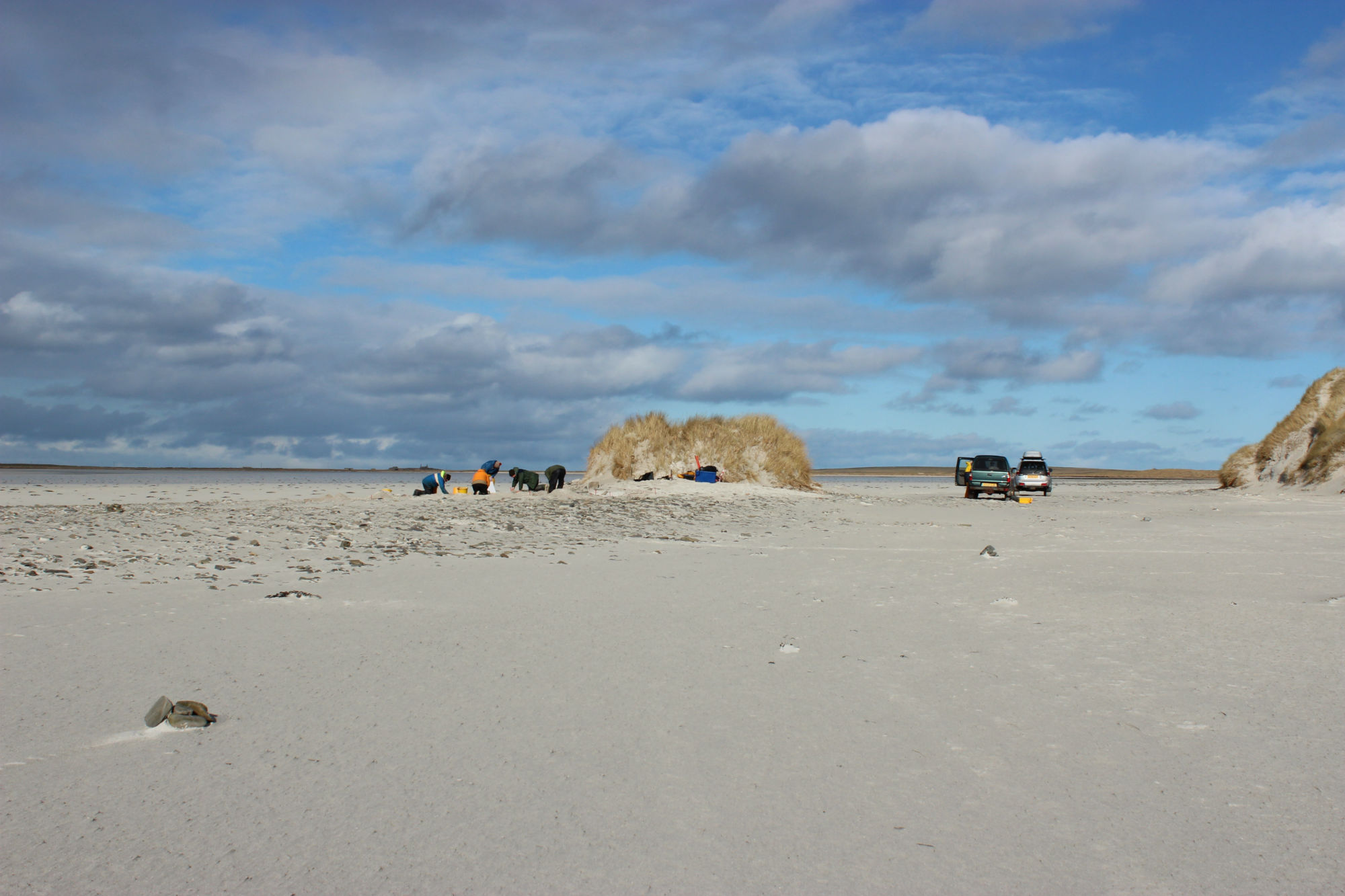
Site looking S
joannahambly
05/03/2016
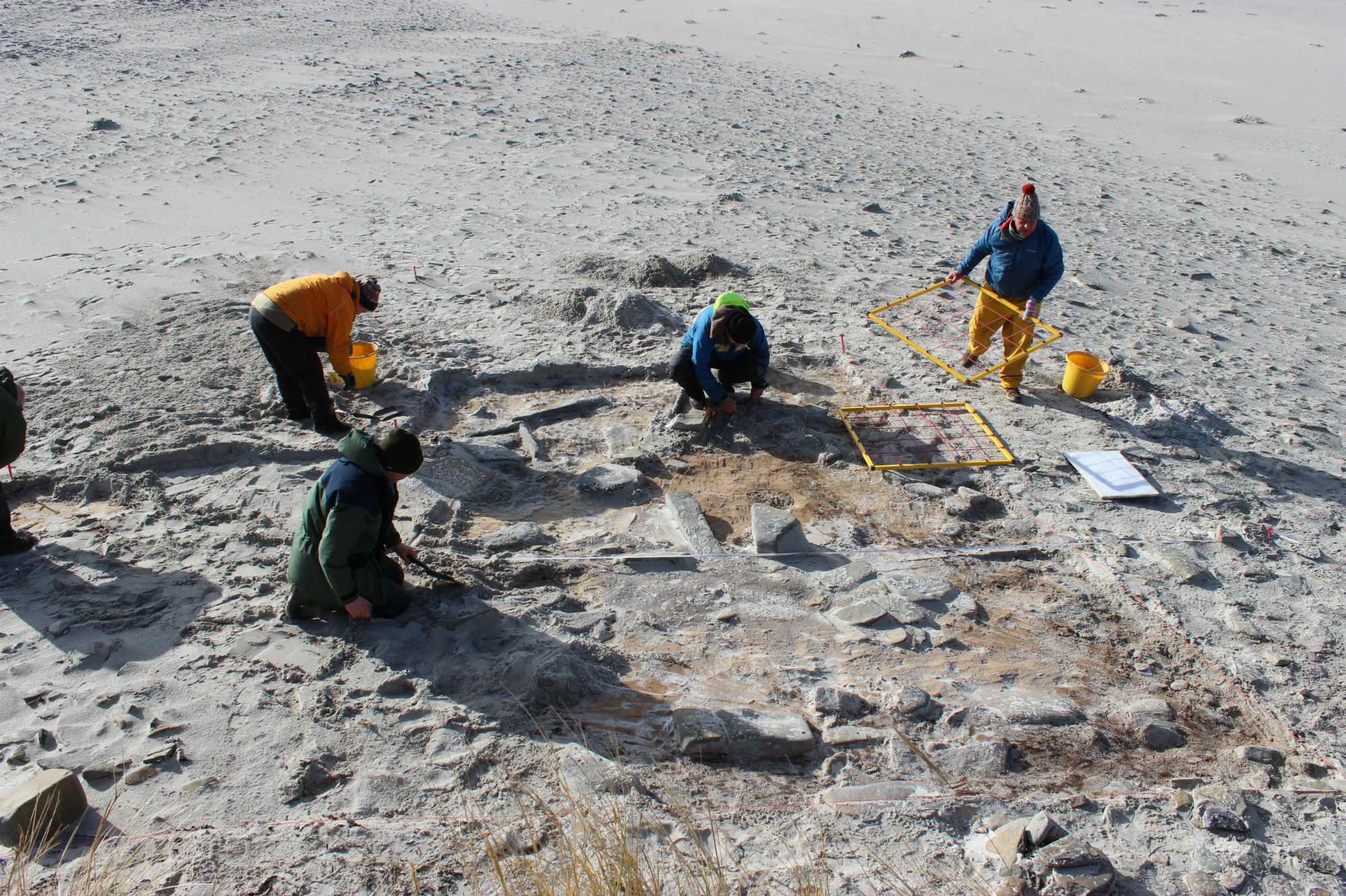
Stone spread and in-situ-orthostats, looking N
joannahambly
05/03/2016
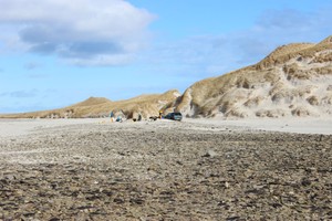
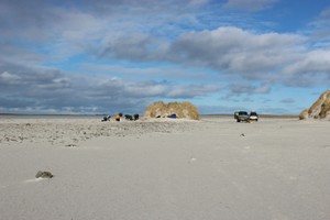
Site located on gravel ridge, looking SSE
joannahambly
05/03/2016
Location in relation to dune ridges and gravel ridge known as 'The Grithies', looking NE
joannahambly
05/03/2016
Site location in relation to the remnant dune, looking N
joannahambly
Submitted updates
Update id
Date
User
3335
06/08/2018
EllieSCHARP
Description
August 2018:
As described.
Further excavation carried out in 2019.
The excavation also revealed two pits cut through the Neolithic structure and filled with the skeletons of pilot whales, either the result of a ca'ing (when whales were driven ashore and butchered for blubber) or a mass stranding
2498
05/03/2016
joannahambly
Tidal state
Low
Site located?
Yes
Proximity to coast edge
Coast edge
Coastally eroding?
active sea erosion; active wind erosion (in dunes only)
Visibility above ground
Limited visibility (partial remains)
Access
accessible - difficult terrain; vehicular access; accessible on foot (no footpath)
Description
The remains are located on a gravel ridge known as The Grithies which extends along the southern edge of Cata Sand. Geophysical survey of the area shows an anomaly roughly 20m x 20m to the south of the extant dune, indicating the remains of more than one building. Blown sand removed from a part of this area revealed spreads of stone, possibly walls, and intermittent lenses of archaeological material emerging from the southwestern edge of the dune. Nine orthostats within the area investigated indicate the remains of at least one surviving structure. Clay-rich midden material containing ash and charcoal was exposed in several patches of the cleaned area. Bone, poorly preserved pottery, coarse stone stools and struck flint have been recovered.
Excavation. Assign priority 1.
Comments
Prehistoric - probably Bronze Age- structure located on gravel ridge known as the Grithies in Cata Sand. The site is located just above the high water mark and is probably inundated at very high tides and in storm conditions. The site was identified by a team from UHI, Manchester University and the University of Central Lancashire in December 2015. An evaluation was carried out by a team from the above in March 2016.